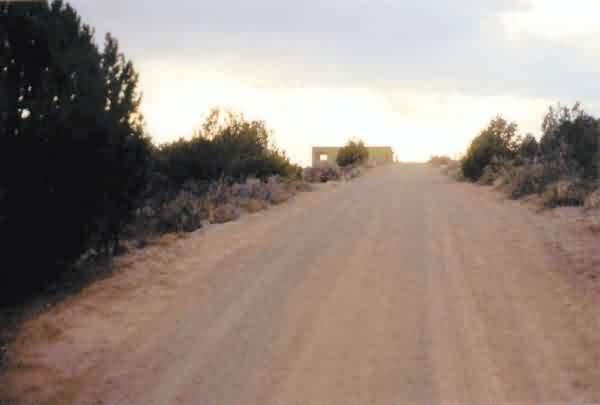
This view is looking up the site access road toward the gap-filler radar annex on top of Pia Mesa, south of Zuni Pueblo. The time of day was late afternoon. The access road was hard-pack gravel, in excellent condition. [looking west-northwest]
Last year I was on a business trip to Albuquerque, and on the weekend visited the four formerly-used USAF long-range range radar sites in northern New Mexico. I also attempted to locate the gap-filler radar annex at Zuni, but at that time was unable to locate the site. Later, I obtained a copy of the US Army Corps of Engineers` FUDS report, and learned that the GFA site was on Pia Mesa, about9 miles south of Zuni Pueblo. As it turns out, I actually had driven within a half mile of the site, but had no way to know it at the time.
This past weekend (on 07-06-2002), I took the kids on a sightseeing tour of National Parks in Utah. I planned the return trip to go through Zuni, so that I could (hopefully) verify the radar site`s location and get several photos. This time, I was successful at finding the GFA site, and was able to get photos. The radar site is located on tribal land of the Zuni Reservation, so I was careful to not disturb anything, only get photos, then leave as soon as possible. No one was around, and I was in and out without incident.
The gap-filler radar building is still extant, pretty much as described in the 1994 updated FUDS report. The radar-equipment section of the building is without roof, but its walls are still standing. The diesel-generator wing still retains its roof intact,although no firewall extending above the roof was seen. All three radar-tower foundations/footings are in place, and an open pit remains where the fuel tank was removed. The original chain-link fence has been removed. Also, pieces of roof material are scattered about the grounds. This privately-owned former-USAF facility appears to be unused for anything at this time.
This view is looking up the site access road toward the gap-filler radar annex on top of Pia Mesa, south of Zuni Pueblo. The time of day was late afternoon. The access road was hard-pack gravel, in excellent condition. [looking west-northwest]
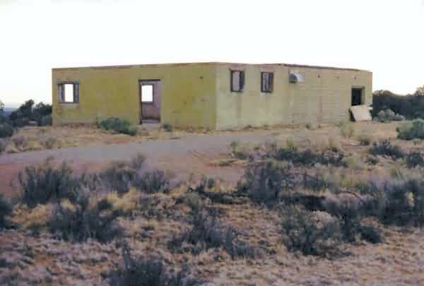
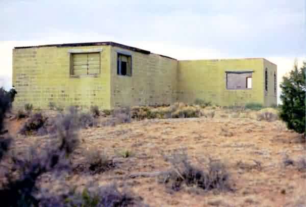
This view shows the old gap-filler radar building as it appears today. The radar-equipment section of the building is seen in the foreground and extending to the left;the diesel-generator wing is to the right and background. [looking west-southwest]
This view shows the north side of the old gap-filler radar building. The radar-equipment section of the building is on the left (east), and the diesel-generator wing is to the right (west). [looking south-southwest]
This view shows the diesel-generator wing and the open pit where the underground fuel tank used to be. Note the fuel pipes sticking out. [looking east-southeast]
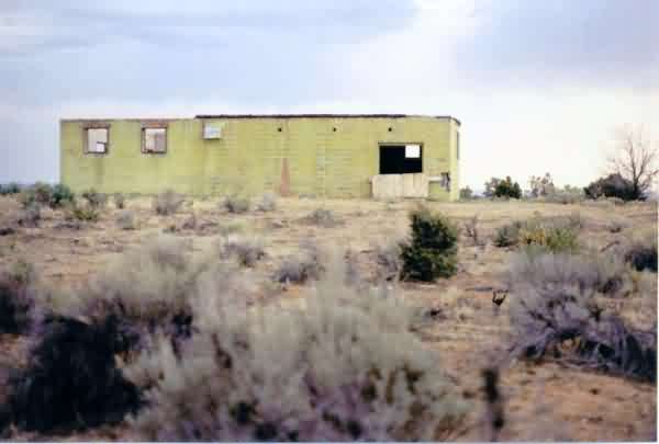
This view shows the diesel-generator wing in the foreground, left (west), with the radar-equipment section in the background and extending to the right (south). [looking approximately due east]
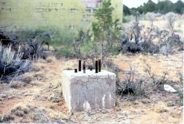
This image shows two of the three radar-tower foundations/footings on the south side of the site. All three are still extant. [looking north-northeast]
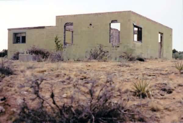
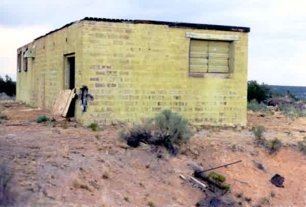
This view shows the radar-tower end of the building, with the radar-equipment section of the building in the foreground (note its missing roof). The diesel-generator wing extends to the left (west). One radar-tower foundation/footing is seen to the left. [looking north-northwest]
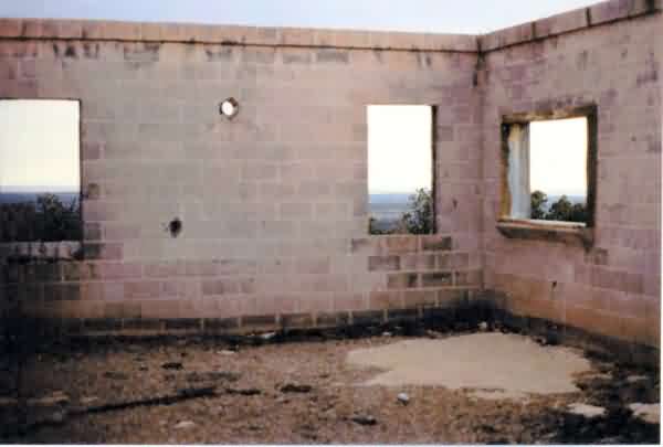
This photo shows the inside of the radar-equipment building. The floor is mostly covered with roofing material. [looking south-southwest]
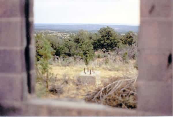
This photo shows the picturesque view seen from the former Zuni gap-filler annex on Pia Mesa. One radar-tower foundation/footing is seen in the foreground. [looking south]
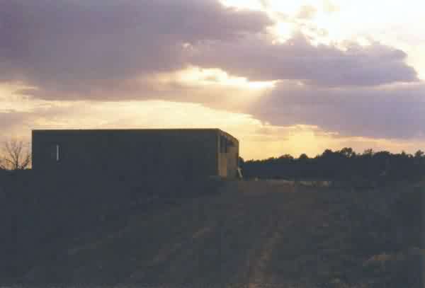
This parting view of the old GFA site shows the late-day sun setting over the facility. [looking west]