Recent Photos of Winnemucca AFS, NV
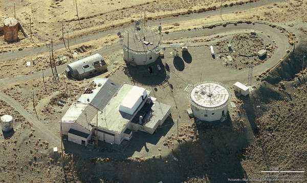
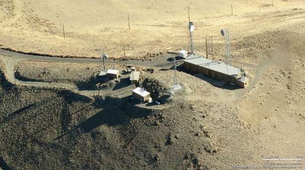
Radar & Operations - Looking North
Radar & Operations - Looking North
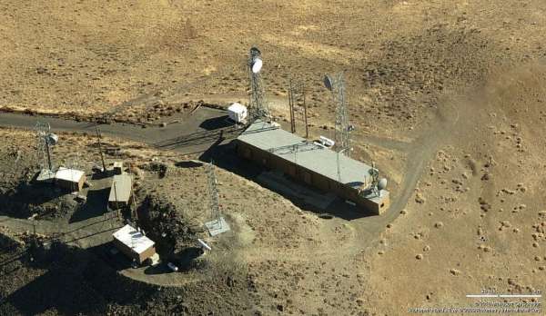
Radar & Operations - Looking East
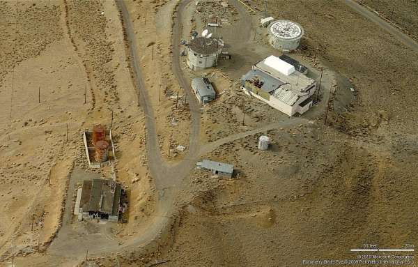
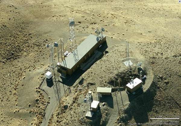
Radar & Operations - Looking South
Radar & Operations - Looking South
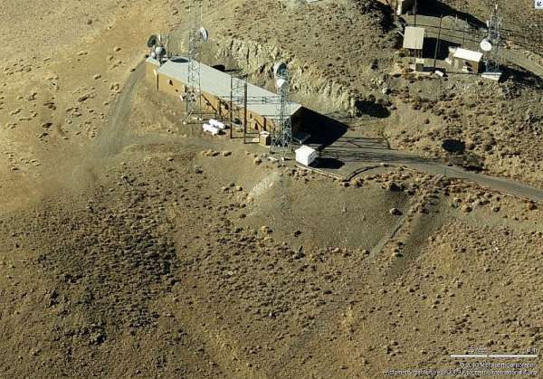
Radar & Operations - Looking West
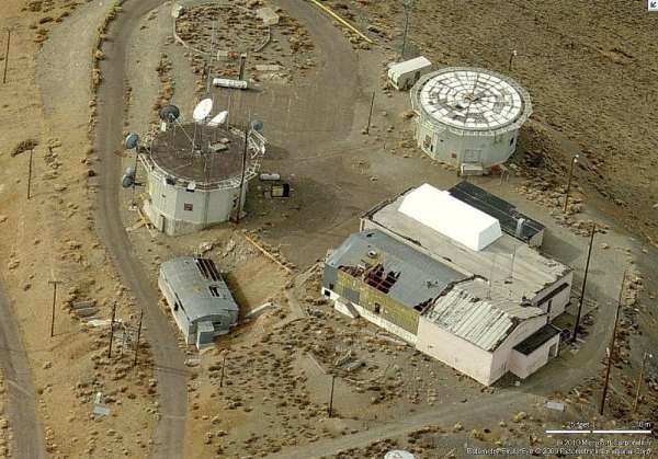
Radar & Operations - Looking West
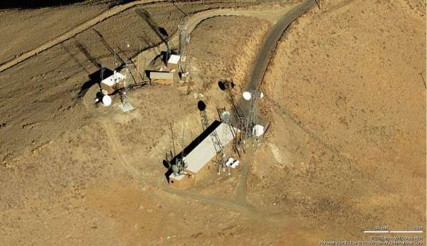
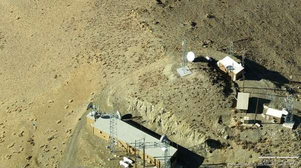
GATR - Looking North
GATR - Looking East
GATR - Looking East
GATR - Looking South
GATR - Looking West
GATR - Looking West
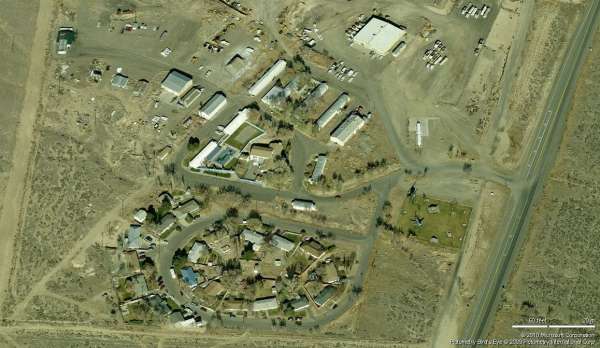
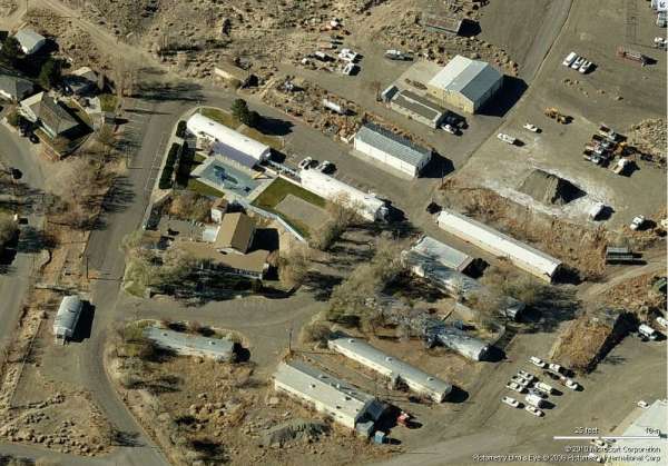
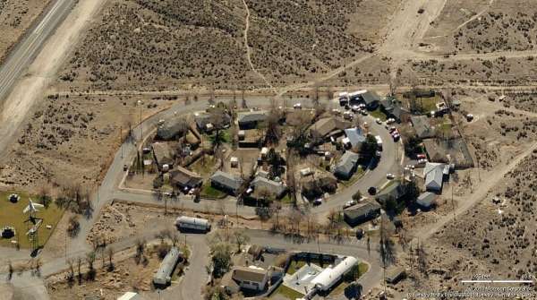
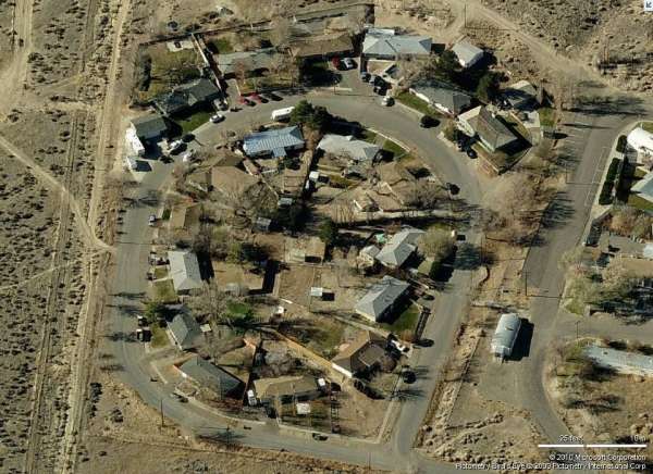
Cantonment & Housing - Looking North
Cantonment & Housing - Looking East
Cantonment & Housing - Looking South
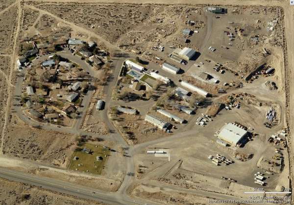
Cantonment & Housing - Looking West
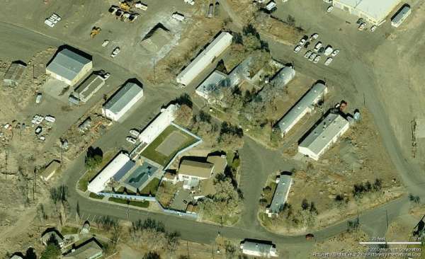
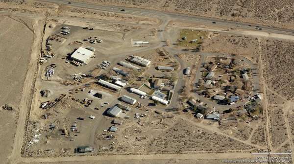
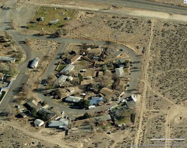
Cantonment - Looking North
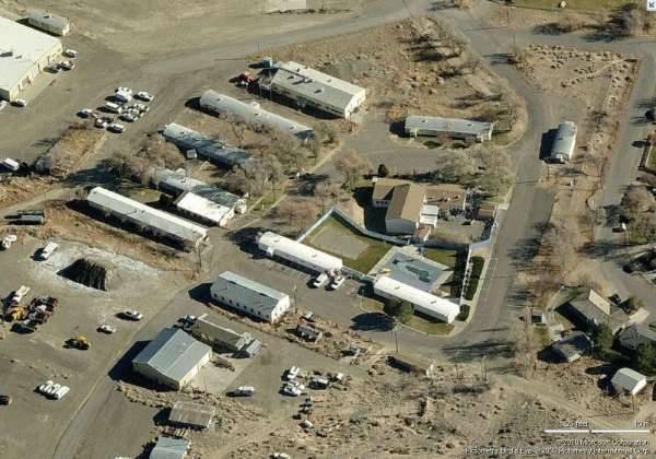
Cantonment - Looking East
Cantonment - Looking South
Cantonment - Looking West
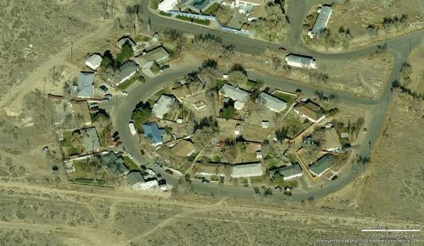
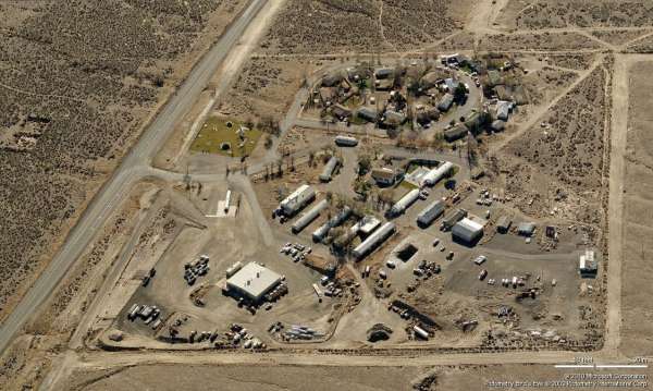
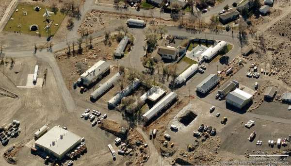
Housing - Looking North
Housing - Looking East
Housing - Looking South
Housing - Looking West
source: http://www.flickr.com/photos/quikbeam/2070244597/sizes/o/in/photostream/
Photo by Zach Sheppard, some rights reserved.
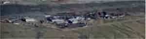
2010 photo of cantonment area. Source: http://www.cohp.org/personal/images/Nevada_prominences_July_2010/Winnemucca_Sabre_60.jpg
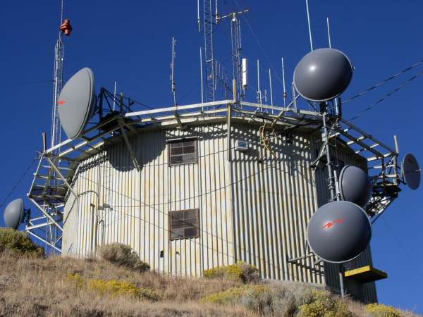
This tower originally housed one of the two AN/FPS-90 height-finder radars.
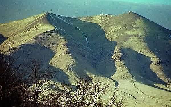
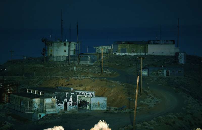
The former Winnemucca AFS seen on top of the mountain in this interesting view
Photo source: http://dmla.clan.lib.nv.us/docs/nsla/SarahW_face.htm>http://dmla.clan.lib.nv.us/docs/nsla/SarahW_face.htm
Oct 2002 photos contributed by Tom Page
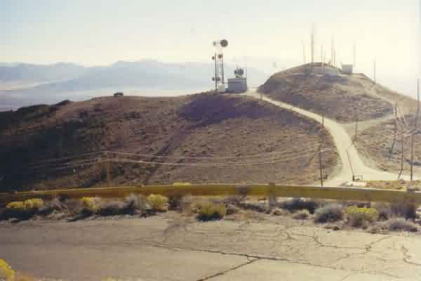
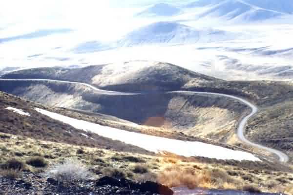
The former Winnemucca AFS, NV (M-127 / Z-127) remains intact and readily accessible. The cantonment area and the family-housing area are both right alongside US Rte 95 just a mile or two north of town. The radar site and the GATR site are both on top of Winnemucca Mountain. The top-camp access road provides an exhilarating drive with great views on clear days. The winds can be extremely strong on the mountain top, but on this particular day (15 October 2002), only a light breeze was stirring.
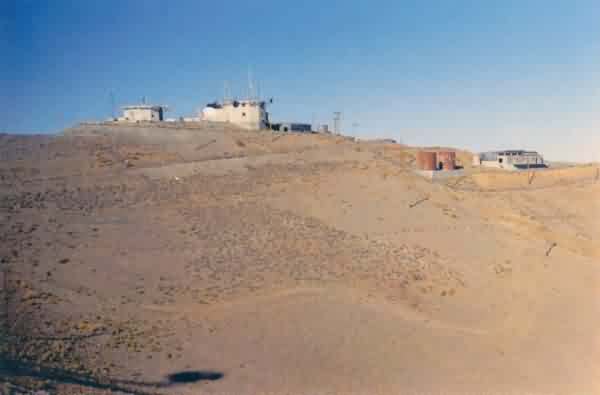
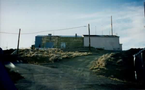
This photo is a telescopic view (though a 300-mm lens) of the top camp, as seen from the town of Winnemucca. The radar/operations site is seen near the upper center, and the GATR site is seen to the left (south). A modern communications facility is seen on the far right. [looking northwest]
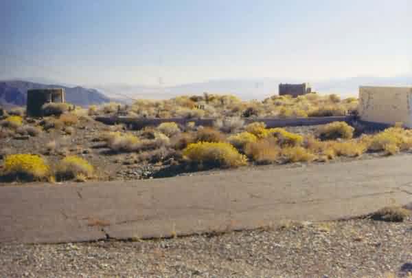
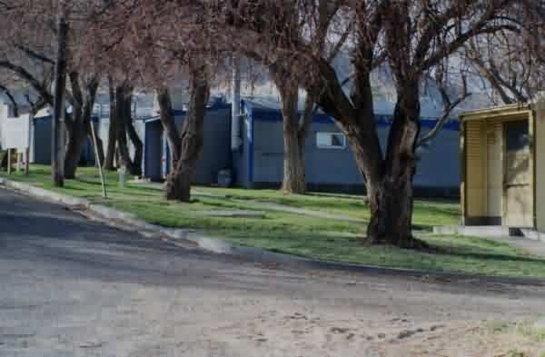
This photo shows the former family-housing area located immediately south of the cantonment area, and just off US Rte 95 on its west side. All houses appeared to be occupied. [looking south-southwest]
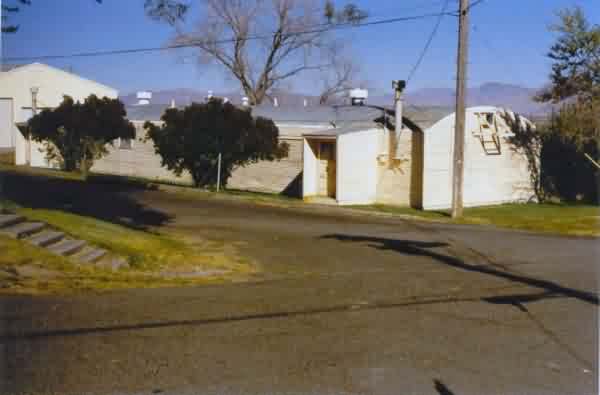
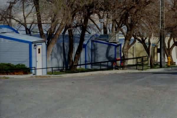
This photo shows one of the Quonset huts at the former cantonment area. [looking east]
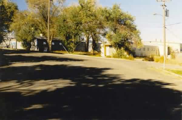
This photo shows some other Quonset huts at the former cantonment area. [looking north-northwest]
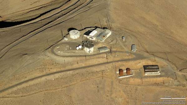
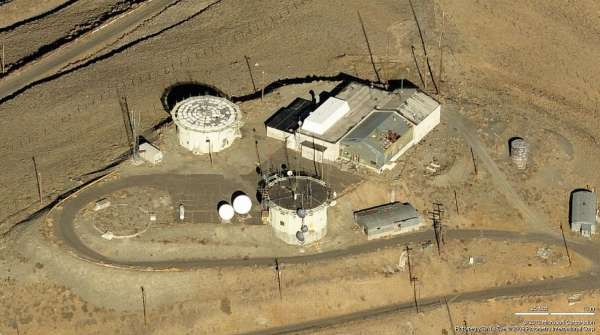
This photo shows one of the two still-extant radar towers with the SAGE LRR Operations building to its right (east). This tower housed the AN/FPS-66 search radar. [looking north-northeast]
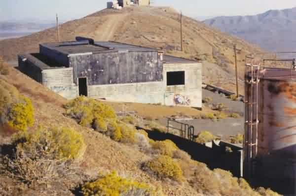
This photo shows the former SAGE LRR Operations building by itself. [looking northeast]
This photo shows the second of two still-extant radar towers. This tower housed one of the two AN/FPS-90 height-finder radars. [looking east]
This photo shows the foundations of the third radar tower which was situated at the southwest corner of the radar site. This tower housed the second AN/FPS-90 height-finder radar. [looking south-southwest]
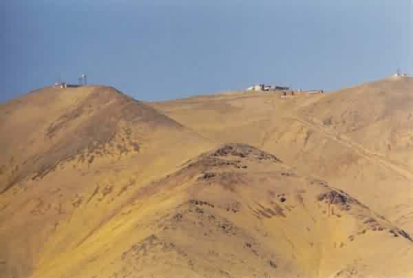
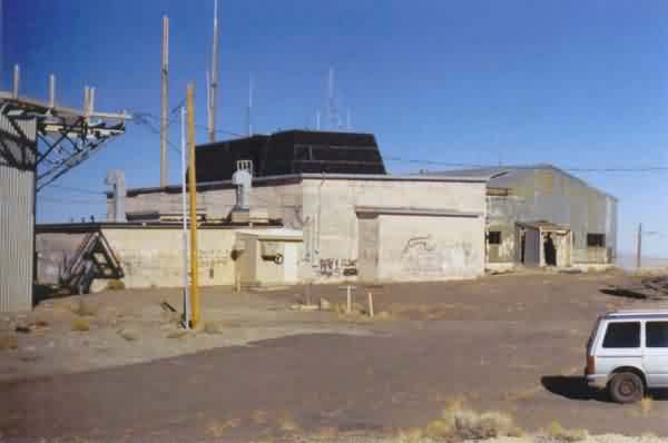
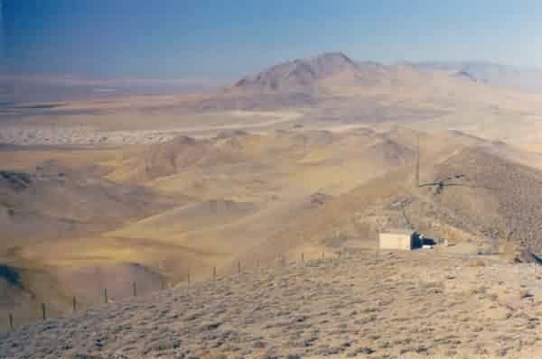
This photo shows the radar site and the power plant as seen from the GATR site. [looking north-northeast]
This photo shows the old diesel power plant located on the east side of the mountain just below the summit. One of two fuel tanks is seen to the right (south). [looking east-southeast]
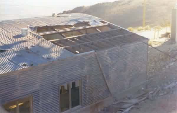
This photo shows one of two Quonset huts at the top camp. This one has clearly seen better days. [looking southeast]
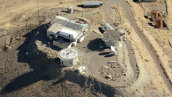
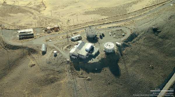
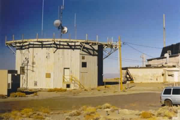
This photo shows the former GATR site which is located immediately south of the radar site. Other communication facilities are seen to its right (west). [looking south]
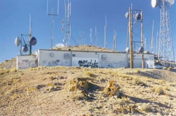
This photo shows the east side of the former GATR building. It appears that the GATR is in use today as a microwave relay facility. [looking west-northwest]
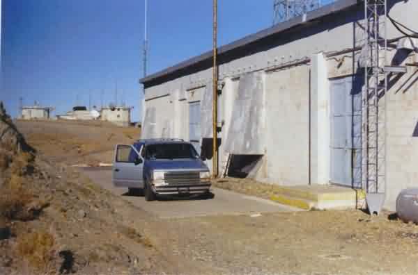
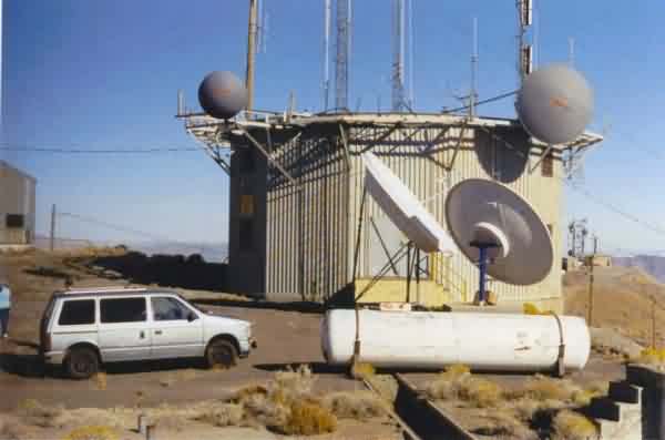
This photo shows the west side of the former GATR building, with the radar site in the background. [looking north-northeast]
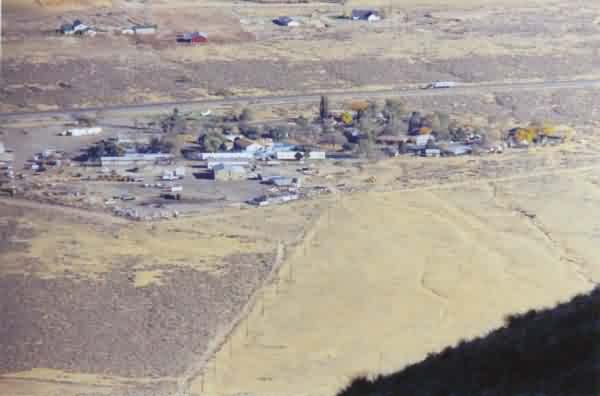
This photo (shot through a 300-mm telephoto lens) shows the cantonment and housing areas at the bottom of the mountain, as seen from the GATR site. [looking southeast]
This photo shows the view to the north of the radar site.
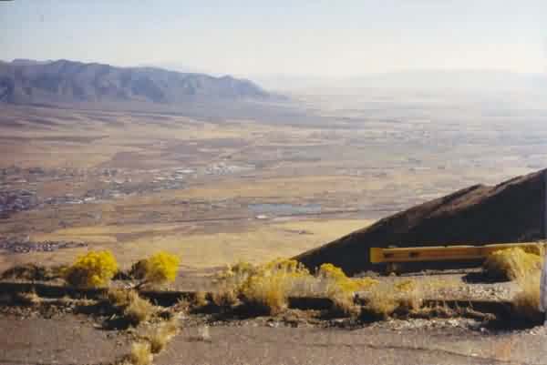
This photo shows the view to the south of the radar site. The town of Winnemucca is seen in the valley to the left (east).
2001 photos contributed by Larry Clare
The site of the 658th AC&W squadron lies three miles north of Winnemucca, NV. and I-80. Of course the interstate wasn`t there during the time that the base was active.
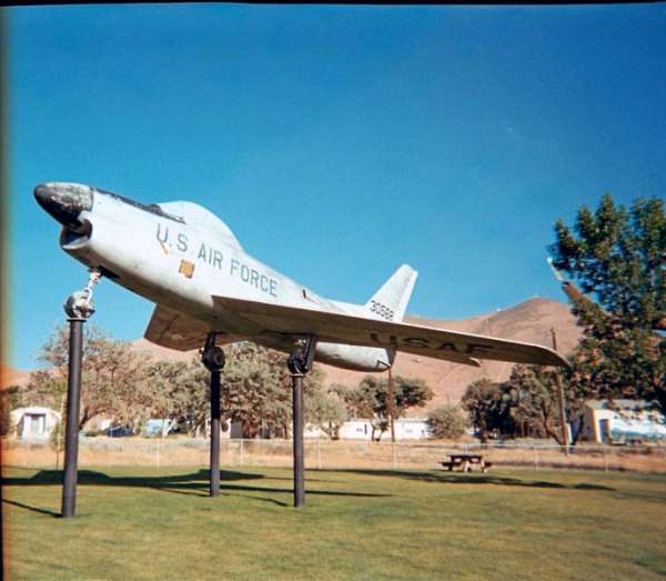
As I exited my car in the parking lot of the hotel, I glanced up. Standing at 4300 ft. you can`t miss Winnemucca Mountain and I didn`t miss the group of building and towers that sit atop it. Driving north on Highway 95 I came to what looked like a little park with an old military tank, an older cannon and a F-86 mounted on a pylon. Behind the park and to the left sits the married housing units, which appear to be fully occupied and well maintained. To the right lies the squadron cantonment area. It also appears well maintained and being used. Several of the Quonset huts seem to be used for storage and some a more active use as a juvenile detention facility. The city of Winnemucca is the current owner of the site and uses all of the buildings for something. Looking up from the squadron area I can still see the old towers and buildings atop the mountain but I cannot see a road to get there. Asking a local policeman refueling his patrol car, he tells me to get back on highway 95 and go north till I see a sign indicating the city garbage dump. He also says to keep going past the dump and follow the road up to the top of the mountain but to watch out for rattle snakes. Following his directions I am on the road up the mountain. The road is paved and in pretty good shape but narrow with many sharp turns. Arriving at the top I see a large no trespassing sign that also states that the area is under video surveillance. I park my car to the side and tried to open the door. The wind was blowing so hard I had to put most of my weight behind it to get it open. Outside of the car as I fight to stay upright I am greeted by very loud whistling sounds of the wind blowing through the antenna`s that now adorn the old radar towers. I estimate 30 to 40 antenna mounted on the old towers and buildings in the old operations area. Back in the car I decide to drive in gate labeled "No Trespassing" and quickly snap a few more pictures before heading down the mountain.
An aerial view
The road to the site
Some of the quonset huts on the site
Another view of the quonset huts
Ops building
Power plant
............................................................................................................................................................................................................

source: Feb 21, 1982, page 16 - Nevada State Journal at Newspapers.com
.............................................................................................................................................................................................................
found online
