Recent Photos of Winfield GFA, KS
The Winfield GFA building and its add-on were mostly destroyed by a tornado. Seen in the center of each image, the building partially standing is the add-on; its north wall is the GFA radar equipment section`s south wall. Nothing else of the GFA building remains except its concrete foundation.
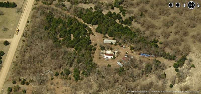
Looking North
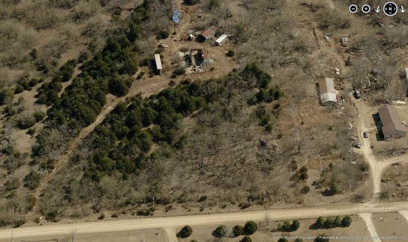
Looking East
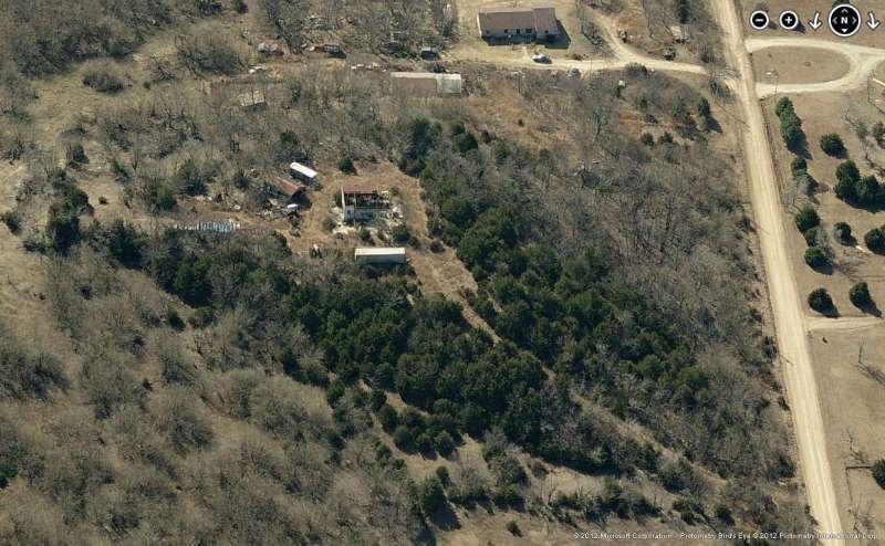
Looking South
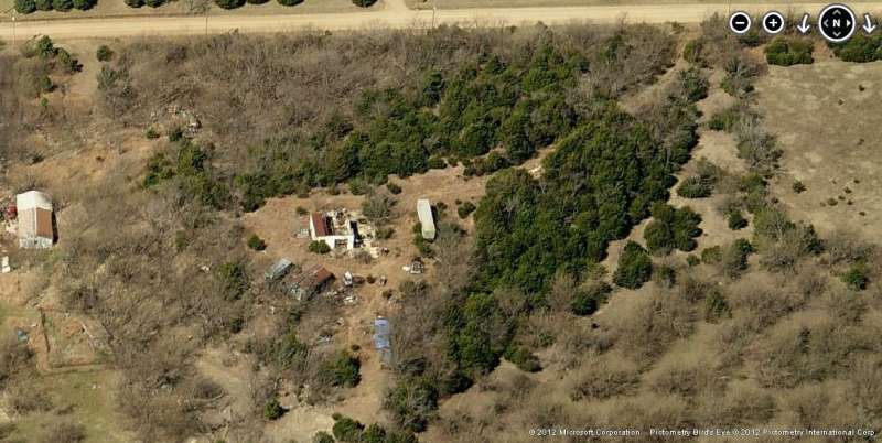
Looking West
Jan 2009 photos & notes by Tom Page
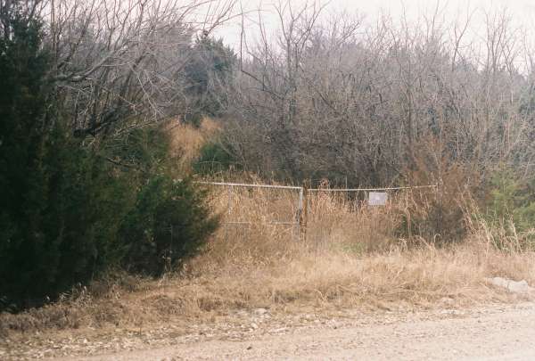
The former Winfield Gap-Filler Annex, KS (P-77D) is located atop a small hill alongside 111th Road (on the road`s east side), about 2 miles southeast of Winfield. Little of the original radar building remains today.
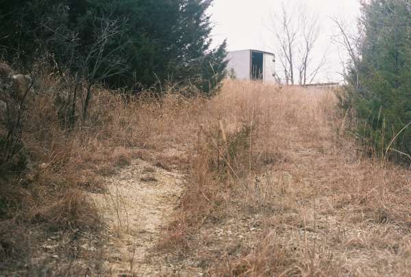
This photo shows the beginning of the site access road where it branches off 111th Road (a hard-packed gravel road). The access road curves to the right as it goes up the hill. From this point, it is a short walk to the top. [looking southeast]
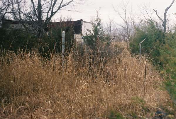
This photo shows the end of the site access road near the radar site`s entrance. The access road is heavily overgrown, as is the site itself. The radar building was to the south of the trailer seen; the top of the building`s later addition is seen to the right of the trailer. [looking south-southeast]
This photo shows the radar site`s entrance and a section of the original chain-link fence. [looking east-southeast]
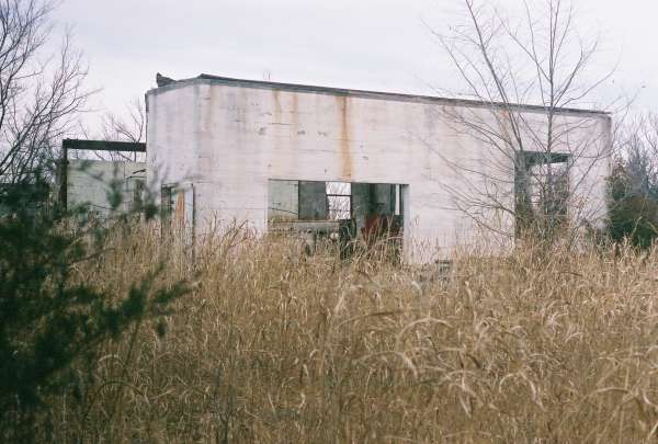
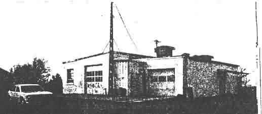
This photo shows the remains of the radar building at the end where the radar tower once stood. The original radar building (now mostly just concrete pad) is on the right, and the later addition is on the left. The addition was built inside the "L." The addition is mostly still standing, although the cinderblock wall between the `old` and the `new` is original. This view is about the same as that for the old B&W photo below taken from the USACE FUDS report. [looking west-southwest]
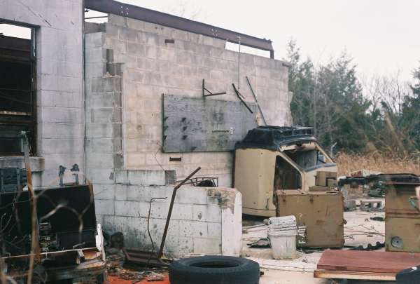
This photo is a close-up of the previous view, showing the few original wall sections of the radar building. [looking southwest]
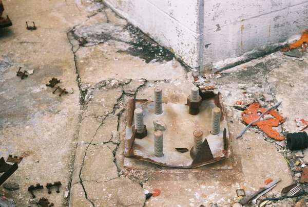
This photo is a close-up of the only remaining radar-tower foundation/footing. [looking southwest]
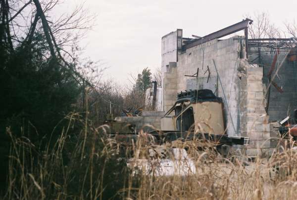
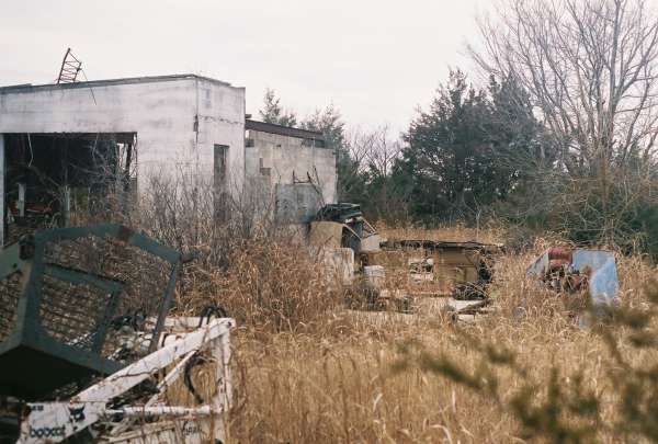
This photo shows the remains of the radar building at the opposite end of where the radar tower once stood. The original radar building (again, now mostly just a concrete pad) is on the left, and the later addition is on the right. As previously mentioned, the cinderblock wall between them is the original radar-building wall. The diesel-power generator wing of the radar building was to the right (out of the picture), in front of (west of) the addition. The near corner is where the firewall once stood, which separated the radar-equipment and diesel-generator sections. [looking east-southeast]
This photo shows the concrete pad of the diesel-generator section of the radar building (foreground), with the later addition behind it. The light-colored cinderblock wall to the left was originally the radar building`s exterior wall. Raised areas were seen on the concrete pad for two electrical generators. [looking east-northeast]
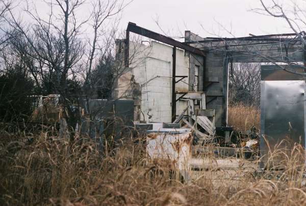
This final photo mostly shows the later addition to the radar building. [looking north-northeast]
From USACE FUDS report
Looking Southwest