Recent Photos of Thomasville AFS, AL
June 2008 photos contributed by William Scott
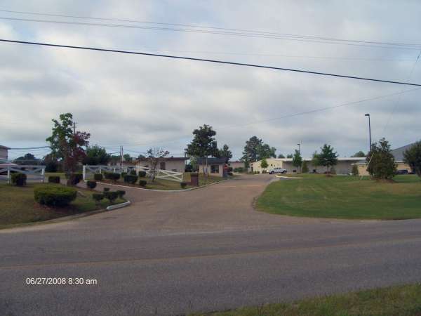
Looking into the former front gate of the radar squadron
The following photos taken from the top of the FPS-35 tower.
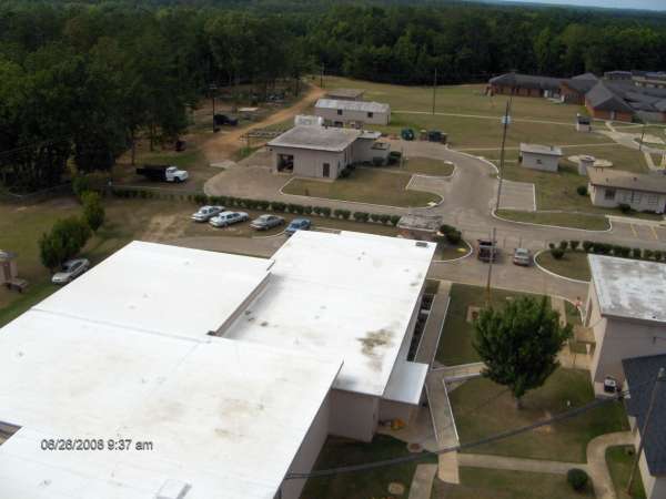
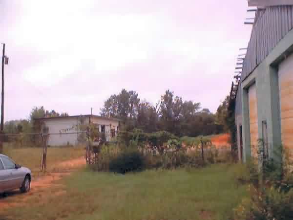
Former radar ops building in the foreground.
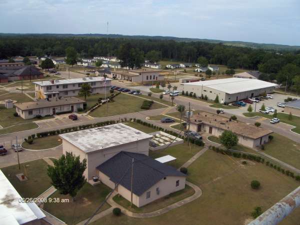
Power plant, orderly room and NCO club picture shows the dining hall is gone and the airmens barracks is gone. The officers barracks is now administrative offices. In the background on the left is inmate dormitories.
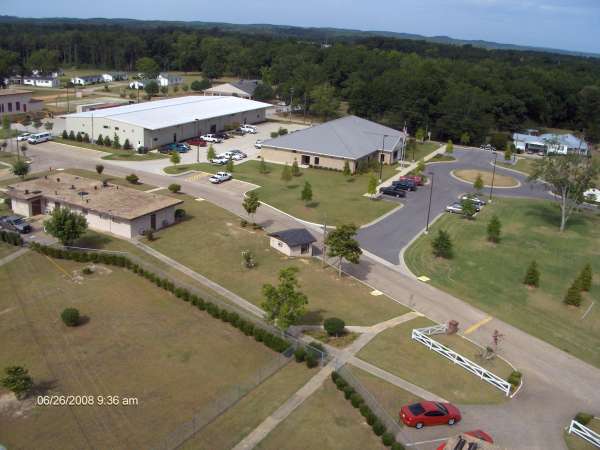
School building on ball field is the new classroom buildings where trades are taught by Alabama Southern Community College.
September 2002 photo by Mark Morgan
GATR Site for Thomaville AFS, AL
February 1999 Photos and notes by Tom Page
Email: tepage@hotmail.com
Tom writes:
"I followed mostly back roads to Thomasville, AL (i.e., Mississippi Routes 27 and 28,
to US Route 49 south and US Route 84 east into Alabama, then US Route 43 north into
Thomasville). I proceeded under the assumption that the "TerraServer" image I had
found earlier was indeed the former Thomasville AFS radar site, which would place
the site on the north side of town. It turns out that this was the correct
assumption — that image is of the former Thomasville AFS site. However, to me, it
appeared that the site was east of US Route 43, just off state route 5 east. When
I went to that location, there was a very-tall fire lookout tower, but nothing else.
Returning to Rte 43, I saw a sign for the "Thomasville Mental Health & Rehabilitation
Center." This seemed like a logical use for a former military facility, so I
followed the signs. About a mile west of town, on Choctaw Road, I rounded a curve
and — voilŕ — there stood the old AN/FPS-35 radar tower! The security folks of
the Thomasville Mental Health & Rehabilitation Center allowed me to take pictures
of the tower and buildings, but told me to make sure I didn`t photograph any of the
residents — there`s a court order in place that prohibits photographing the patients
there. The eastern side of the station, where the radar towers and LRR Ops
building stood, was less restrictive, as that part belonged to the state Alabama
Department of Youth Services. There, I located the footings and cable trough of
one of the AN/FPS-90 towers (east of the LRR Ops building, which stood south of the
AN/FPS-35 tower). The other AN/FPS-90 tower must have stood west of the LRR Ops
building, but no traces remained. As before, I concluded my tour with a quick drive
through the old family-housing area, then I headed east for Eufaula."
Comment: I was surprised that the experimental AN/FPS-35 VHF FD radar at Thomasville
AFS was on a "permanent" concrete tower (same as the production models of this radar
type and the production AN/FPS-24 radars). I thought this prototype model might
have been placed on a steel tower like the prototype AN/FPS-24 radar at Eufaula AFS
(and probably the prototype AN/FPS-28 radar at Houma AFS). This observation suggests
to me that maybe the Air Force had already selected Sperry Gyroscope to produce
AN/FPS-35 radars, while Raytheon and GE were perhaps still competing to see if the
other VHF FD radar type would be the AN/FPS-28 or the AN/FPS-24 (????). Obviously,
the AN/FPS-24 won out, but it`s not clear to me why.
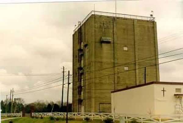
The prototype AN/FPS-35 search-radar tower at the former
Thomasville AFS, AL, as seen from Choctaw Road just north of the site;
view is to the east-southeast.
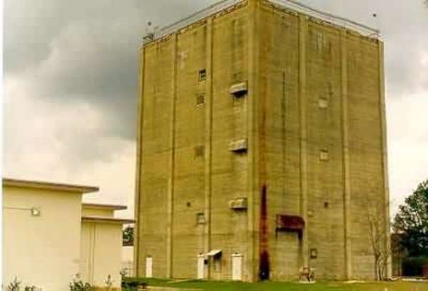
Another view of the prototype AN/FPS-35 search-radar tower,
as seen from the approximate location of one of the AN/FPS-90
heightfinder radar towers (both removed), east of the LRR Operations
building. Note the plaque to the right of the center door (see photo
#3). View is to the west-northwest.
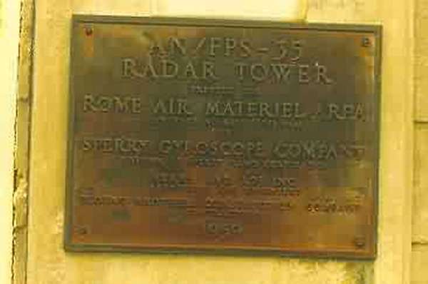
Plaque commemorating the development AN/FPS-35 by Sperry
Gyroscope, etc.
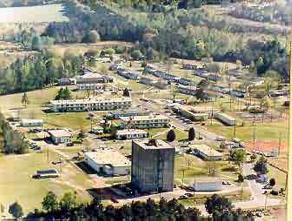
Photo of a photo, aerial view of the former Thomasville AFS,
AL, after site closure. [Facility is now the Thomasville Mental Health
& Rehabilitation Center {southwestern 75%} and an Alabama state Youth
Services center {eastern 25%}.]
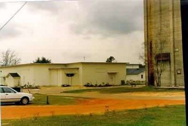
LRR Operations building, looking ~ southwest.
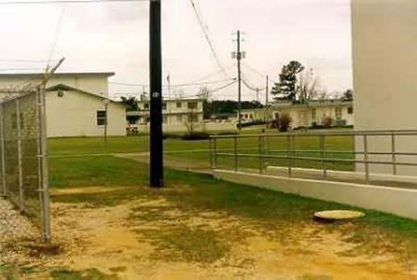
View of the cantonment area, looking ~ south.