Recent photos of Stewart AFB, NY (DC-2)
.............................................................................................................................................................................................................
The following four aerial photos of the former SAGE DC blockhouse are courtesy of "Google Maps" (2017):

Looking North

Looking East

Looking South

Looking West
.............................................................................................................................................................................................................
SAGE Bldg, Looking Sourh
GATR, Looking South
GATR, Looking West
Photos by Christian McCusker, contributed by Joe McCusker
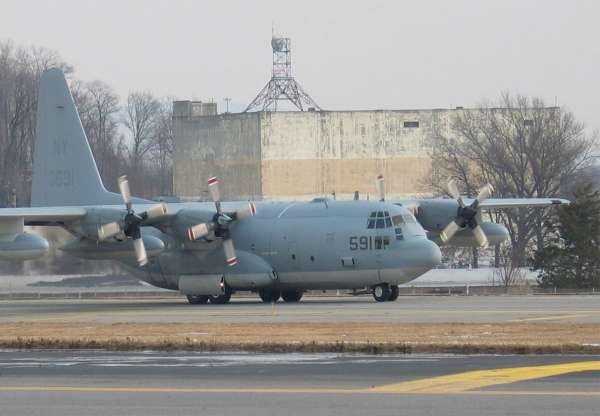
KC-130 of VMGR-452 passing the SAGE DC building
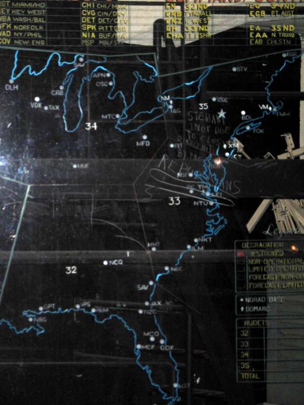
The status board on the right side
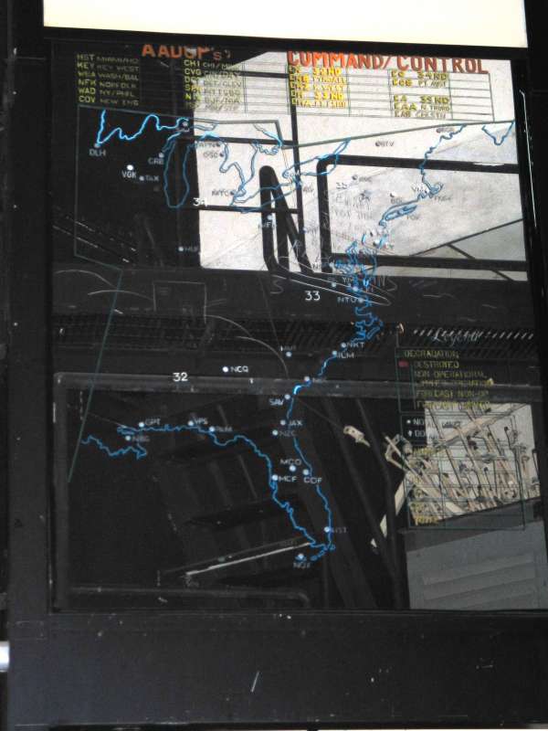
Another view of the board on the right
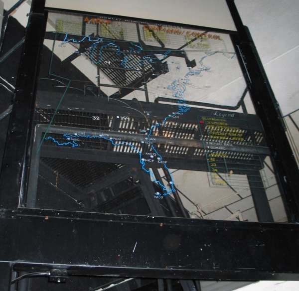
Another view of the board on the right
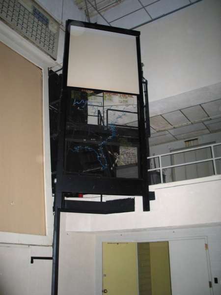
Seen from the main floor level, this is the right side status board.
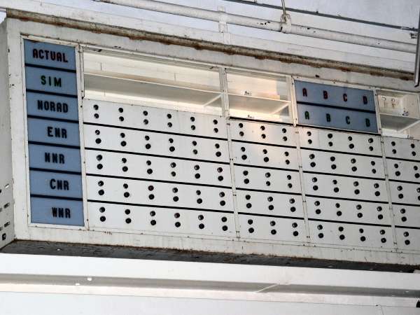
These displays were alongside and slightly above the status boards. They were probably backlit color coded signs. The front panels are missing.
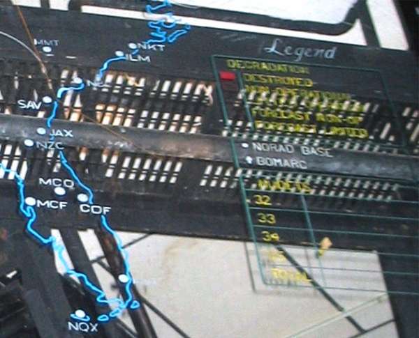
Lower right detail of the board on the right side. The map shows the locations of ADC installations in the 32nd (Gunter AFB), 33rd (Ft. Lee AFS), 34th (Custer AFS), 35th (Hancock Field) Air Division. It would indicate by changing the color of the white circle or arrow for BOMARC sites which ones had been affected by attack. Further down is an indicator to show how many NUDETS had occurred in region.
The board text is:
Legend
Destroyed
Non-operational
Limited operational
Forecast non-op
forecast limited
[white circle] NORAD base
{white arrow] BOMARC
NUDETS
32
33
34
35
Total
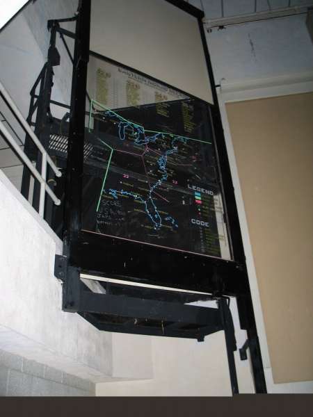
The status board on the left side of the projection screen.
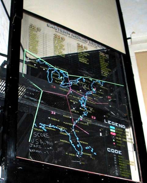
Close up of the left side status board. The top of the board reads: Eastern NORAD Region, Ground Environment Status, and lists the several Air Divisions.
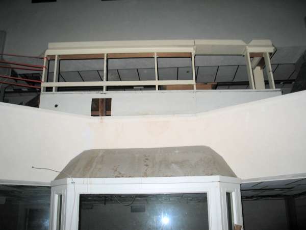
Looking up at the battle cab from the floor, the displays were behind the camera`s view.
SAGE building interior.
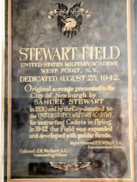
Stewart Field dedication now located in airport operations
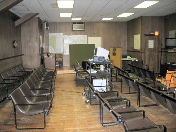
Briefing room in airport operations.
This building was the Hq for the FIS at Stewart in the 1950s and the 4713th Defense Systems Evaluation Sq (EB-57) in the 1960s. While in USAF use, the chairs faced the stage at the far wall.
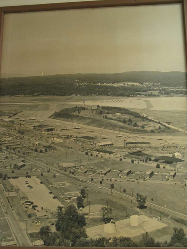
This is a photo taken of a photo of the flightline area, probably early 1960s. EB-57s can be seen on the flightline in the bottom of the picture. The airport operations building (former FIS and 4713th ops bldg) is the small structure on the flightline just at the right edge of the frame. The tower (replaced in 2006 or 07 at a different location) is on the hill. I think the GATR was there, too. The FIS alert area is out of the picture to the top left. Todays ANG base is out of the picture to the right.
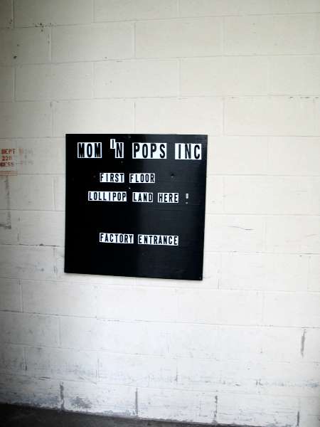
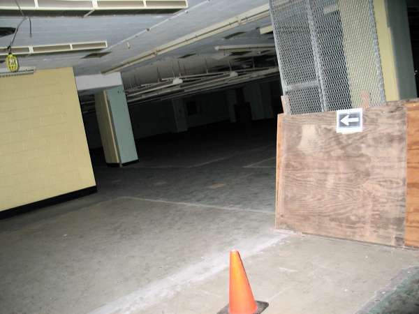
Part of the ground floor is occupied by this candy company. Sky Chefs operated here 20 years ago when American Airlines had service at Stewart. Entry to the places shown in the interior SAGE photos is through here, through a blocked and secured door.
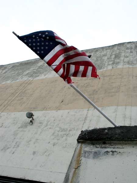
The flag is still there...
The fighter-interceptor alert area.
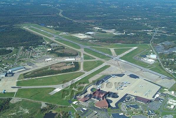
Source: http://www.skyviewpictures.com/html/galleries/airports.html
April 2001 photos and notes contributed by Tom Page from the "New" Tour, 2001
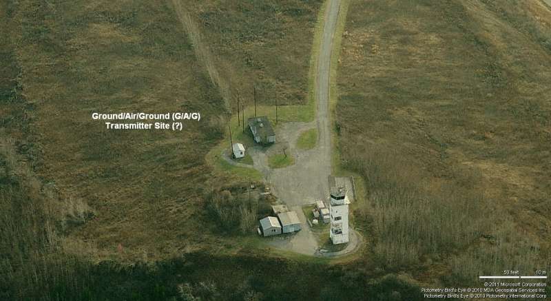
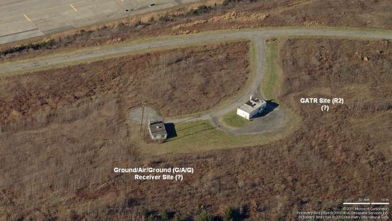
The former Stewart AFB is now Stewart International Airport, and is located on the west side of I-87, near Newburgh, NY. The old SAGE Direction Center (DC) blockhouse, still extant but with faded paint, is located west of the airport terminal area and south of the runways. The blockhouse appears to be partially used by Bell Atlantic, and has a microwave tower on its roof. What appeared to be a radio transmitter or receiver site of typical USAF construction was seen on the ridge top east of the blockhouse, near the airport control tower. A few of the other buildings near the blockhouse were in use, but most appeared vacant. Baseball fields across the street were being used by Little League teams.
The gate guard at the nearby ANG base said the 4th floor of the old SAGE blockhouse still has plotting boards and other equipment left behind. Some of this just *might* be of interest to the USAF Museum for some of their planned Cold War Air-Defense exhibits.
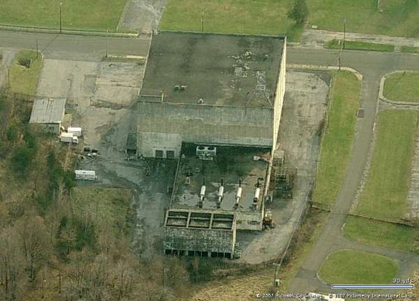
The SAGE DC blockhouse is located near the present-day Stewart International Airport, but to the west of the terminal area.
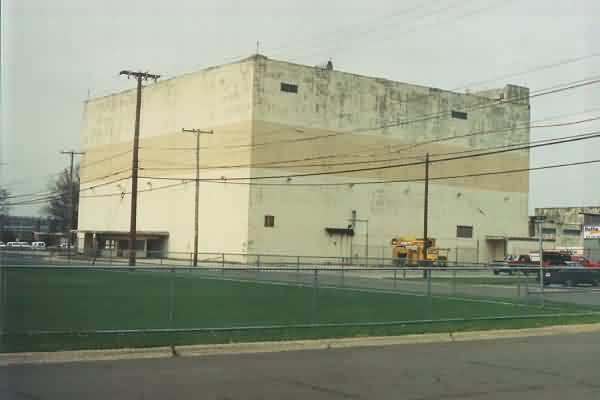
SAGE DC blockhouse (looking northwest); on Brooks Street.
SAGE DC blockhouse (looking east-northeast); appears to be used by Bell Atlantic now.
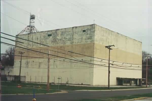
SAGE DC blockhouse, power plant, cooling tower (looking northeast).
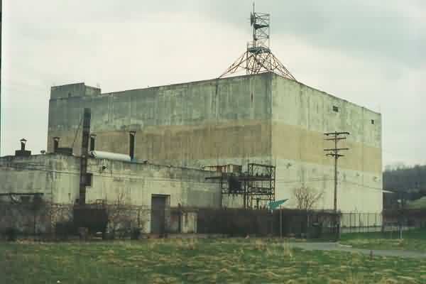
SAGE DC blockhouse and power plant (looking south-southeast).
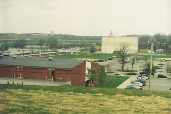
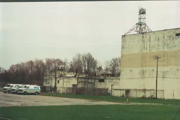
SAGE DC blockhouse and runways, as viewed from hill to the south (looking north).
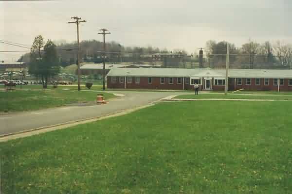
Probable administrative area, as viewed from just west of the SAGE DC blockhouse (looking south).