Recent Photos of Sierra Blanca GFA, TX
Looking North
Looking South
March, 2002 photos contributed by Tom Page
Looking North
Looking South
March, 2002 photos contributed by Tom Page
Before this site visit, the location of the Sierra Blanca (TX) gap-filler radar annex was not at all certain. The "Formerly-Used Defense Sites" (FUDS) compilations maintained by the U.S. Army Corps of Engineers (USACE) actually lists the Sierra Blanca GFA as being in New Mexico. [We can now say that this is probably a simple typographical error, since this GFA site is within the Albuquerque (NM) USACE District.]
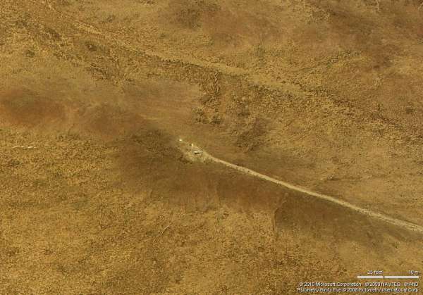
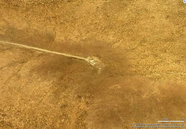
Not having a FUDS report to provide the site`s location, the only other readily-available way to find the site was by a pain-staking search through the "TerraServer" aerial imagery looking for a tell-tale L-shaped structure. Since this GFA was assigned to Walker AFB, NM (M-90), it seemed likely that the site would have been north of the town of Sierra Blanca. Sure enough,a likely-looking candidate was spotted just west of TX State Road 1111, about 5 miles south of US Rte 62 / 180. Since this suspected location was a good 43 miles or so north of Sierra Blanca, the GFA location remained far from certain. The only way to know for sure would be to see the site up close from the ground.
A site visit was conducted, and the suspected location was easily found. The access road had a locked gate across it (but there were no signs saying to stay out). The gate itself did provide a valuable clue indicating that this indeed just might be the right place!
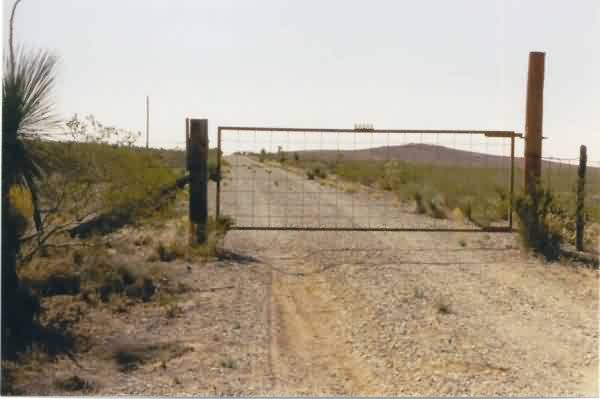
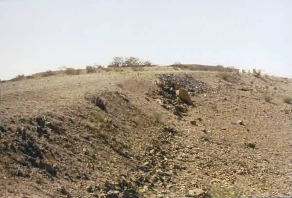
A view of the hill (distant, right), about 0.25 mile west of TX SR 1111, where the Sierra Blanca
gap-filler radar annex was believed to be situated. Hmmm, could that be a clue on the gate
indicating that this might indeed be the right place? :-) [looking west]"
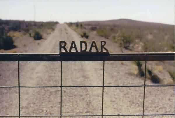
A close-up of the gate decoration. Yeah, the lettering strongly suggested that the old
Sierra Blanca gap-filler radar site just might be located atop the hill ahead! [looking west]">
The end of the access road and the top of thehill -- no building is seen, but ... is that a
foundation up there? [looking west
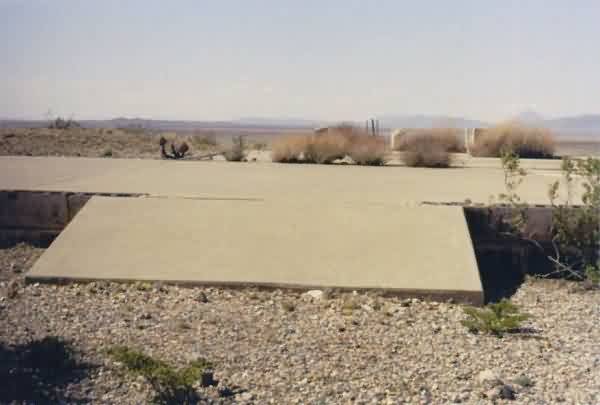
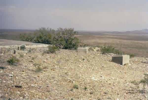
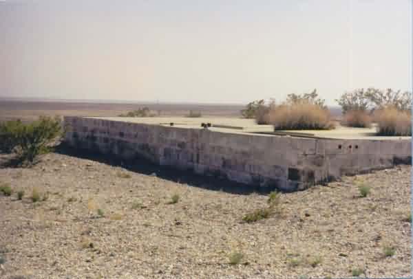
Yes, by George! This is -- without any doubt -- the Sierra Blanca gap-filler radar annex.
In the foreground is the entrance ramp to the former radar building. Beyond the
radar-building concrete pad, straight ahead, is the diesel-generator concrete foundation
with two raised pads for the generators. Just beyond that are the three supports
for the above-ground fuel tank. The three radar-tower foundations / footings were likewise
still extant, and were located to the left out of the photo. In the far distance on the
right, the mountains of Guadeloupe National Park can be seen. [looking northwest]
A view of the southwest end of the former gap-filler radar building and the three foundations /
footings for the radar tower. [looking east]
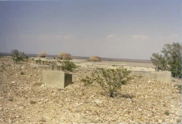
Another view of the old gap-filler radar-building pad and the three foundations / footings for
the radar tower. [looking north-northeast]
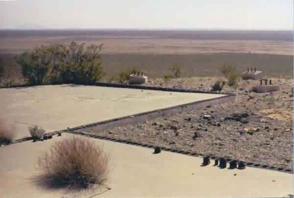
A view of the northeast side of the former gap-filler radar building and the diesel-generator
wing (closest corner). The two raised pads for the generators can be seen. [looking south]
A view of the former radar building (foundation) with the diesel-generator wing in the
foreground. The three radar-tower foundations / footings are seen to theright
(southwest). The peak faintly seen is the far distance (left) is believed to be
the mountain known as Sierra Blanca. [looking south]
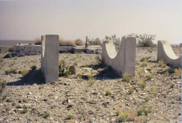
A view of the three supports for the above-ground fuel tank, with the GFA building beyond it.
[looking southeast]
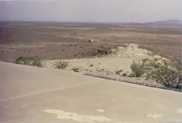
A view of the access road looking down the hill. [looking east-southeast]