Sedgwick, ME GFA Recent Photos
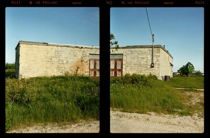
Photo source: http://stevendkeirsteadphoto.blogspot.com/
Photo source: http://stevendkeirsteadphoto.blogspot.com/
Radar House, Radar Road, Sedgwick, Maine, MMVII
I photographed this odd, blocky building without knowing what it was, and as I did so I was thinking about how to make the simple structure less banal. While the lushly growing lupines and other plants, the peeling yellow paint and rusting metal doors framed a compelling subject, I wanted to approach it creatively. I was not content to simply document it. So I decided to photograph this diptych shooting the building from the two corners, which would give a glimpse of both sides of the building, along with the front. In the back of my mind I was thinking of David Hockney’s photocollage of a desk, a more complex composition that shows the top, sides and front of the furniture.
I was later told this was a World War II radio house for a radar installation, but recently I learned this is not quite right. Built in the postwar, the 1950s, this was the Sedgwick Z-6BB (sic) Radar station, that had an unmanned radar tower and equipment to transmit data to Charleston Air Force Station in Charleston, Maine. The Sedgwick station was a Bendix model AN/FPS-14 radar, placed to fill in gaps in radar coverage from the larger installation at Charleston.
Posted by Steven D. Keirstead at Thursday, June 02, 2011
April 2001 photos and notes contributed by Tom Page from the "New" Tour, 2001
This former gap-filler radar annex is located 1.3 miles north-northwest of the town of Sedgwick, just off Christy Hill Road on Radar Road (north side).
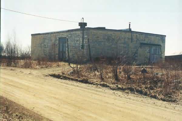
The old gap-filler radar equipment building appeared to be sealed up and vacant. The only fence section left in place was the two gate poles on either side of the ‘driveway,’ seen in front of the corner. The diesel generator room was the wing to the right. [Looking west-northwest]
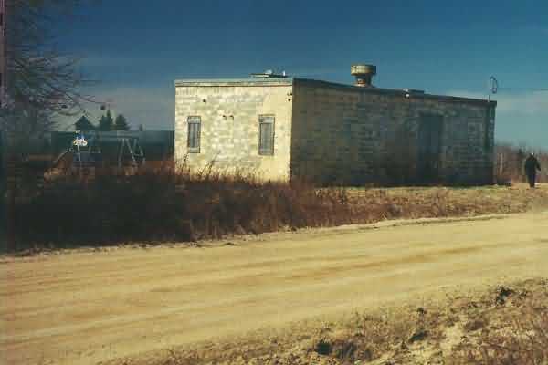
A view from the south side. The sun-lit end is where the old radar tower once stood. A children’s swing set was set up behind the GFA building, probably belonging to the residents of the farmhouse seen in the background. However, it was not clear if they actually owned the former GFA facility or not. [Looking north-northeast]
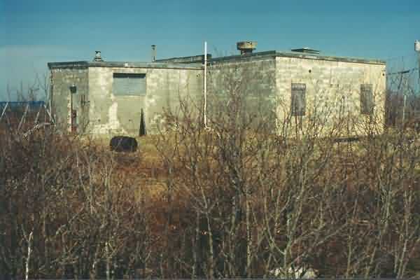
The ‘back side’ of the former Sedgwick gap-filler radar annex. The diesel generator room was the wing to the left. [Looking east-southeast]
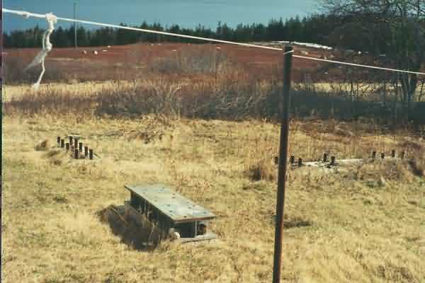
The support footings for the old radar tower (looking south).
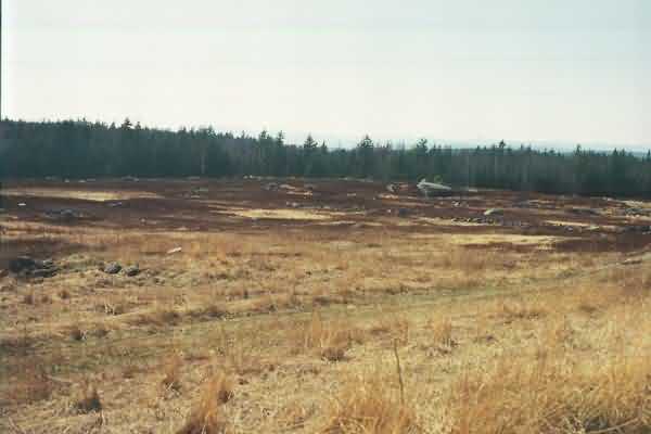
View from the old Sedgwick GFA site, looking ~ west-northwest.