Recent Photos of Port Austin AFS, MI
.......................................................................................................................................................................................................
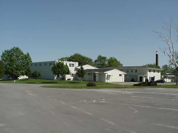
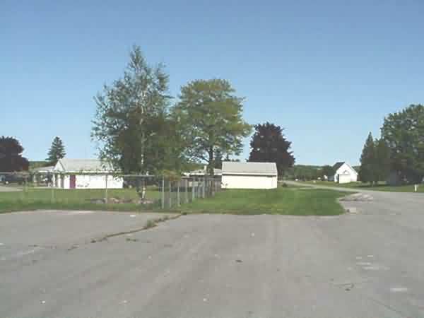
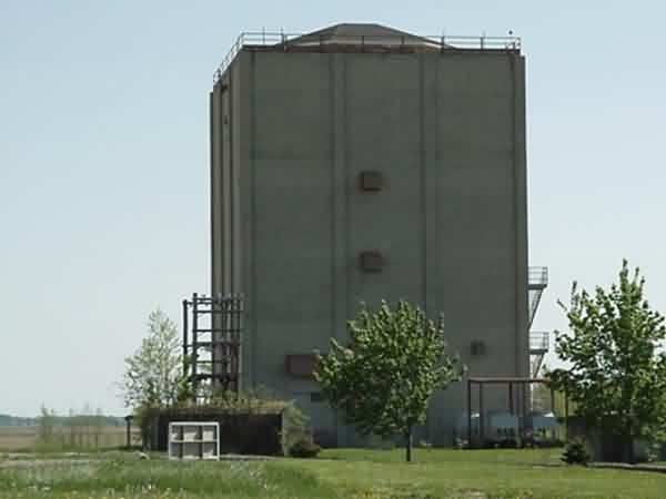
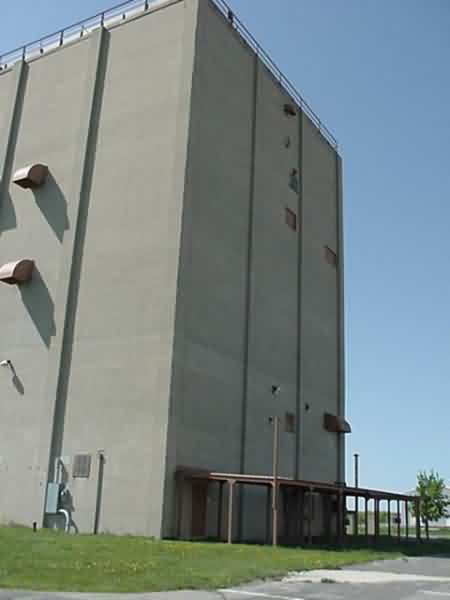
The following five photos were made by Tom Page on 9 June 2025:

The former AN/FPS-26A FD height-finder radar tower, later AN/FPS-116 height-finder radar tower (looking west)
.

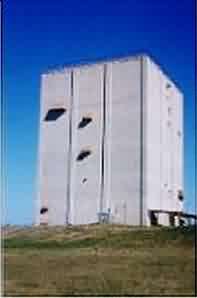
The former AN/FPS-24 FD search radar tower, later AN/FPS-91A search radar tower (looking southwest)
.

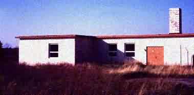
The former squadron area (looking south-southeast)
.

A rainy view of the former AN/FPS-24 FD // AN/FPS-91A search radar tower (looking southwest)
.

The family housing area - eight of the nine houses appeared to be occupied; one was for sale (looking northeast)
.
........................................................................................................................................................................................................
drone video: https://www.youtube.com/watch?v=dDVJCgiMzuQ

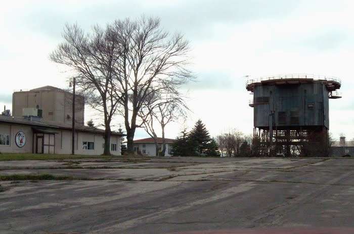
photo source: http://www.panoramio.com/photo/60082089
(c) Copyright - All Rights Reserved - Displayed here for historical / non-commercial purposes only.
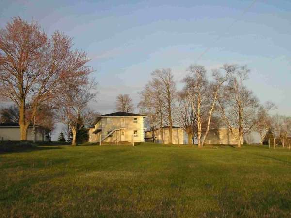
Photo source: http://www.portaustin.net/notopmainframe.html
The view appears to be to the east.
Looks like this former AF Station is now the "Port Austin Bible Campus."
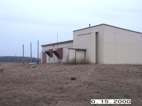
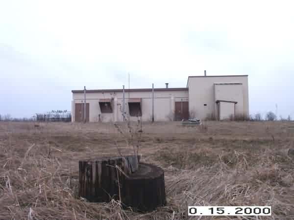
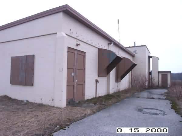
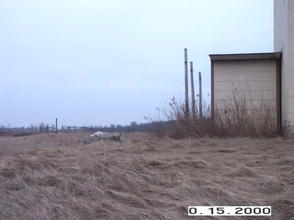
March 2002 photos and notes contributed by Tim Tyler
Date of visit: 20 MAR 02.
It was a little after 5PM as I finished poking around the old Burnside Gap Filler Annex (see prior email), and I had a major decision to make -- head back home & end the totally impromptu Cold War site Curious-Georging, or press on to Port Austin, a straight shot N from where I was? The mission objective at Port Austin would be to locate, explore & document the Port Austin AFS Ground-Air/Transmit-Receive (GATR) radio annex site. Then re-visit the AFS, risking not making it to the area until after dusk, or just call it a day & get home in time to go to the gym.
I`d already had the Port Austin AFS coordinates stored in my GPS from a prior visit, and my GPS-V was advising that the AFS would be about a 67 mile drive North. The GPS also told me exactly when sunset would occur, and I decided to go for it. As long as there weren`t any traffic issues, I should make it into the area with enough time to at least give a good look for the GATR site before sunset.
I`ve violated the former Port Austin AFS several times in the mid & late 1990s while doing some deep shipwreck diving from boat charter operations out of Grindstone City and Port Hope, and while in the area for that, I`ve detoured to the old AFS. So it was nice to know that in my mad rush to get there before dusk, I could concentrate on the GATR, and only hit the AFS-proper again if there was enough daylight left.
I`d received a couple conflicting reports about where the old GATR was. Seems like over the decades, the GATR operation was located in a couple areas. This was rendered somewhat moot by my not having printouts of that data with me anyway. There was one report that indicated for in some years, the GATR operation was right on the AFS, with separate transmit & receive sites.
Take a look at the great airborne photo on the Port Austin home page. You`ll notice the rather isolated building in the lower center foreground of the photo, and then diagonally on the other side of the base, you can see a similarly isolated building. I don`t know much about the layout of AFSs, but these two do give off the signature of separate transmit & receive sites to me, though there is no evidence of any antenna farms in the photo (which could be because the GATR mission was relocated to the off-base annex long before the photo was taken). I understand the technical reasons for locating the GATR away (thousands of feet, not just dozens or hundreds) from the main installation, but I did here from for former Port Austin AFS`ers that for a while the GATR was on-base, so...
ANYWAY, the drive up that way from Burnside was pretty simple -- straight up on M-53, and according to my GPS, it was looking like I`d get to the area with a decent enough amount of time to prosecute my primary mission.
Tom & Gene advised that they did have reason to believe the GATR was on Knoblock Road, and that went along with one of the reports I`d received from someone who has been assigned to the AFS once. I saw the FPS-24 tower & the rest of the site from about a mile away. In typical fashion, the installation was up on high ground.
I made the left turn on Knoblock Road, and it was hard to concentrate on looking for GATR signatures, instead of looking at amazement at the massive old AFS on my right. I did succumb a little, and stopped the car in order to take PTAUSAFS1.JPG, which is looking North, onto the S side of the former AFS.
Having memorized the map of the area already, I knew one nice thing about this GATR hunting task was that as long as the former GATR site was indeed West of the AFS, there was only so much land it could be on, before I`d hit Lake Huron!
I spotted someone in a service van leaving a driveway off Larned Road, so I decided that since I was pressed for time, I`d actually interrogate the local populace, rather than just driving aimlessly about like I usually do. He was familiar with the general area, didn`t know about any buildings that resembled my description of a former GATR. Oh yeah, the only other former AFS GATR I`ve ever seen is the Belleville AFS GATR, which I`d located while actually trying to find Belleville AFS itself... If you`ve been to that GATR, you`ll understand how surprised I was to have come across it while searching the area looking for the AFS (which I never found!). At the time, I found it, the old Belleville AFS GATR was the HQ AF MARS (Military Affiliate Radio System) station, callsign AGA3HQ. But I digress...
The guy claimed to be reasonably familiar with the area, though he lived in a community about 5 miles away. He knew of nothing that resembled the GATR picture I painted for him. He did suggest I try stopping buy a particular bar & pizza joint in Port Austin, as plenty of knowledgeable old-timers hung out there. I thanked him, and instead of turning back around to Knoblock Rd, I continued North on Larned to both look for the GATR as well as see the back (west) end of the AFS. PTAUSAFS3.JPG is a photo looking east, onto the W end of Port Austin AFS.
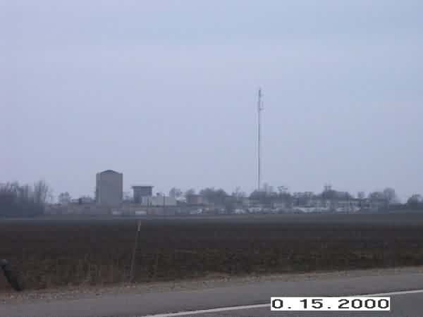
I made a left turn on Sand Rd, in order to make a rough circle (actually a triangle) of the target area, based on my mental recollection of the roads. Sand Road is appropriately named, and I`m glad I have a 4WD vehicle, though the problem was mostly due to the accumulated precipitation, not the sand itself. Sand Rd crossed Knoblock after about a mile, and I headed E on Knoblock in order to complete the vicious circle. Sho`nuf, as I see the modern cellular antenna tower located at the old AFS in the distance, I notice an isolated, fenced compound up ahead which definitely had a military signature. 10 or 12 tall telephone poles would have provided the specific GATR signature, but that was lacking. The site was only about a half-mile away from where I conducted the field interview with the guy who claimed some familiarity with the local area...
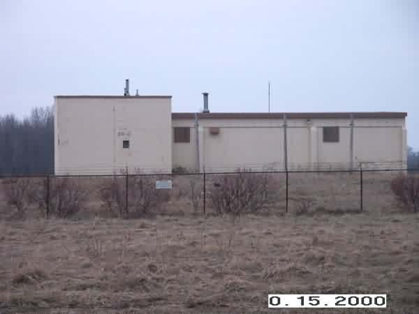
PTAUSGATR1.JPG (above) is of the GATR site, while I was still headed East on Knoblock Rd.
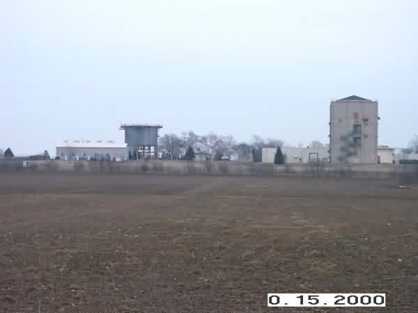
PTAUSGATR2.JPG (above) is taken from Knoblock Road, looking North at the `front` of the former GATR site.
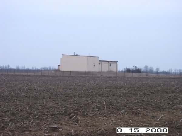
PTAUSGATR3 is the same image, zoomed in. The antenna-like pole on the roof of the building is indeed some sort of old antenna support mast, but for something fairly small & light -- perhaps a TV antenna, mediumwave/shortwave wire dipole antenna, etc.
I started walking around the front (South) side of the perimeter, and came across a small AT&T buried cable marker. I`m assuming the cable fed the GATR to the AFS, but I wonder why they would have had AT&T do it, instead of just running a USAF-owned underground cable the mile or so distance to the AFS. I`ll save any `your government at work!` comments because I don`t know for sure that the AT&T cable connected the GATR to the AFS... This is PTAUSGATR5.JPG
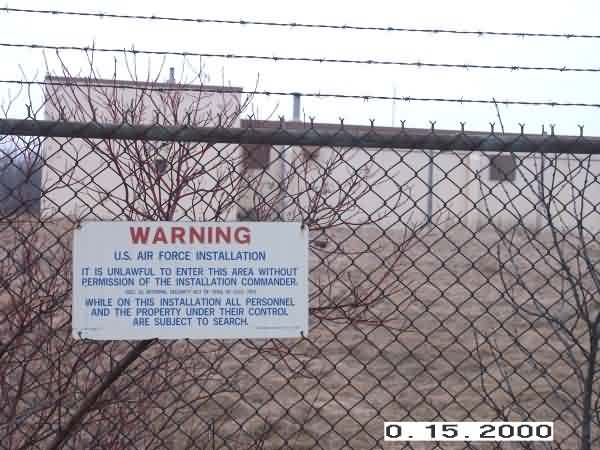
As PTAUSGATR6 indicates, many of the USAF signs are still up along the fence. All the signs are 1974 vintage, per the little US Govt Printing Office item # in the lower right corner of the signs.

There were ample remains of the old telephone poles that had once provided height for the antennas, but at some time in the distant past, the poles had been axed down & removed. PTAUSGATR7 is a close-up of the remains of one of the approximately 7 or 8 former antenna masts.
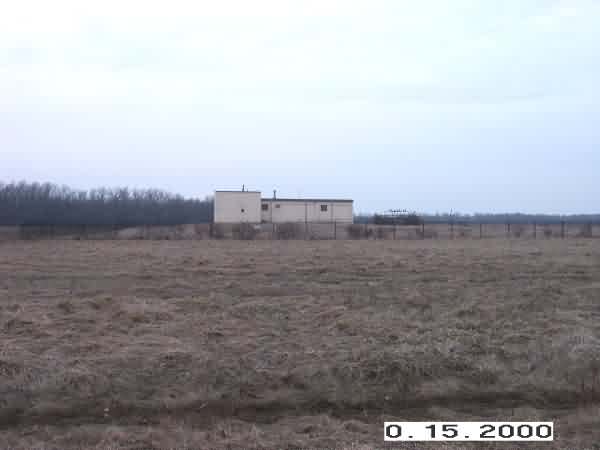
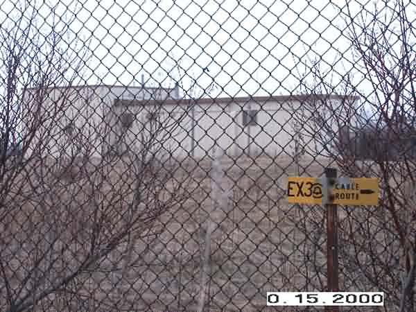
PTAUSGATR8 is a more distant shot, through the fence. At this point, I`m still along the front fenceline of the site.
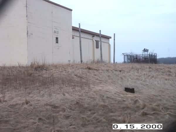
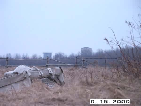
PTAUSGATR9 is aiming SE, looking at the N & W sides of the building. The three small telephone poles were maybe for power or telephone lines? Too close together methinks to have been HF antenna supports, though my understanding is the AFS did have HF radio. And this is where I discovered one major breach of the fence! It was probably done by some farm equipment, as about 20` of the fence is missing. I`m glad I had the time & inclination (temp was in the upper 30s, and I really wasn`t dressed for it, but I maintained mission-focus).
PTAUSGATR10 is a nice, kinda artsy shot taken of the back of the site, witht he camera pointed south, showing one of the GATR antenna masts in the foreground, with the entire GATR building & some nasty old couch in the background. I wonder if the couch came from within the GATR building, as the compound is surrounded on three sides by farmland, I don`t see why someone would haul an old couch and dump it at the back of the GATR site...
As PTAUSGATR11 shows, all doors & other openings (the ventillation) for the GATR building were secured. It`s kinda too bad, as I would have loved to see what was inside. No signs of vandalism or frequent use. A spent shotgun shell was found by the front gate. The one and only door that I was able to open is of that little shed-like building on the far right of PTAUSGATR11. I was thankful of my `knock & announce` protocol, because this time, I DID hear some commotion coming from within! I opened the door slowly, and it turned out to be a raccoon. I mostly looked at the hissing raccoon, so I dunno what else is or ever might have been in the shed. Any ideas? The door had been closed, so I`m wondering how it was the raccoon got in there. It & that big wall up against it are interesting. Is the cinderblock wall some sort of blast wall to shield the GATR blockhouse?
Damn, I wish I`d left the door open so that raccoon could get out!
PTAUSGATR12 at first glance looks to be a rather boring shot. It`s of the back of the raccoon-infested shed you saw in some prior photos, but if you look carefully in the background, you`ll see the AN/FPS-24 and one other tower at Port Austin AFS! OK, maybe it`s still a boring, worthless shot, but with a digital camera, I can afford to take such shots, and with a broadband connection, I can afford to send you such shots, so deal with it!! :)
PTAUSGATR13 is a similar shot from the back of the GATR compound, but in this one, you get the added bonus of seeing the old, overturned sleeper sofa too! Who knows how many Port Austin AFS GATR-rats spent many a duty shift snoozing on this AN/ZZZ-01 couch...
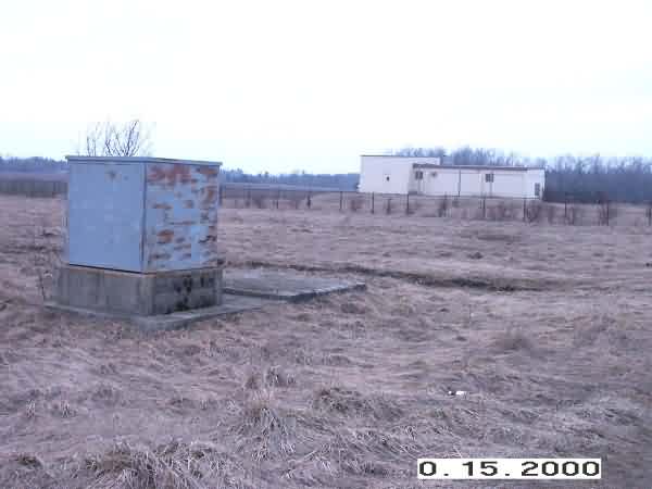
PTAUSGATR14 is a view of the site from back in my car on Knoblock Road. The site`s access road is out of view to the right of the image. I have no idea what the concrete foundations in the foreground were for. It`s hard to believe in this day and age that at one time, the USAF might have had the need *and* the budget & personnel available to staff a guard shack at the GATR, and utilities in that area were above-ground. The power transformers were housed in a fenced facility inside the main compound, as you will notice in PTAUSGATR16, which is taken from the SE side of the facility (the little yellow sign is another AT&T buried cable warning marker). Any ideas about the blue box & foundation?
Yes, I drove hundreds of miles one afternoon to poke, prod & probe a couple old military sites, but do you think I actually took 30 seconds to walk 20` to this blue box thing to kick it & try to figure out what it was? Nope.... Maybe if I go back up there to let the poor raccoon out...
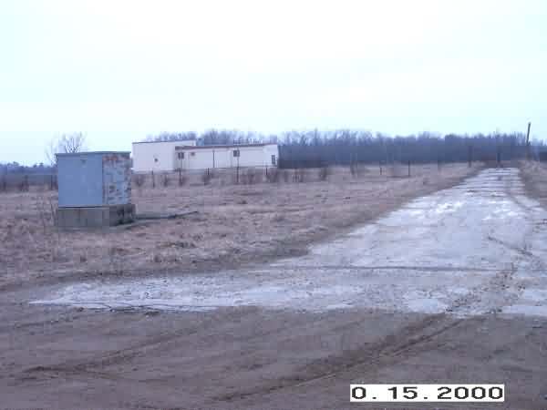
PTAUSGATR15 is a little more of a distant shot than 14. By the way, the Port Austin Air Force Station Ground-Air/Transmit-Receive site gate is at: 44-01.5N/083-01.3W
OK, by now, the sun had definitely set, and since I was up there already, perhaps for the final time, I decided to scoot on over to the old AFS & see what`d changed since I was last there in about 1998...
Spring, 2001 photoscontributed by Jack Arensberg

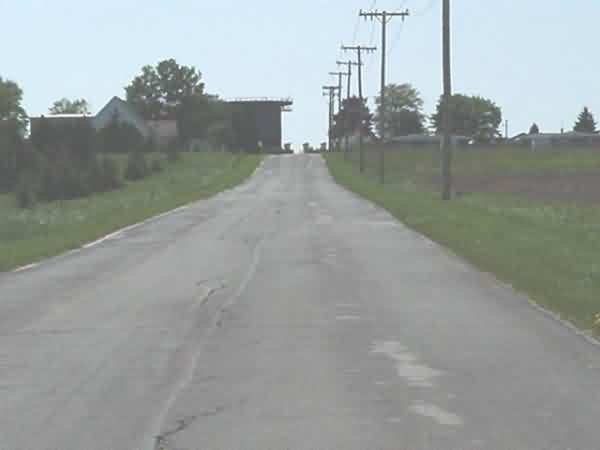
Road leading to the base

Main entrance. Little Caesar`s Pizza is in the building now.
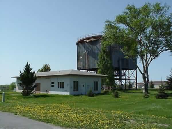
AN/FPS-24 Tower
There is now a "For Sale" sign on the -24 tower. Hmmm....
A view through one of the -24 tower windows.
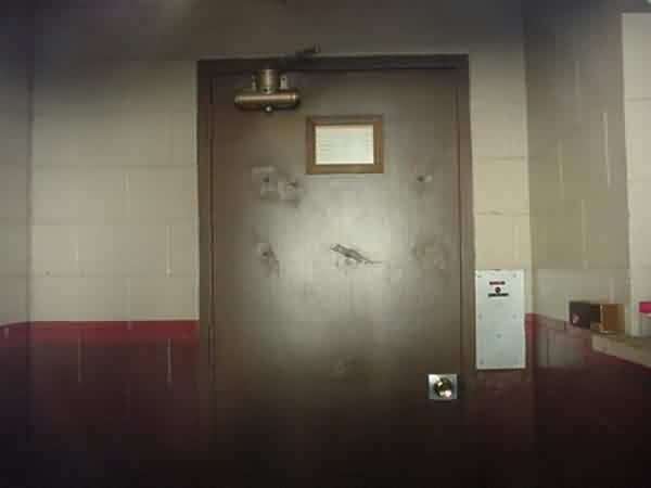
Looking toward the barracks.
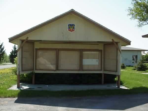
Squadron bulletin board. Note insignia at top.
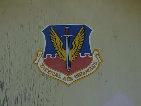
Insignia closeup from bulletin board.
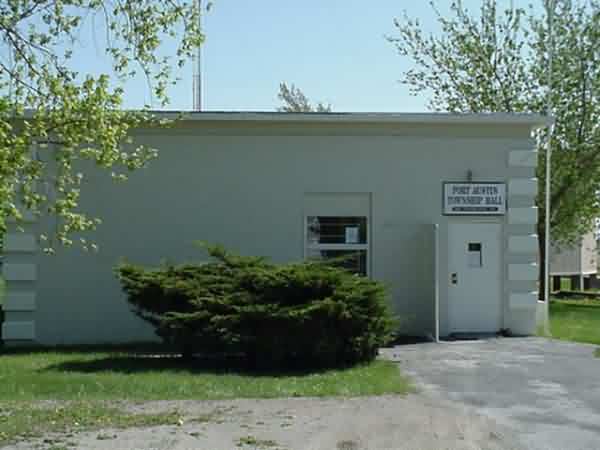
This building is across the street from the bulletin board (above), and is now the Port Austin Township Hall.
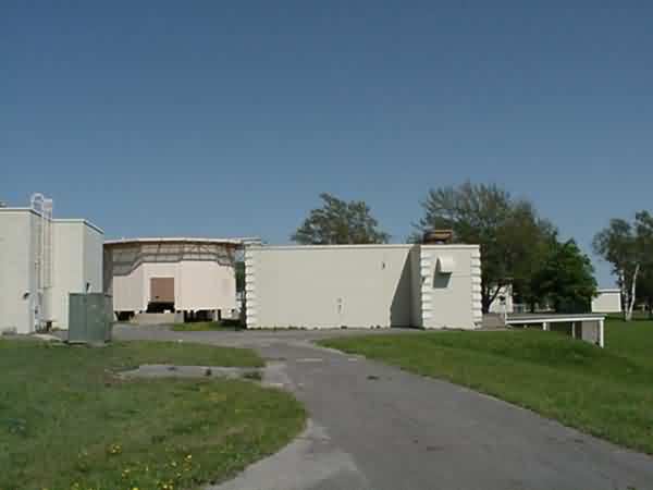
Looking just to the right of the -24 tower.
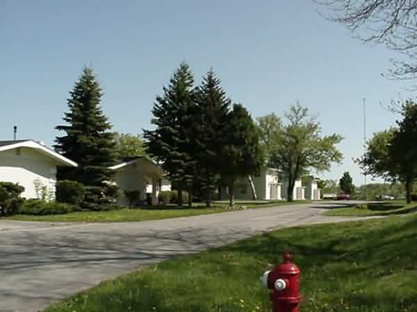
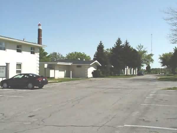
Looking down the street from the main entrance toward the barracks.
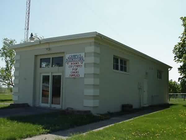
This small bookstore is behind the -24 tower.
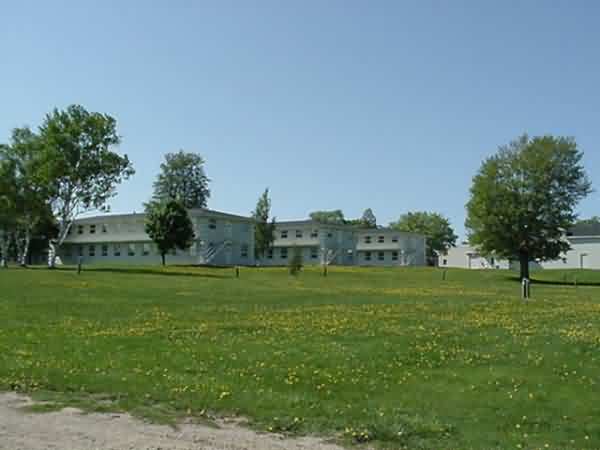
Barracks.
The following photos are "borrowed" from http://multimag.com/city/mi/portaustin/
http://www.realestate-mls.com/detail.cgi/hometown%7Ccaseville:075-00-0049