Recent Photos of Pickstown AFS, SD
---------------------------------------------------------------------------------------------------------------------------------------------------------------------------
Former Pickstown AFS radar site, now casino (courtesy of Google Maps 'Street View' (looking north-northwest)

.
----------------------------------------------------------------------------------------------------------------------------------------------------------------------------
The following six photos were made by Tom Page on 3 August 2023

This interior view of the present-day casino shows what was once the south exterior wall of the AC&W / SAGE radar Operations building (far side of the room). The Ops building was converted into the casino, and then was added on to on all four sides. (looking northwest)
.

The former SAGE Ground-Air/Transmitter-Receiver (GATR) radio building, located about a half mile north of the radar site. The former GATR site is now used as a county recycling center. (looking east-northeast)
.

Another view of the former GATR building (looking west-northwest)
.

Another view of the former GATR building (looking west-southwest)
.

Another view of the former GATR building (looking east-southeast)
.

Interior of the former GATR building (looking due east)
.
---------------------------------------------------------------------------------------------------------------------------------------------------------------------------
June 2011 photos & notes contributed by Jay Reynolds
Jay writes: I noticed there were no panoramic views from the back of the site. We stopped by Pickstown on our way home from ND and stayed at the Hotel and Casino. Shot a couple of views from the parking lot at the rear of the property. It is not surprising the view has not changed that much, trees have grown.
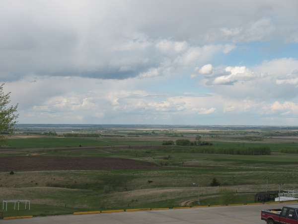
If you note the white structure in the lower left this is about where the FIS 102�s flew by to say hi. We actually could look down into the cockpits. We used to call three of the pilots, Rich, Randall and Reid, the corn poppers as the made wakes in the corn field straight out form the site. But AFR was always maintained, well maybe.
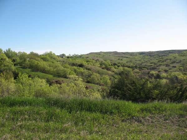
The second photo is of the canyon south of Pickstown that the 102�s used to fly up when they did not tell us they were coming. The top of the canyon broke out across the highway from the site near the church. Fewer trees then. Great fun when there was traffic on the highway and two or four 102�s came buster across.
May 2001 photos & notes contributed by Tim Tyler
I looked at the listing for Pickstown on the radomes.org web site, and it was somewhat bare. I thought it`d be great if I could find the old site & provide radomes.org with a current SITREP & photos for the place, and it`d be semi-convenient, since the plan was to then head into Nebraska. Mark Morgan had poked around looking for the old site, and advised the only thing he could see in the area was a big casino. Scott Murdock had provided me with some location info contained on my StreetAtlas map.
The route to Pickstown was interesting - gotta love heading South on a dirt road for 20+ miles, and it gets even better when you blow by a sign at 30MPH which reads "End of state maintenance, proceed at your own risk" but per the StreetAtlas USA CD-ROM mapping software I had tied into my GPS, I was on a pretty direct route so I continued along past numerous farms & wetlands. It was a fascinating & strange feeling to pass numerous large farms that were completely abandoned, and looked like they had been so for decades - a big farmhouse, one or two barns, old hen house, and other structures, plus the obligatory 2 or 3 ancient tractors. I wondered how long the places had been abandoned, why they were abandoned, and what sorts of cool things I might find if I looked around them. But alas, I was a man on a mission - a Cold War archaeology mission!
Reaching the vicinity of Pickstown, I started looking around on hill/mountaintops for any AFS signatures, but saw nothing, so I vectored myself to the cords Scott listed on StreetAtlas. I found a housing subdivision which definitely had a few whiffs of a military air to it, but it surely wasn`t the former AFS itself, so I kept on going. I wrapped around the large Fort Randall dam & finally decided to head E on the main drag (State Route 46) up to higher ground. The following is text written while on-site:
Sunday, 1322 local CDT:
I`m writing this from 43-04.9N/098-28.6W -- the parking lot in front of the entrance to "Fort Randall Casino & Hotel" which is operated by the Yankton Sioux tribe.
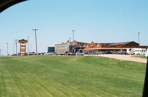
I`m going to keep looking for a bit, but I`m thinking this may be the grounds of the former Pickstown AFS, SD. It`s apparently the only thing Mark Morgan found when he poked through the area. The site is definitely on high ground with a decent 360 degree view.
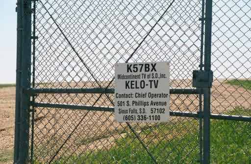
About 200` from where the newish-looking casino sits is a small, fenced-in enclosure with a fairly old ~100` tall guyed tower & old cinderblock equipment shelter. The tower is now used as a TV station translator (rebroadcast site) for KELO TV (translator FCC callsign: K57BX). This antenna site might actually be owned by the casino though, as a lot of casino-related junk is stored within the compound).
A newish Yankton Sioux Tribe water tower is in between the casino/hotel & the broadcast site.
OK, I just confirmed it via two independent sources -- the casino is on the grounds of the former AFS. Sometime after the AFS closed down, some of the buildings were used as a bingo hall. In the past 10 years or so, they did a major renovation/expansion & enlarged the facility quite a bit, turning it into a full-fledged casino.
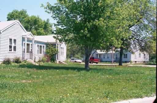
OK, now I`m at 43-03.8N/098-31.9W -- what was *probably* the AFS housing area -- lots of 1-story duplexes intermixed with a few new houses. Definitely old infrastructure such as streetlights & fire hydrants, and a few old support buildings. One large building next to a park has an old `Rainbow Room` sign on it -- probably a recreation center, though many of the windows are now boarded up. Now it`s apparently owned by Weaver Electric Inc. A round park in the middle of the street (Lewis Ave) at the entrance to this housing subdivision has a fairly old flagpole, and then some new markings, indicating the park is dedicated to all veterans of the Armed Forces.