Recent Photos of Petoskey GFA, MI
-------------------------------------------------------------------------------------------------------------------------------------------------------------------------------------------------------------------------------

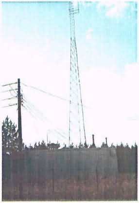
This first photo provides a view of the former GFA building (diesel-generator section) from across the parking area. The commercial transmitter tower stands inside the building's "L." The chainlink fence appears to be the original. (looking south)
.

Here is a closer view of the former GFA building. The diesel-generator section is on the right (north side) and the radar-equipment section is on the left (south side). (looking southwest)
.

This view shows the inside the GFA building's "L" where the present-day commercial transmitter tower stands. (looking south-southeast)
.

This view shows the front, or road-facing side, of the former GFA building. The diesel-generator section is on the right (north side) and the radar-equipment section is on the left (south side). (looking due west)
.

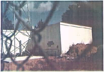
This view shows the radar-equipment section of the former GFA building on the left (south side) as seen through the chainlink fence. (looking west-northwest)
.

This view shows the rear of the former GFA building. One radar-tower foundation / footing is still visible; the other two are covered over. (looking east)
.

This final photo shows the National Park Service (NPS) sign on the west side of the neighboring parking area for the North Country National Scenic Trail. (looking west)
For additional information, see https://www.nps.gov/noco/index.htm
.
-------------------------------------------------------------------------------------------------------------------------------------------------------------------------------------------------------------------------------
January 2004
The following three photos came from the US Army Corps of Engineers' Formerly-Used Defense Site (FUDS) report: