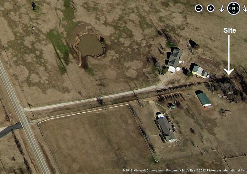
2012 image looking North
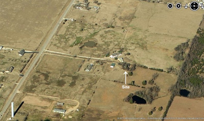
2012 image looking North
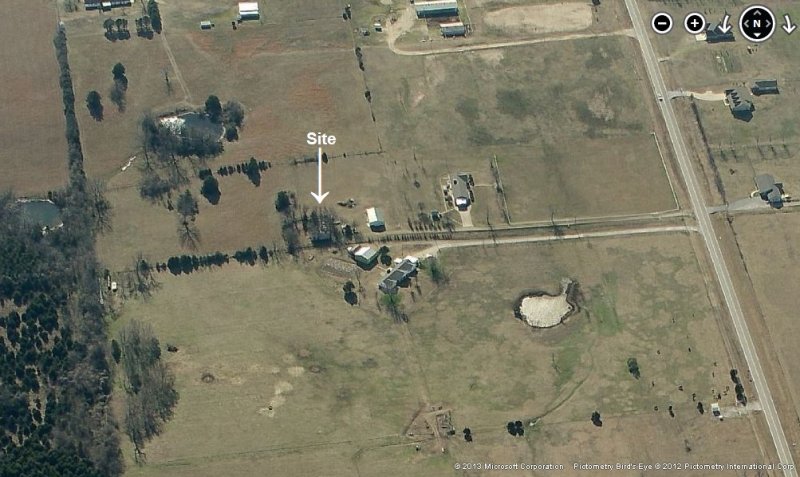
2012 image looking South
Jan 2009 photos & notes by Tom Page
The former Ottawa Gap-Filler Annex, OK, proved to be relatively easy to find. At Miami, OK, from the Will Rogers Turnpike (toll road), one goes east on Road 10 for about 3.5 miles. At Road 137, one turns south, and travels about 0.75 mile. The site is then to the east of Road 137, at Latitude 36-51-37.5 N, Longitude 094-47-05 W.
For whatever reason, I expected this old radar facility to be no longer extant. This expectation, fortunately, turned out to be incorrect. Though not exactly in pristine condition, the radar building is still extant. The building is the rare "left-hand" configuration; that is, when facing the radar tower location from the building, the diesel-generator wing is on the left (normally, it`s on the right).
I arrived at the site in the late afternoon / early evening just after sunset. There was just enough daylight remaining to get photos. The site appeared to be on private property, but was not posted. I drove down the access road, now a driveway, and stopped by the old radar building. I expected someone to come out and ask me what I was doing there. However, no one did, so I shot my photos and left.
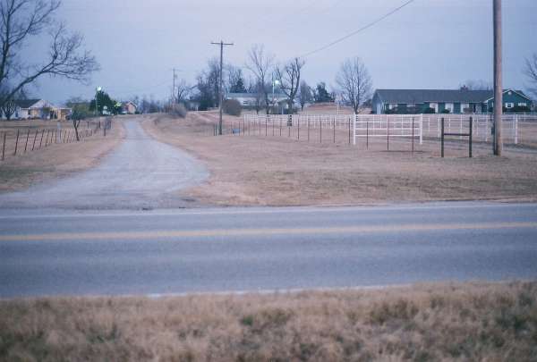
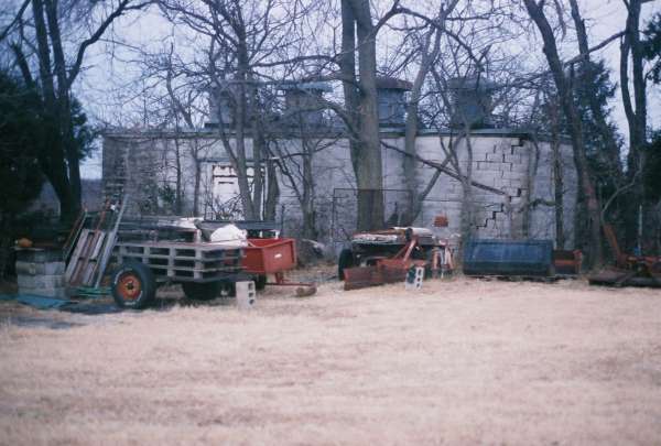
This photo (actually taken last) shows the gap-filler radar facility and its access road as viewed from the main highway, Road 137. The site is on the rise in the far distance (just left of that building in the center), and the access road is the driveway on the right next to the white fence. [looking east]
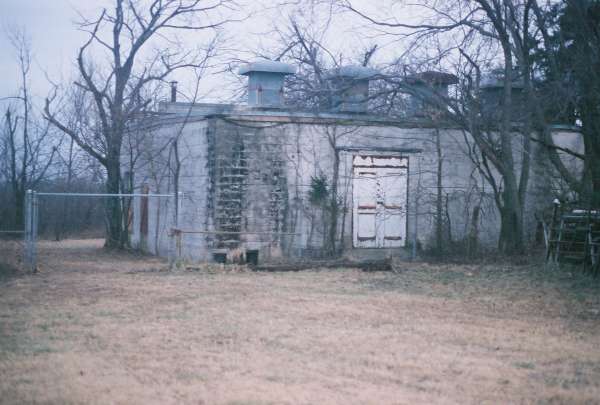
This photo shows the radar building up close at the site entrance. The radar-equipment section extends to the right (south), while the diesel-generator section extends to the back (east) on the left. The chain-link fence might be original, but I could not tell for sure. [looking east-southeast]
This photo is about the same as the previous one, just a tad closer up. [looking east-southeast]
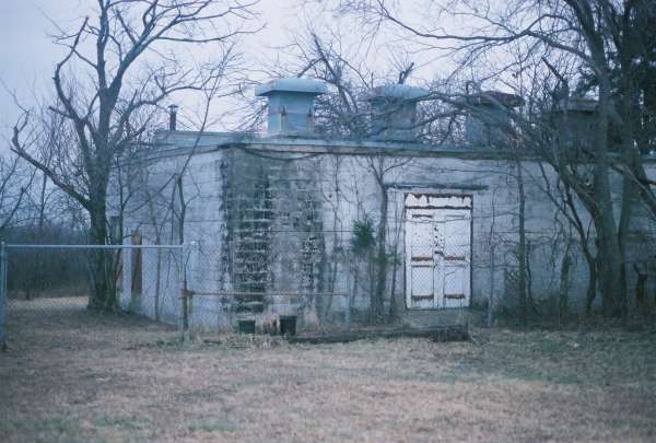
This photo shows the "front" of the radar building (i.e., the west face of the radar-equipment section). The radar tower stood to the right. [looking east-northeast]
This photo is about the same as the previous one, but is a little bit closer up. The opening in the south wall (on the right) for the radar waveguide can be seen. [looking east-northeast]
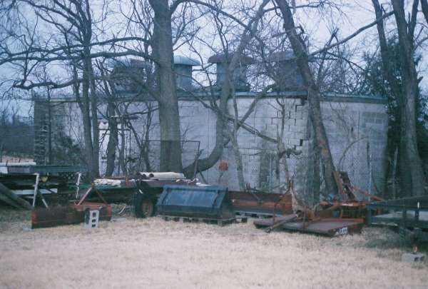
This photo shows the inside of the "L," with the diesel-generator section on the right, and the radar-equipment section on the left. [looking northwest]
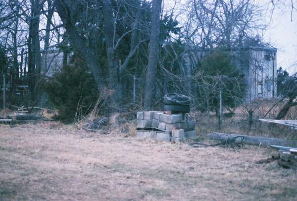
This final photo shows two of the three radar-tower foundations/footings. [looking east]