Myrtle Beach, SC GFA Recent Photos
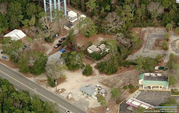
Looking North (2009)
Looking North (2009)
Looking North
Looking North
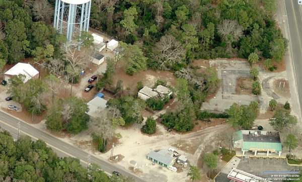
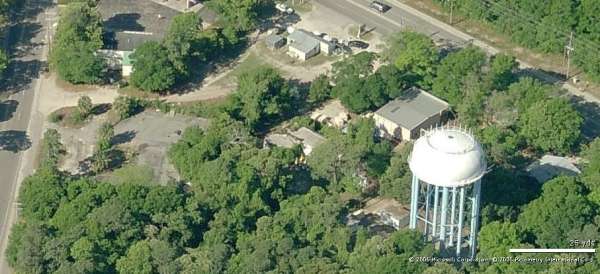
Looking East (2009)
Looking East
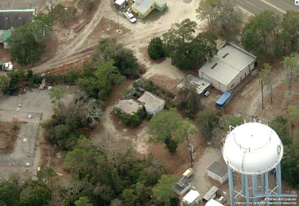
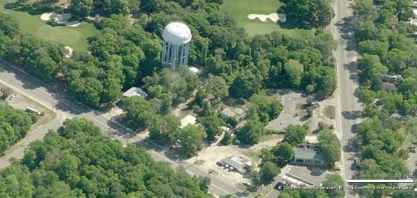
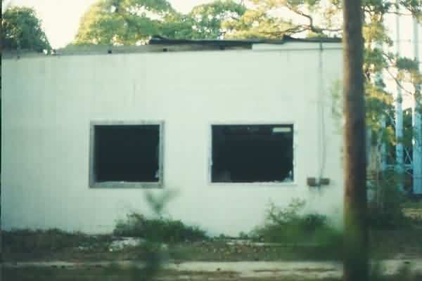
Looking South (2009)
Looking South
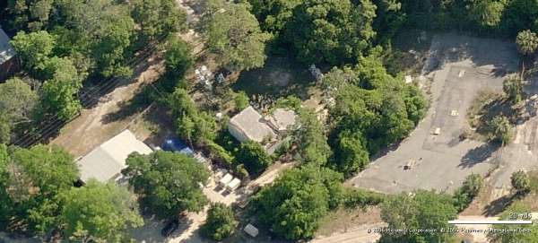
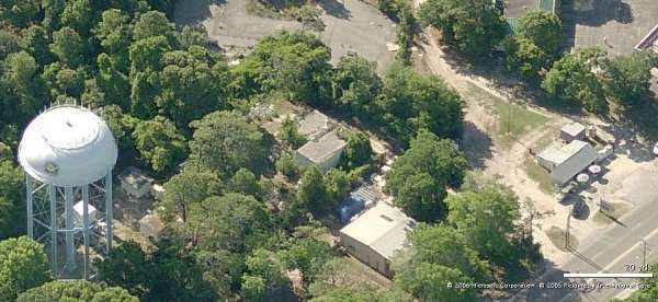
Looking West (2009)
Looking West
11 May 2019 photos and notes contributed by Tom Page
When I first visited this former gap-filler radar site in May 2001, the gate was closed & locked, and the fence was heavily covered by vines, so I could not get any good photos. This time, the gate was open, so I was able to go inside the compound for several good close-up views. The facility appears to be owned by Horry County.
.

This first photo shows the old gap-filler radar building and chain-link fence from just outside the gate. [looking east-northeast]
.

This second photo shows the building from just inside the gate. Part of the roof over the south end of the radar-equipment section (shown here) has collapsed. [looking north-northeast]
.

This third photo shows the south side of the diesel-generator wing of the radar building. [looking due north]
.

This fourth photo shows the east end of the diesel-generator wing of the radar builing. The radar-equipment section of the building is seen on the right. The radar tower once stood where the tree is further to the right. The orange wooden items have ordinance signage on them for the Horry County Beaches. [looking due west]
.

This fifth photo shows the inside of the "L," with the diesel-generator wing on the left, and the radar-equipment section on the right. [looking southwest]
.

This sixth photo shows the radar-equipment end of the building and the three radar-tower footings (all covered by vines and other undergrowth). [looking due south]
.

This final image is a close-up of one radar-tower footing (the one farthest away from the building), taken from the photo above.
.
---------------------------------------------------------------------------------------------------------------------------------------------------------------------------
2017 photos and notes contributed by Thede Loder

looking north into the building from the south window

a second shot looking up towards the ceiling from the south window

a view of the door on the east side of the building

the western tower footing, looking west

a view inside the building from the east door

the west-facing door, looking east

the west side of the building, looking northeast


another antenna tower footing

the eastern tower footing and eastern extension of the building

May 2001 photos and notes contributed by Tom Page
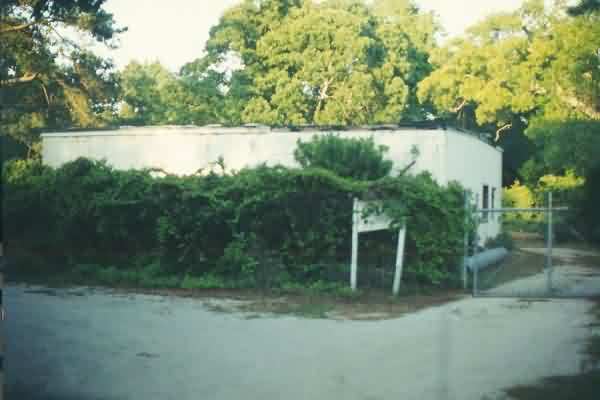
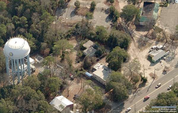
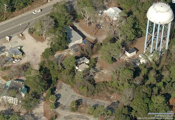
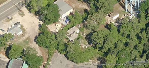
The "front" of the former radar-equipment building, with the diesel-generator wing seen at the right rear. The site is situated off Lake Arrowhead Road, about 40 or 50 yard east of that road. The site is east of US 17, about halfway between Myrtle Beach and Briarcliffe Acres. The former GFA site is behind an Horry County EMT station, and adjacent to a large water tower. All of the chain-link fence is covered in thick vines. [looking east-northeast]
The radar-tower end of the former GFA building. All three tower foundations are seen in this view. [looking south]
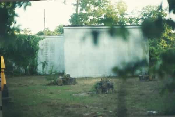
The diesel-generator wing. The neighboring water tower is seen in the background to the right. [looking north]