Mount Lemmon AFS, AZ Recent Photos
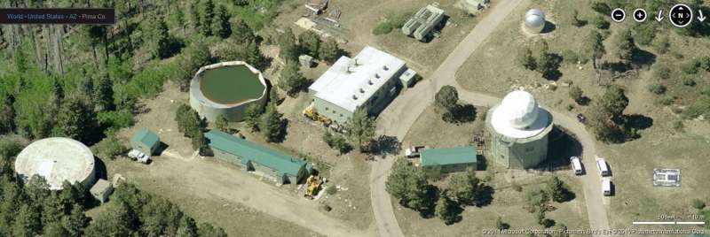
Site, looking North
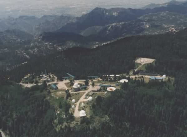
Site, looking East
Site, looking South
Site, looking South
Site, looking West
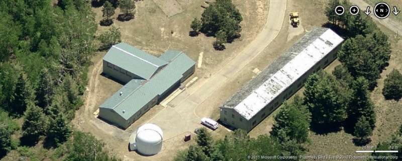
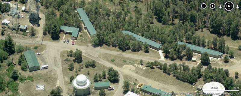
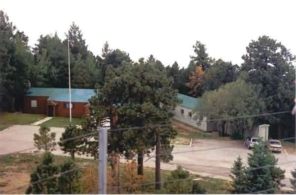
Rec Building an Barracks, looking East

GATR Site, looking East
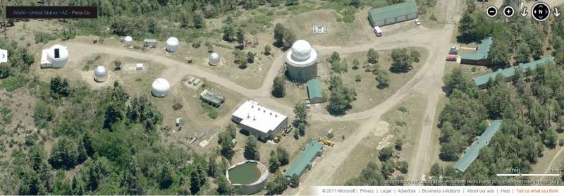
Site, looking North
Site, looking East
Site, looking South
Site, looking South
Site, looking West
Rec Building an Barracks, looking East
GATR Site, looking East

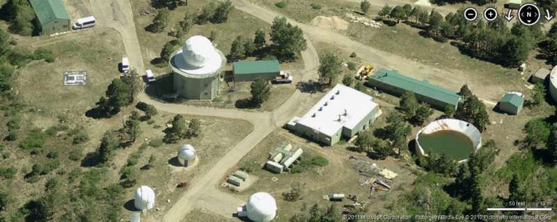
Former AN/FPS-6 Height-Finder Radar Tower at Night
Photo Source:
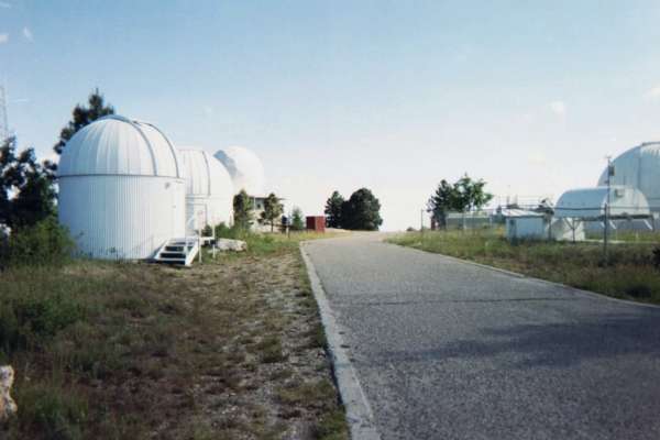
Photo source: http://www.universetoday.com/html/archive/2005-0728.html
The sole remaining USAF radar tower is seen in the back, just to the left of center. The view is looking roughly south from about where the Ops building or search radar tower once stood.

Photo source: http://www.wapa.gov/media/cct/2003/july18/25no151.htm
The photo appears to have been taken either from one of the communication towers near the GATR site (seen at the very bottom of the photo) or from a helicopter immediately behind the comm antennas. The view is to the NW. The photo is from July 2003.
August 2004 photos contributed by Tom Page
Tom writes:
These eleven photos of the former Mount Lemmon AFS were taken in early August 2004. We try to drive up the Mount Lemmon Highway at least once a year just for the great scenery and views. On this occasion, one of the observatory care-takers allowed us to come onto the grounds, AND I had my camera with me this time, so �.
One thing we learned that day is that the U.S. Army has now completely discontinued use of the site. They have removed their tracking radar that was housed in the last-standing U.S. Air Force radar tower (originally used for an AN/FPS-6 height-finder). That tower, according to the care-taker, will now be used to house another telescope. Since the tower was currently empty, he allowed us to go inside and up onto the antenna deck. There are great views from up there; however, we could not stay long because a summer thunderstorm with lightning was rolling in.
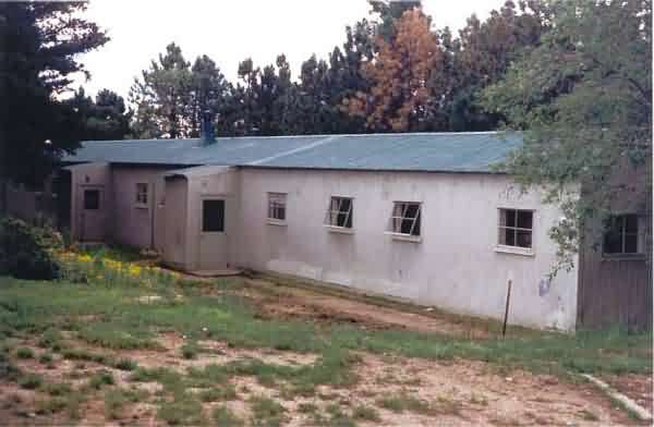
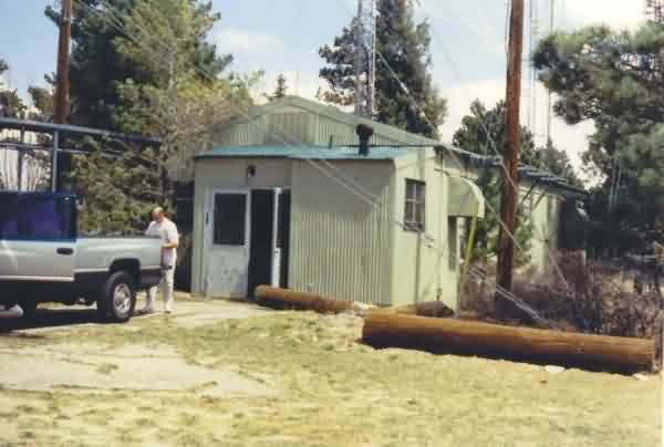
This old metal building stands immediately west of the old Administration building near the site entrance; I am unsure of this building's original purpose.
This is one view from the antenna deck of remaining radar tower. The Administration building is on the left, and the building shown in the first photo is on the right. [looking south]
This is another view from the antenna deck of radar tower. The large building seen is the former diesel power plant. The catwalk of the radar tower is seen in the foreground. [looking west]
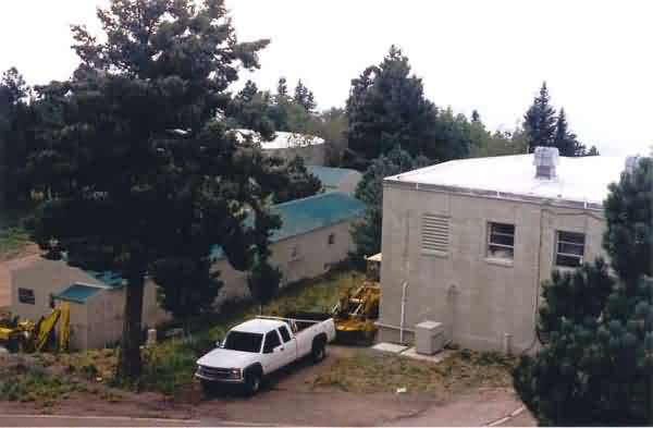
Just south of the former diesel power plant stand several other original USAF buildings and the original water tank to their west. [from the radar tower, looking southwest]
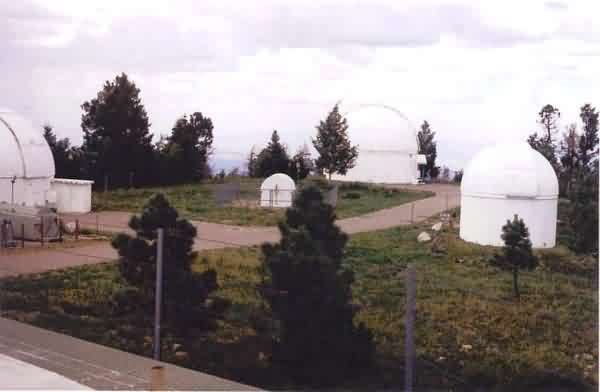
To the north once stood the LRR Operations building and the other two radar towers. According to the care-taker, those structures were torn down to make room for the observatory telescope domes seen here. Originally, he said, the towers were going to be used to house telescopes, but they were deemed not stable enough for the larger telescopes. [from the radar tower, looking north-northwest]
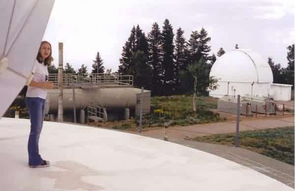
This view shows the original diesel-fuel tanks and an observatory telescope dome that stands about where the other AN/FPS-6 height-finder radar tower once stood. The fuel tanks now hold non-potable water to help fight future forest fires that might occur. (This site came close to being lost to a large forest fire just last year.) In the foreground is seen the antenna deck of the remaining radar tower; note how much smaller the Army radome was compared to the original Air Force radome which extended to the edge of the circular pad seen here. My youngest daughter, Stephanie, looks on. [looking northwest]
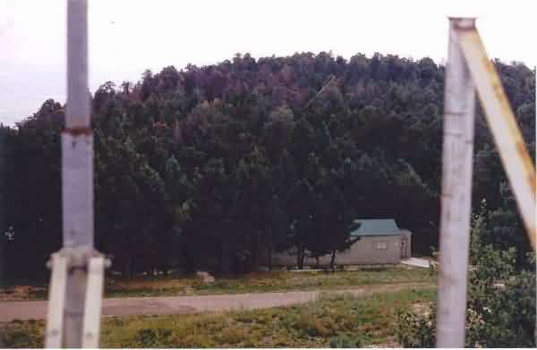
This photo shows yet another original Air Force building nestled among the trees. [from the radar tower, looking south-southwest]

The Air Defense Command (ADC) was not the only Air Force user of Mount Lemmon in its heyday. The Strategic Air Command (SAC) unit at Davis-Monthan AFB used the hardened radio site seen here (top center) for communicating with its 18 Titan-II Missile silos scattered around the greater Tucson area. Several old SAC antennas still stand. [from the radar tower, looking south-southwest] [Side Note: Visitors to Tucson who have time are encouraged to visit the last Titan-II Missile site, now a museum, south of town near Green Valley; it's well worthwhile.]
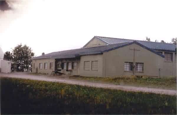
This is the former multi-purpose Recreation building, still in use today. At this point, the thunderstorm had arrived, and we were getting pelted by pea-sized hail. I'm told that this is a very common event during the summer monsoon season (July and August), as I'm sure many veterans of the 684th AC&W Squadron / Radar Squadron will recall. [looking west-northwest]
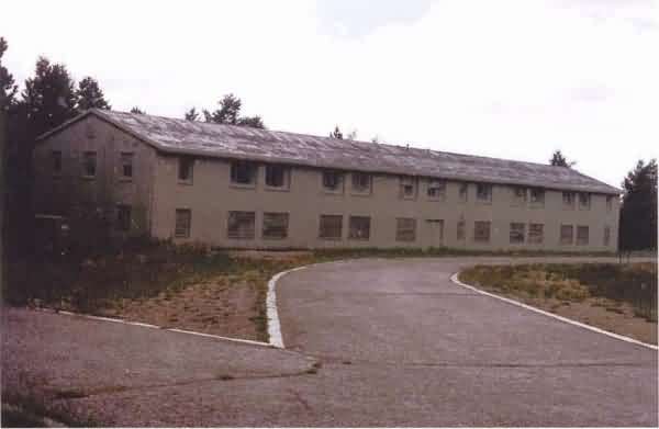
This barracks appears to have been possibly for Sr. NCOs, as it seems somewhat newer than the other metal buildings. This building is not in use as it still contains asbestos, according to the care-taker. (The hail storm was in full production.) [looking southwest]
This final photo shows the same barracks as pictured in the previous photo, as viewed from the front of the multi-purpose Recreation building (where we were taking shelter from the hail storm). The care-taker then drove up, and let us go inside the Rec. building for a look-see. [looking east-southeast]
Aspen Fire, June, 2003, contributed by Tom Page
AP photo that appeared on the Arizona Daily Star`s website circa 22 June 2003
GATR Site, April 2002 Photo
August, 2001 photos and notes by Tom Page
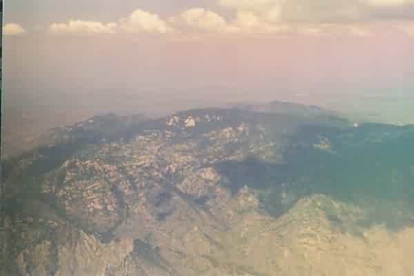
A view of Mount Lemmon and the former AF Station as seen from the window of a commercial airliner. [looking north-northwest] (August 2001)
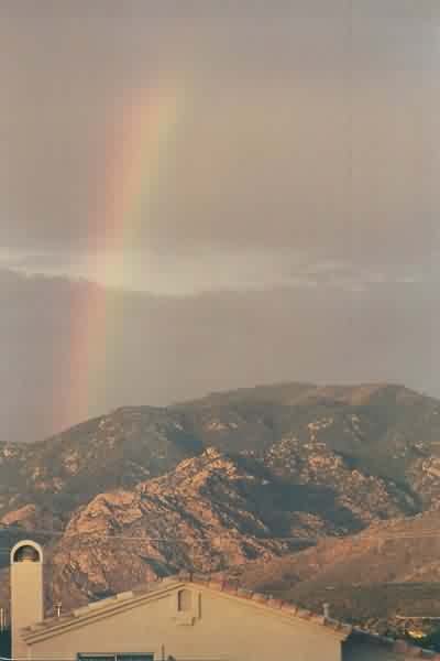
A view of Mount Lemmon and the former AF Station as seen from the back of my house after a summer thunderstorm. [looking east] (June or July 2001)
March, 2001 photos and notes by Tom Page
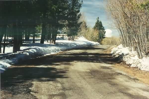
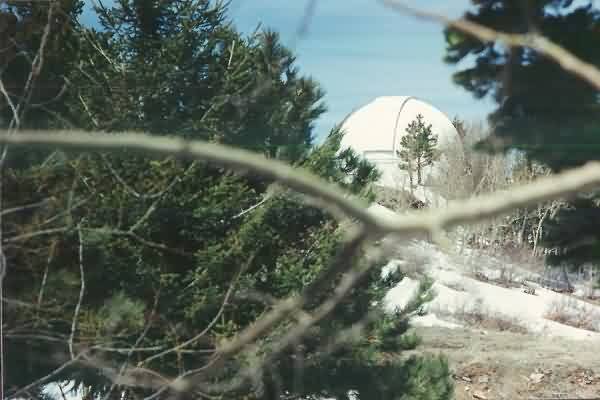
The road approaching the former Mt. Lemmon AFS, AZ. The Army tracking radar dome is seen in the distance. [Looking west]
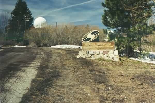
University of Arizona sign for the present-day observatory at the former Mt. Lemmon AFS. The Army tracking radar dome is seen in the distance to the left; one of the telescope domes is seen in the distance to the right. [Looking northwest]
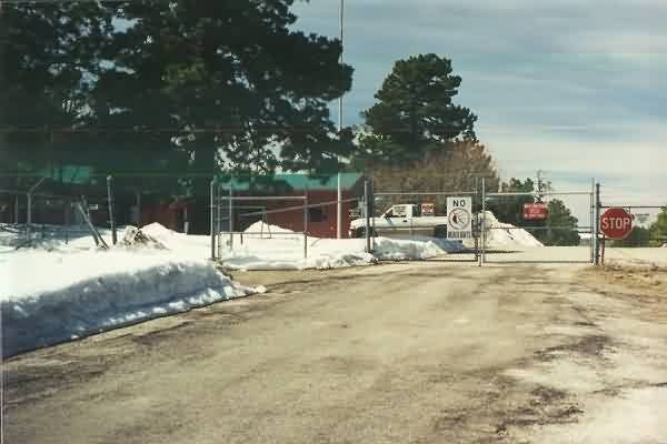
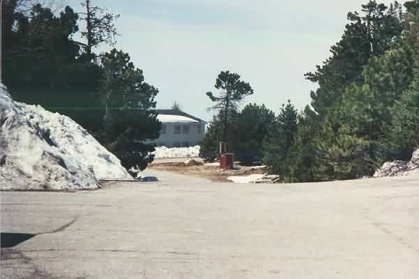
Entrance to the former Mt. Lemmon AFS. [Looking west]
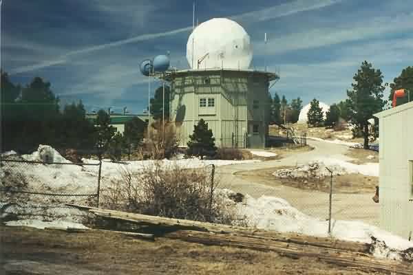
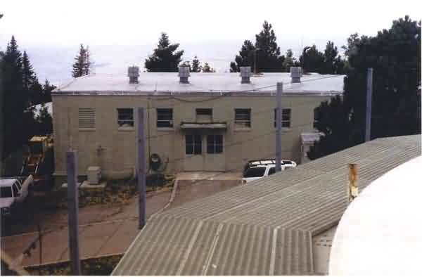
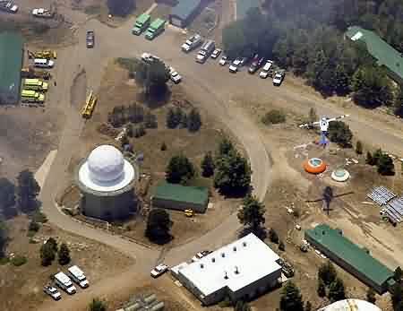
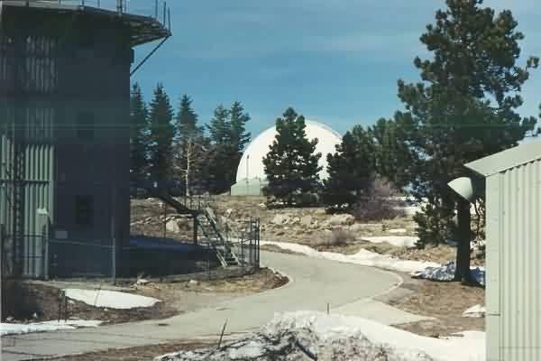
The former Mt. Lemmon AFS as viewed from the site's main gate. The tower with the radome is one of the former US Air Force radar towers, now housing the Army tracking radar. The diesel power-production building is seen just to the tower's left (west), and one of the telescope domes is seen in the distance to the right. [Looking north-northwest]
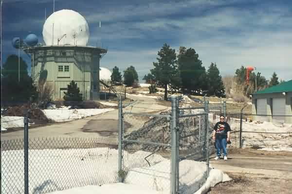
Another view of the former Mt. Lemmon AFS and the present-day Army tracking radar tower as viewed from the site's main gate. That's my wife, Kay, by the gate. [Looking north]
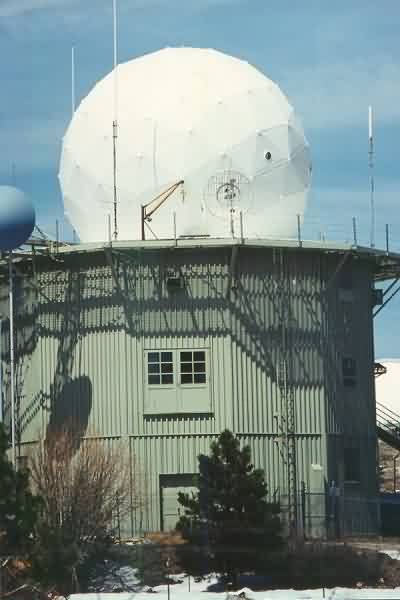
Close-up view (using a 135-mm camera lens) of the Army tracking radar tower at the former Mt. Lemmon AFS. [Looking northwest]
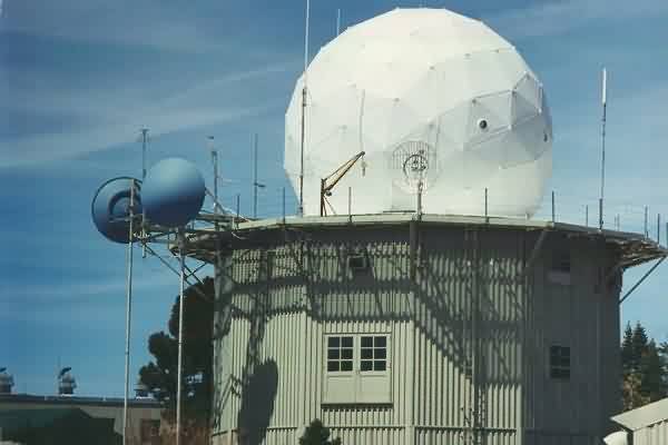
Another close-up view (using a 135-mm camera lens) of the Army tracking radar tower at the former Mt. Lemmon AFS. [Looking northwest]
Close-up view (using a 135-mm camera lens) of one of the telescope domes at the north end of the compound where the other US Air Force radar towers and Operations building used to stand. [Looking north-northwest]
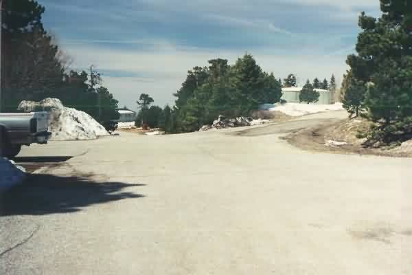
View of the cantonment area of the former Mt. Lemmon AFS. One of the old barracks is seen in distance where the road bends to the right. [Looking west]
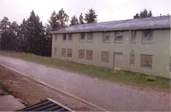
Close-up view (using a 135-mm camera lens) of the old barracks. [Looking west]
Close-up view (using a 135-mm camera lens) of another telescope dome at the north end of the compound where the other US Air Force radar towers and Operations building used to stand. [Looking north]
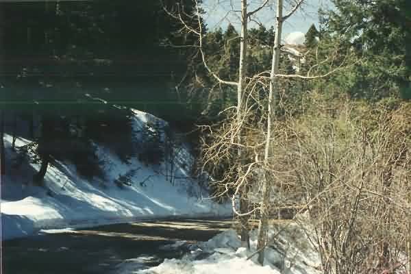
The access road for the former Mt. Lemmon AFS, looking downhill. One of the observatory telescope domes is visible through the trees at the upper right. [Looking west-northwest]
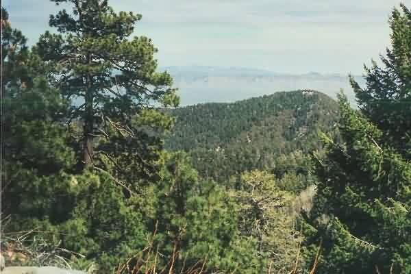
View from the access road for the former Mt. Lemmon AFS, looking north-northeast.
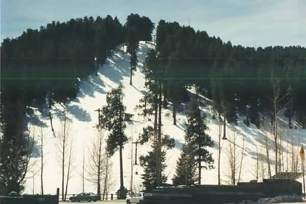
The Mt. Lemmon Ski Area, located about 2 road miles below the old radar site. This is also as far as one can normally drive; to get to the summit, one must walk the rest of the way. The road up to the top has approximately a 20% grade, and the mountain top is above 9100 feet -- this makes for a somewhat strenuous walk. [Looking south-southwest]
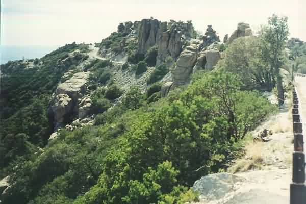
The Catalina / Mt. Lemmon highway: This is the only road between Davis-Monthan AFB (Tucson) and the former Mt. Lemmon AFS. It takes about an hour and a half to drive from Davis-Monthan AFB to the former Mt. Lemmon AFS under good weather conditions. However, the scenery is spectacular! [Looking south]
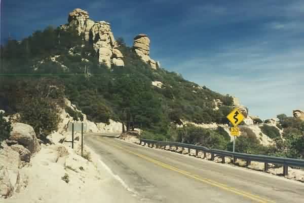
Another view of the Catalina / Mt. Lemmon highway, looking roughly north.
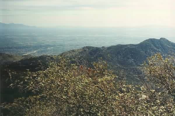
The city of Tucson, AZ, as seen from the Catalina / Mt. Lemmon highway. [Looking south]
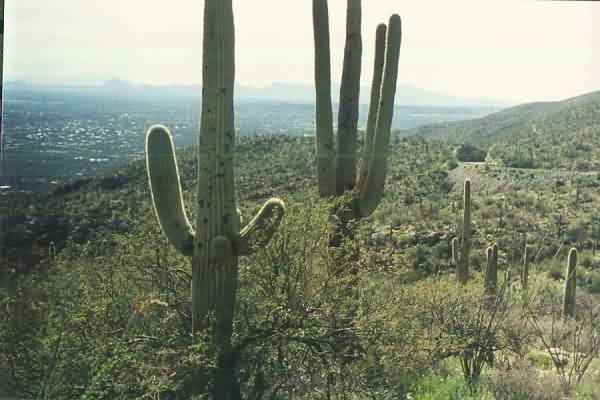
Saguaro cacti, ocotillo plants, and other desert vegetation along side the Catalina / Mt. Lemmon highway, with the city of Tucson seen in the distance. [Looking southwest]
The Santa Catalina Mountains and Mt. Lemmon, as seen from the south end of Tucson (near the Airport). [Looking roughly north-northeast]
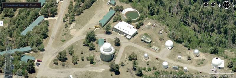
From the Mt. Lemmon Observatory web site.