Recent Photos of Moscow AFS, ME
May 2008 photos contributed by David Dauphinee
Moscow (ME) OTH-B
The Moscow radar site is about 80 miles west-northwest of Bangor. Columbia Falls, the receiver site, is about 80 miles east-southeast of Bangor off of Coastal Route 1.
Moscow is easily reached by either heading to Skowhegan and taking 201 north towards Bingham or by taking 16 West from the Guilford/Abbot area. Unless you’re already in Charleston checking out the old radar site turned juvenile correctional facility, heading to Skowhegan (or SkowVegas as it we call it locally) is going to be the quickest way and also the prettier drive, because you get to follow the Kennebec River most of the way.
Heading into Moscow, going north on 201 (also sometimes called Canada Rd), you’ll see Donigan Rd on your right. It’s almost easier to look for the Bemis St sign, as the Donigan sign is not as apparent. Once on Donigan, take an immediate right on Frith [sic] Rd. Continue straight when you see a hard right across a stream. After passing that turn-off, you should stay to the right at each of the forks you come to. It’s an easy drive on pavement most of the way until you reach some well-maintained dirt.
This is the part where everyone else can benefit from my experience. Just before you reach the radar site, you will run across a faded US Government sign and much newer Private Road No Trespassing sign. Ignore them. I didn’t. I stopped, pulled out my Maine Gazetteer and plotted a route around the site to the east. I back-tracked, crossed the stream and then took Dead Water Rd north. Dead Water Rd is owned by a local logging company and thus is open to public use. Much of it is washboard and nasty. I wouldn’t take a car down it. I tried a few side roads when I knew I was close, but I only succeeded in scratching my paint.
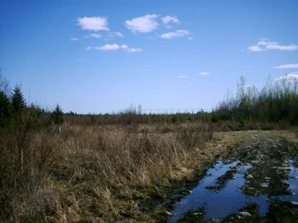
Eventually Dead Water Rd comes around and meets Chase Pond Rd, although there’s no signage at the intersection. Heading west on Chase Pond Rd, you will soon see the top of one of the arrays over the tree tops to your left (south). The next intersection you come to will be Stream Rd, which becomes Frith Rd. On your right, you will see a locked gate leading to two of the three antenna arrays. Go left and you will see the third array almost immediately. If you proceed a short distance past it, you will end up exactly where I turned around. Had I not turned around, I would have saved my paint, some fuel and an hour of my life. Don’t turn around when you see the Private Road sign. Anyone can reach the site from the back side, so don’t worry about it.
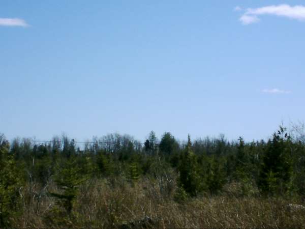
01 & 02: These pictures show one of the arrays looking south from Chase Pond Rd.
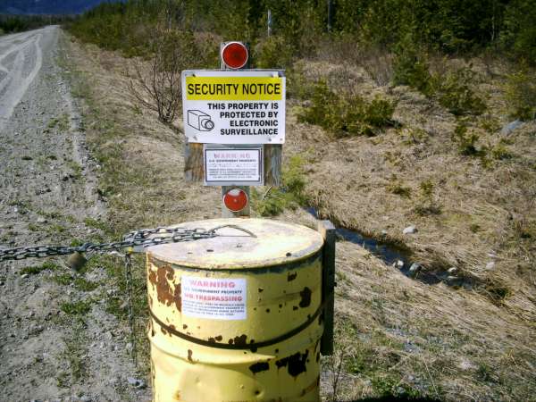
03 & 04: The locked "gate" to the other arrays. The road is in excellent shape and there are fresh tire tracks.
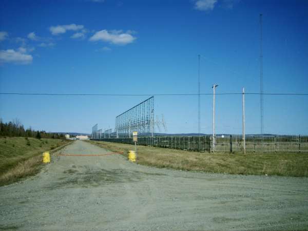
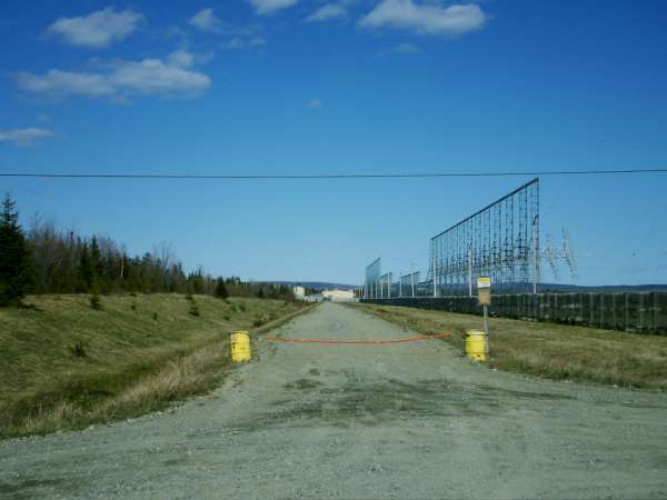
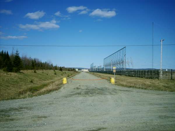
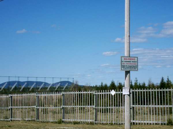
05 – 07: Looking down the locked access road to the one visible antenna array. Notice that the buildings and the fence appear to be identical to the Columbia Falls site.

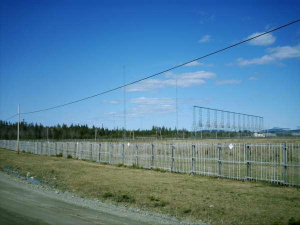

08 - 10: The antenna array. Notice the large towers with guy wires coming down.
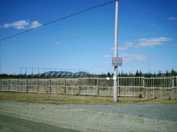
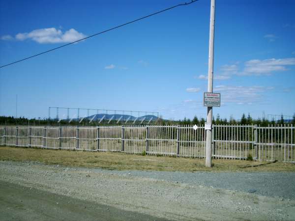
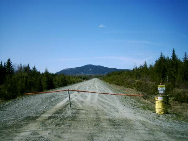
11 – 13: This is the view you would get coming into the site, if you ignored the signs that I turned around for. There is another US Government No Trespassing sign here as well.
There is heavy forest ranger activity in this area. If you are thinking about hopping a gate for pictures, I wouldn’t. Why this site is so locked down and Columbia Falls isn’t is anyone’s guess. I took pictures for less than ten minutes and, as I was driving out, two forest ranger Super Duties blew by me, headed for the radar site. It was probably coincidence, but I’m still glad that I wasn’t on the wrong side of one of those gates just then.