Recent Photos of Manassas AFS, VA
..............................................................................................................................................................................................................
2025 "Google Street View" showing the former AN/FPS-35 radar tower, now painted. PWCS stands for Prince William County School (district).

.
A representative at PWCS was queried about this renovation project; here is his reply:
"... The renovation to the radar tower is a great improvement, both structurally and visually. The project was completed in July 2023 by Eastern Waterproofing & Restoration of Virginia, LLC, and the material used is metal panels. ...."
.
..............................................................................................................................................................................................................
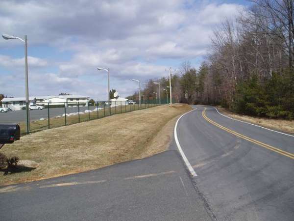
2015 "Google Street View" showing the former location of the family-housing area; the nine houses were apparently demolished sometime in 2012 (looking south, from Aden Road)

..................................................................................................................................................................................................................
August 2008 photos & notes by Tom Page
While in northern Virginia for my oldest daughter`s wedding, I had some free time on Friday, 1 August 2008, and decided to pay a quick visit to the former Manassas AFS. Based upon other recent photos, I suspected that most of the radar towers might have been torn down since my last visit in 2001. Sure enough, the two cylindrical masonry towers for the AN/FPS-3 search radar and for the AN/FPS-6A height-finder radar, and the steel-frame tower for the AN/FPS-26 height-finder radar, indeed are now gone. According to a worker at the site, the AN/FPS-26 radar tower was torn down in 2007, and the other two radar towers were removed the year before. All other buildings and structures, including the former AN/FPS-35 search radar tower, are still in place and beneficially occupied.
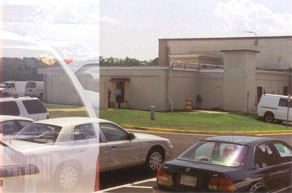
This first photo (unfortunately, a double-exposure caused by the film in my `archaic` camera not advancing properly) shows the front of the former Long-Range Radar (LRR) Operations building. A few years ago, the tower for the AN/FPS-3 search radar would have been seen behind the Ops building just to the left of the photo`s center. [looking west-southwest]
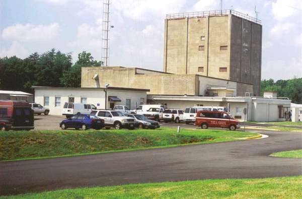
This photo shows another view of the front of the former LRR Operations building plus some of its east side. Based upon its larger size, the Ops building looks as if it might have been modified in the early 1960s for BUIC-II operations ... although we have no records indicating Manassas AFS was ever a BUIC-II site. It is possible the building was enlarged for BUIC-II operations, but plans were cancelled when the Air Force decided to close the site in 1965. [looking roughly due west]
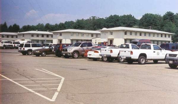
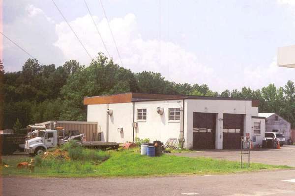
This photo shows the former barracks. It appears all four buildings continue to be utilized for office space. [looking northeast]
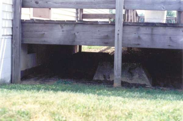
This photo shows what is presumed to be one footing of the former steel-frame AN/FPS-6B height-finder radar tower which was situated immediately south of the barracks. This concrete block is located underneath a deck connecting two newer buildings. It`s possible the other three footings could be underneath one of those two buildings; however, this is the only one that is visible. Without S.J. Shaffran`s vintage photo at http://www.radomes.org/museum/photos/ManassasAFSVA.jpg (taken by his wife from the housing area looking south), we would not have known where the AN/FPS-6B stood. [looking south]
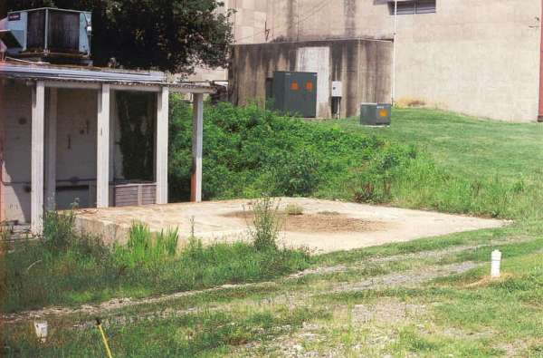
This photo shows the base for the former cylindical masonry tower for the AN/FPS-6A height-finder radar. The circular outline of the tower is faintly visible. In the background are the AN/FPS-35 radar tower (left) and the LRR Ops building (center and right). [looking northeast]
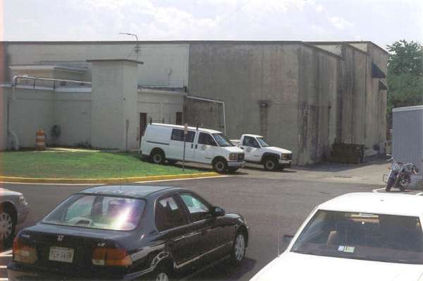
This photo shows where the AN/FPS-6A and AN/FPS-26 height-finder radar towers used to stand. The AN/FPS-6A tower stood immediately beyond the metal Butler building just left of the photo`s center (foreground), while the AN/FPS-26 stood in the background behind those two, roughly centered between the two modern radio towers. To the right are the AN/FPS-35 radar tower and the LRR Ops building. [looking roughly due east]
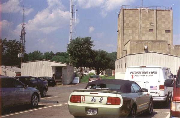
This photo shows where the AN/FPS-6A height-finder radar tower and the AN/FPS-3 search radar tower used to stand. The AN/FPS-6A tower stood to the photo`s far left, while the AN/FPS-3 tower stood near the photo`s center, about three car widths behind that red van. Unlike the base for the AN/FPS-6A tower, the base for the AN/FPS-3 tower is not visible -- that area is completely paved over, part of the modern parking lot now. In the background are the LRR Ops building and the AN/FPS-35 tower. [looking north-northwest]
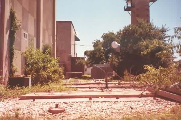
This final photo shows where the AN/FPS-26 height-finder radar tower used to stand, which was immediately left (south) of the buildings seen. No traces of the radar tower or its foundations were visible. [looking west-northwest]
2006 photos contributed by Dennis Quigley
Dennis writes: Prince William County Education Department took it over some years ago and maintains it as a logistical support base. The buildings are all in good condition and well maintained, looking very much like they did when the site was closed in 1965. This is the place where I spent the Cuban Missile crisis in 1962. We were all locked down during a three day period when Adlai Stevenson duked it out with his opposite number at the UN and the Marines next door at Quantico were loading out on naval transports. Our grim humor was that the Soviets would drop their IRBMs short of Washington and on us, as we were directly under the flight path from Cuba.
Summer 2001 photos & notes contributed by Alex Cheek
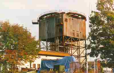
From left to right: AN/FPS-26 tower, civilian radio tower, AN/FPS-6A height-finder search tower, AN/FPS-35 tower. Note tree growing atop the FPS-26 tower.
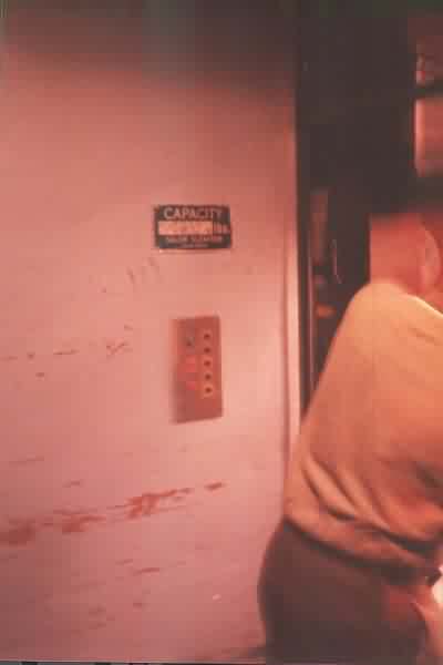
Elevator controls in the AN/FPS-35 tower. Made by Salem Elevator of Salem, VA.
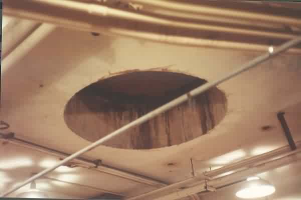
Opening for the antenna above the mezzanine level in the AN/FSP-35 tower.
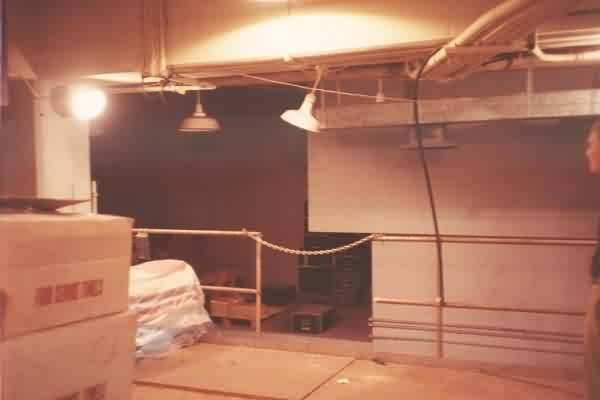
Mezzanine level (5 1/2 floor) inside the AN/FPS-35 tower.
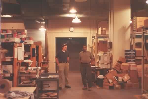
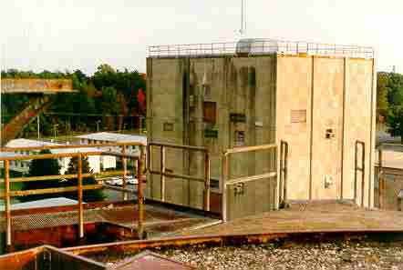
Each of the floors of the old FPS-35 tower is used for storage by the Prince William County (VA) school system. It`s beautiful to see one of these buildings filled with people and activity rather than silence, emptiness and mildew.
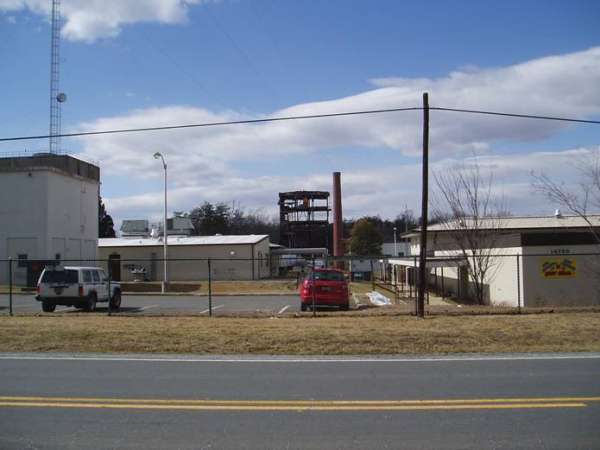
Concrete oil tank foundations behind the FPS-35 tower.
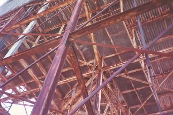
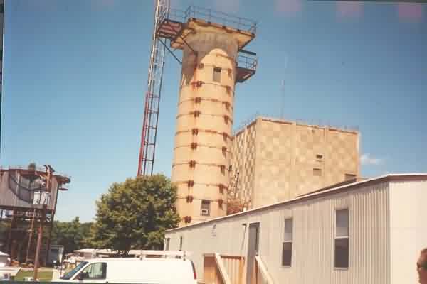
The structure underneath the AN/FPS-26 height-finder tower.
October 1998 photos and notes by Tom Page Email: tepage@hotmail.com
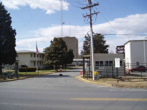
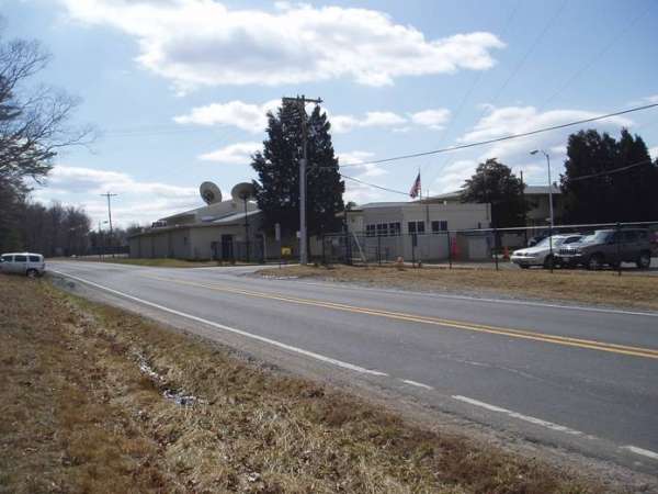
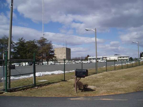
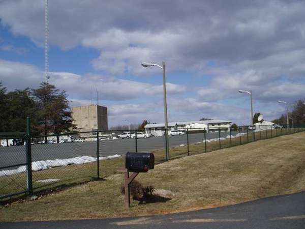
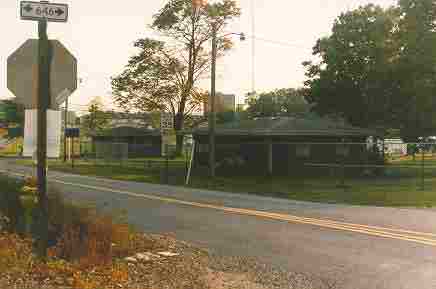
The former Manassas AFS, VA (Z-55) is situated in Independent Hill, VA, at the intersection of Joplin Road (VA Rte 619) and Aden Road (VA Rte 646) {southwest quadrant}, on a tract of land that originally was the northeast corner of the Quantico Marine Base. Today, the Prince William County (VA) School Board and the Independent Hill School use some of the former Air Force buildings. Several commercial radio towers are also situated on this site today. The GATR site (used after the radar mission ceased, as site R-20, stayed open until the mid to late 70`s) was located about a half mile or so west of the main site, with access from Aden Road. The GATR site today is used by a Government agency, and sports several large dish antennas in its antenna farm.
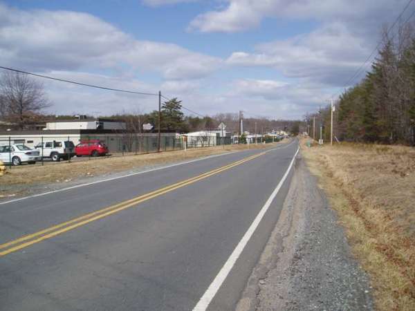
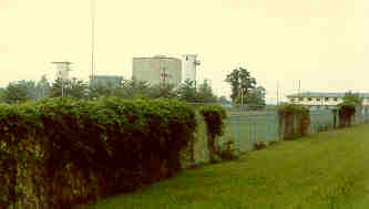
| View of the radar area from the southeast side (looking northwest), as seen from Joplin Road. |
 |
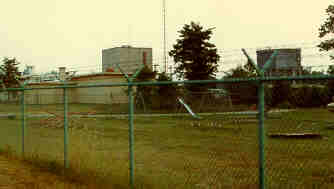
| View of the radar area from the east side (looking west-southwest), as seen from Joplin Road. |
 |
| Housing area, immediately at the intersection of Joplin Road (VA Rte 619) and Aden Road (VA Rte 646); the former AN/FPS-35 tower is in center, background. Looking ~ south-southwest. |
 |
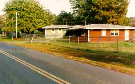
| Housing area, viewed from Aden Road, looking roughly east-southeast. |
 |
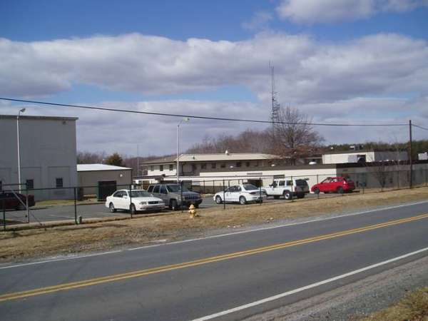
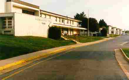
| Former administrative area, barracks. Radar towers (not shown) are to right (west). |
 |
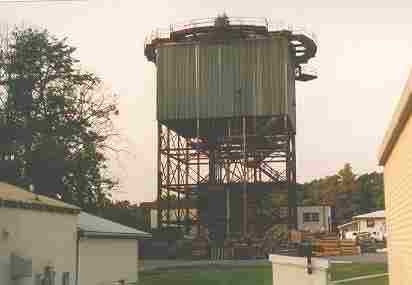
| AN/FPS-35 search radar tower is in the center. The older radar towers (that look like "lighthouses") on either side of the AN/FPS-35 tower held an AN/FPS-6A height-finder radar (right) and an earlier search radar, AN/FPS-3 (left). [Manassas AFS might have been the only USAF radar site to use these types of towers (?).] [looking south] |
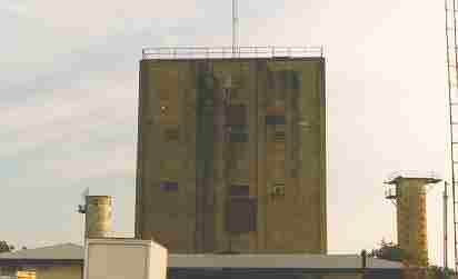 |
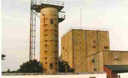
| AN/FPS-26 heightfinder radar tower, viewed from northwest side; AN/FPS-35 tower in the background. |
 |
| AN/FPS-35 search radar tower, as viewed from the top of the AN/FPS-26 heightfinder radar tower (note catwalk, foreground). [The old heightfinder radar tower is home now to numerous pigeons, and apparently has been for quite some time, as evidenced by the foot-deep layer of droppings inside the work-center area!] |
 |
| One of the old "lighthouse-shaped" radar towers (for AN/FPS-6A), with AN/FPS-35 search radar tower in the center, and the old Operations building to the right. |
 |
| AN/FPS-26 heightfinder radar tower, viewed from the south side. |
 |