Recent Photos of Las Vegas AFS, NV
..................................................................................................................................................................................................

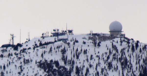
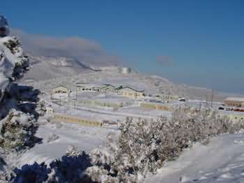
A snowy day atop Angel Peak at the former Las Vegas AFS
The LRR Operations building once stood in front of the pictured search radar tower; part of that building's concrete foundation can be seen in the forground. The base of the old AN/FPS-27 search radar tower can be seen on the far right. The view is roughly due west.
..................................................................................................................................................................................................
From http://www.panoramio.com/photo/41509703
� Copyright - All Rights Reserved - displayed here for historical, non-commercial purposes only.
Source: http://www.tacomaworld.com/forum/attachments/military/35242d1252436950-show-us-what-you-work-military-smhs-photos-010.jpg
A rare view of the `backside` of the peak. All the radar towers, past and present, can be seen.
source: http://farm5.static.flickr.com/4054/4310095644_0eea581028_b.jpg
The following eight photos source: http://www.familycourtchronicles.com/org/smyc/photos/ (All photos by Glenn Campbell)
February 2004
October 2002
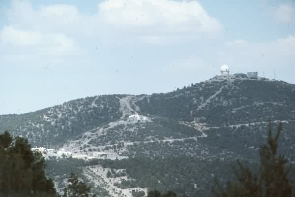
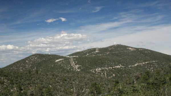
The former Las Vegas AFS, NV (Z-163) is located on top of Angel Peak, which is north-northwest of the city of Las Vegas, and east of Mt. Charleston. The former USAF cantonment area is still the Spring Mountain Youth Camp, and the top camp is still an active FAA long-range radar facility. The entire area is very scenic.
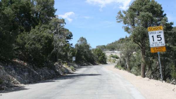
Both facilities (SMYC and FAA) are restricted. However, the gate was left open, so I decided to drive as far as possible until stopped by assigned personnel or by some barrier. However, no one or nothing stopped me, so I carefully drove on up to the top of the peak. I took several photos of the former Air Force structures, mindful not to disturb anything. Then I carefully drove back down the mountain. [No harm, no foul.]
On the way out, I found the gate had been locked. A white pickup truck then pulled up behind me, and the two gentlemen inside got out and asked what I was doing here. I showed them my ID, and explained my purpose. They emphasized that the area was restricted -- but they seemed satisfied with my explanation. They then unlocked the gate, and advised me to drive safely down the mountain. [Once again, the old adage "it`s easier to gain forgiveness than to gain permission" came to pass.] I thanked them, and headed on my way.
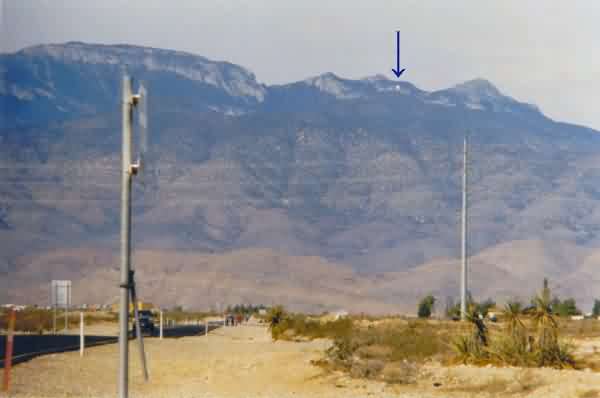
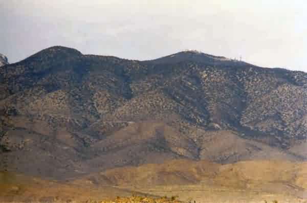
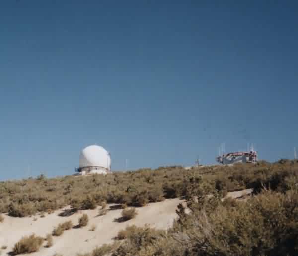
This photo (shot through a 300-mm telephoto lens) shows the now-FAA radar site as seen from State Road 157 just west of US Rte 95, north of Las Vegas. This former USAF radar station sits atop Angel Peak; Mt. Charleston is seen in the distance to the west (left). [looking northwest]
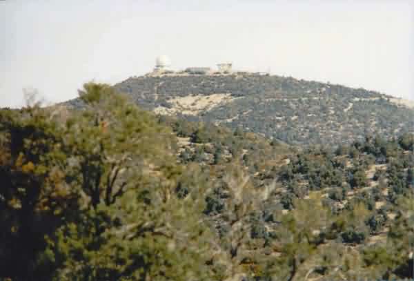
This photo (also shot through a 300-mm telephoto lens) shows Angel Peak and the radar station from State Road 157 further to the west. The former GATR site is seen to the right (east) of the radar dome. [looking north-northwest]
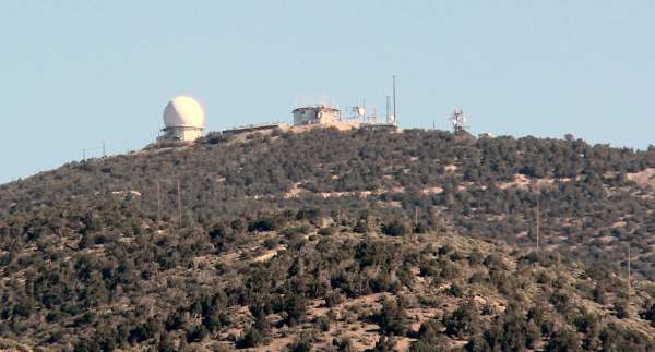
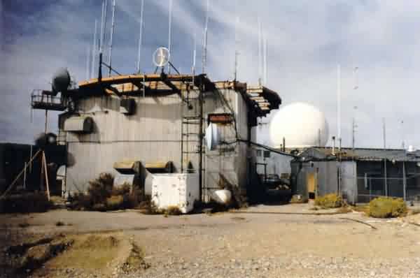
This photo (likewise shot through a 300-mm telephoto lens) shows the radar station from State Road 158 not far south of the site access road. The now-FAA AN/FPS-20A search radar tower (with dome) is on the left, and the former USAF AN/FPS-26A height-finder radar tower (without dome) is on the right. The old SAGE LRR Operations building is seen between the two radar towers. [looking north-northeast]
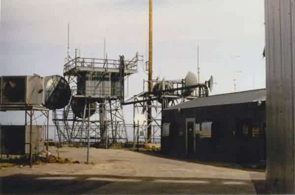
At the top of the peak, this photo shows the old AN/MPS-14 height-finder radar temperate tower, now used to support various communication antennas. ADCOM historical records indicate this radar was removed in 1968, about a year before the 865th Radar Squadron was deactivated. The structure to the extreme far right is the former AN/FPS-26A height-finder radar tower. [looking north]
This photo shows the old AN/FPS-26A height-finder radar tower as viewed from a point next to the AN/MPS-14 tower. [looking south-southeast]
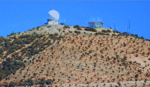
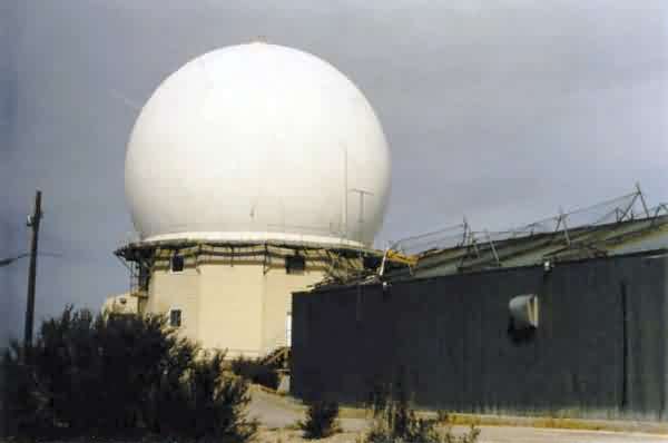
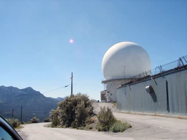
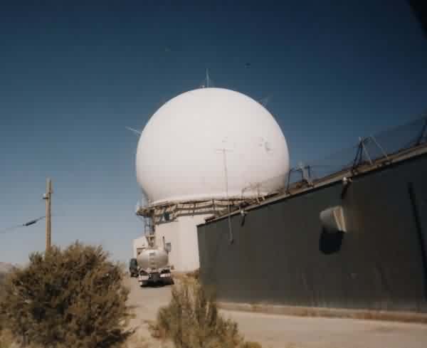
This photo (viewed through a 28-mm wide-angle lens) shows the former AN/FPS-26A height-finder radar tower and the FAA`s still-operational AN/FPS-20A search radar tower. [looking west]
This photo shows the FAA`s AN/FPS-20A search radar tower and the former SAGE LRR Operations building to the right. [looking west-northwest]
This photo also shows the FAA`s AN/FPS-20A search radar tower and the former SAGE LRR Operations building to the left. The base of the former USAF AN/FPS-27 search radar tower (no longer extant) is seen to the far right -- it`s the white structure with the two vents / hoods protruding. [looking west-southwest]
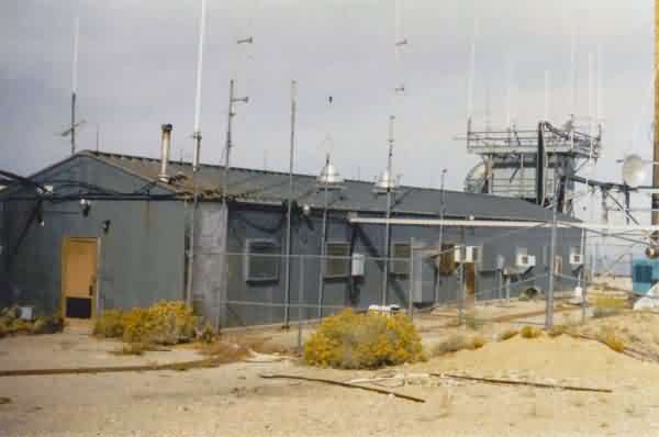
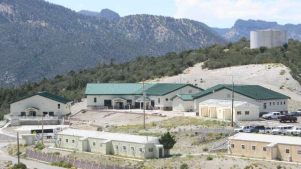
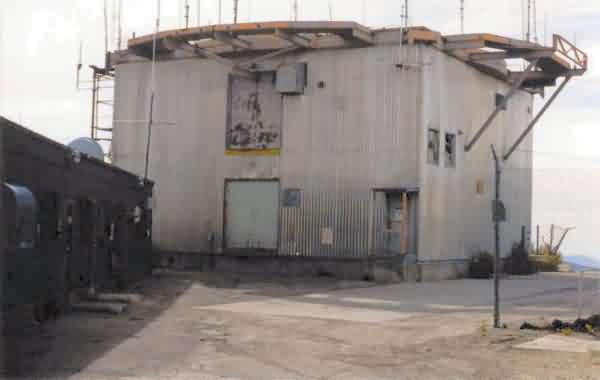
This photo shows one of the old USAF metal buildings at the top camp, with the AN/MPS-14 tower standing to the right (north). [looking northwest]
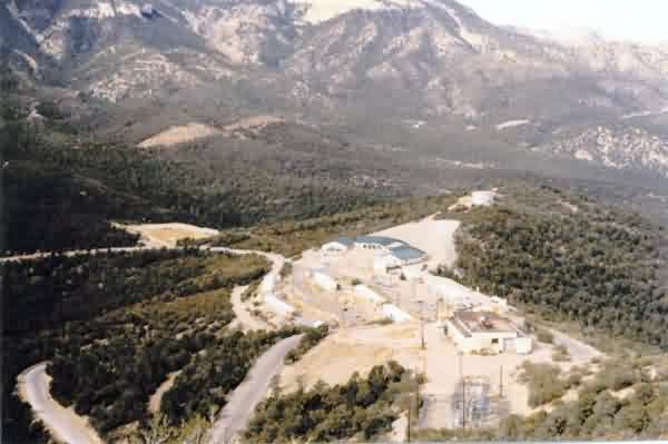
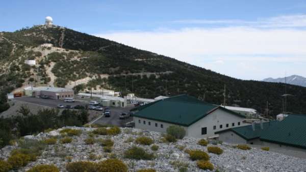
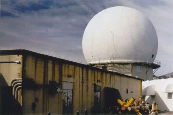
This photo, taken just below the AN/FPS-20A search radar tower, shows the diesel power plant in the foreground, and the cantonment area in the background. Mt. Charleston is seen in the distance in the center and to the left. [looking slightly north of due west]
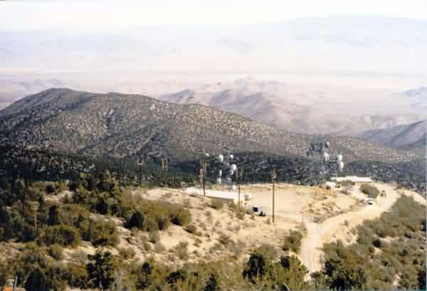
This photo, taken from the top of the peak just east of the AN/FPS-26A tower, shows the former GATR site near the center of the photo, and a newer communications facility to the right. [looking northeast]
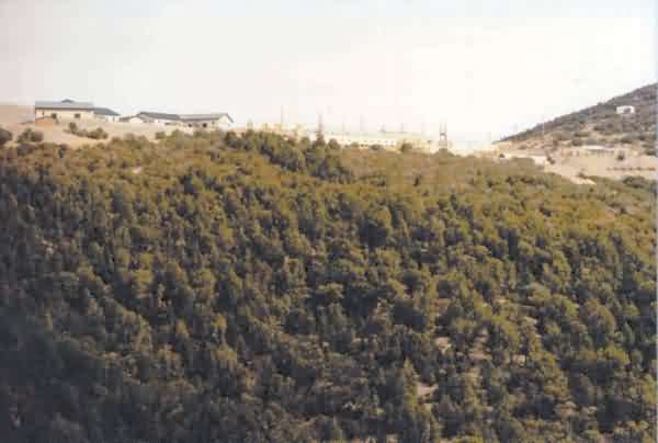
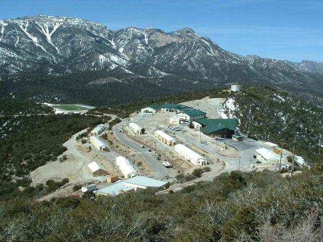
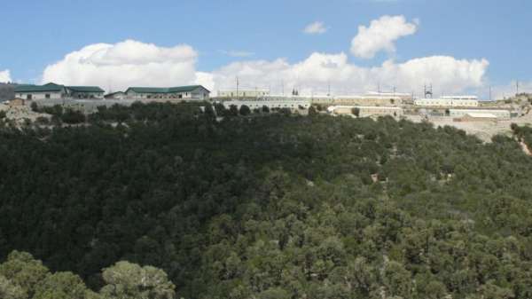
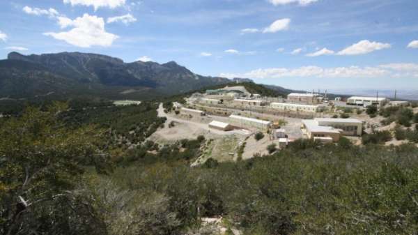
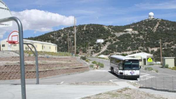
This final photo was taken from the site access road just before the present-day gate, and shows the former cantonment area (now Spring Mountain Youth Camp). Angel Peak is to the right (out of the photo). [looking north-northeast]
From the web site http://community.webshots.com/photo/25896147/25897248MELqIKTgIL
2001
Contributed by Chuck Comstock
Chuck writes: The Height Finder has been removed due to the fact that they have mode C onboard most A/C flying around the area.
2000
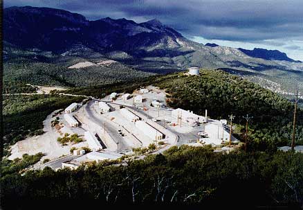
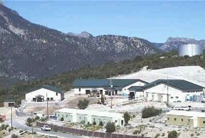
Cantonment area, from the Spring Mountain Youth Camp web site.
1989