Recent Photos of Inverness GFA, FL
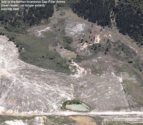
East
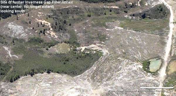
South
East
South
March 2005 photos contributed by Tom Page
Special thanks go to Mr. Keith Mousel, Resource Administrator for the Withlacoochee State Forest, for taking me out to "Radar Hill" and showing me the former location of the Inverness Gap-Filler Annex. The site of the old radar annex is located about 9 miles south-southwest of Inverness, within the Withlacoochee State Forest in Citrus County, on the south side of County Road 480, on top of a large limestone hill. The latitude-longitude coordinates of the top of Radar Hill (and presumably the radar site itself) are 28-41-22 N and 082-24-07 W. However, the radar facility no longer stands today.
Not only is the old gap-filler radar facility itself no longer extant, the very hill it sat on is now about 45 feet shorter than it was when the radar was in operation. The reason is, Florida Rock Industries, Inc., quarried away one side of the hill. Subsequent reclamation activities by the forestry department resulted in some leveling of Radar Hill. The original hill was ~200` above mean sea level, and the hill today, after reclamation, is only about 155` MSL (based upon an elevation reading from my hand-held GPS receiver unit). The only remnant of the radar facility today is the access road on the north side of the old quarry, except where the access road was truncated by the quarry.
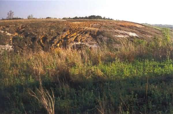
The photos below were taken on Friday, 18 March 2005, in the late afternoon.
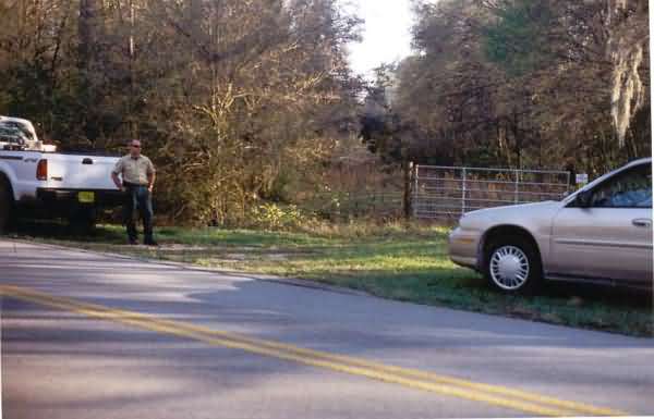
This photo shows the original access road (beyond the gate) for the radar site at the turnoff from County Road 480 (foreground). The latitude-longitude coordinates of this turnoff are 28-42-04 N and 082-23-57 W. The gentleman on the left was my tour guide, Mr. Keith Mousel. [looking south]
This photo shows the point where the original access road was cut off by the quarry. Radar Hill, or what`s left of it, is seen on the bare rise in the distance. (The tree-covered area seen in the distance is actually another hill beyond Radar Hill, and was originally shorter than Radar Hill.) [looking south]
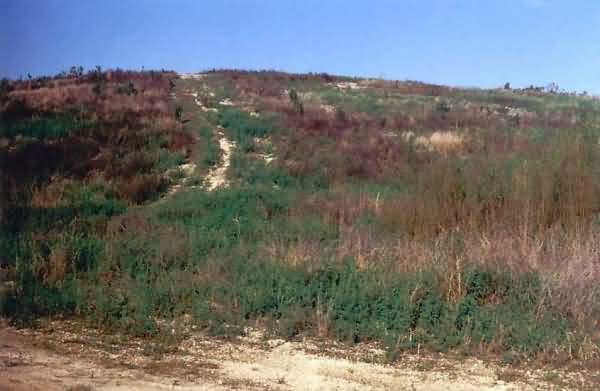
This photo shows Radar Hill from inside the former quarry. As mentioned before, this hill was once about 45 feet higher than it is today. [looking roughly northeast]
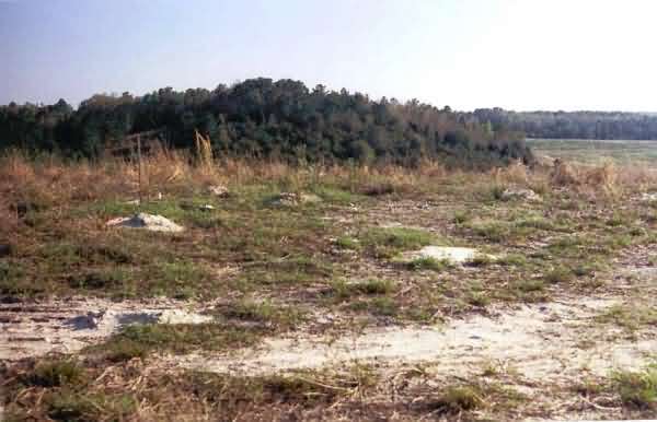
This final photo shows the present-day top of Radar Hill. There`s not much to see now. [looking southwest]