Hermanville GFA, MD Recent Photos
Feb. 2003 photos & notes by Tom Page
On Sunday, 23 Feb 2003, with my friend Keith Loney and my oldest daughter Lisa in tow, I succeeded (finally) in locating and photographing the old Hermanville Gap-Filler Radar Annex located in St. Mary`s County, Maryland. This former radar site is located alongside Poplar Ridge Road on its west side. The county recreation & parks board uses the site for storage, and a modern-day microwave tower is also in-use on the premises. This microwave tower utilizes the original radar-tower foundations/footings. Most of the chain-link fence around the site appears to be the original.
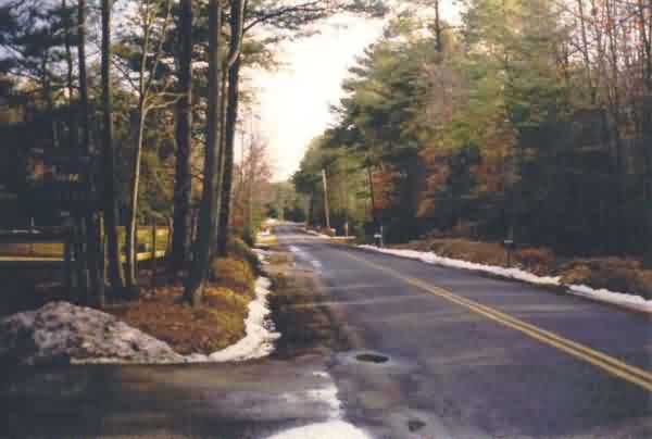 This photo is a view of Poplar Ridge Road from a point about Ľth mile north of the Hermanville gap-filler radar site. The purpose of this photo is merely to show what the general area and the road approaching the site look like. [looking south]
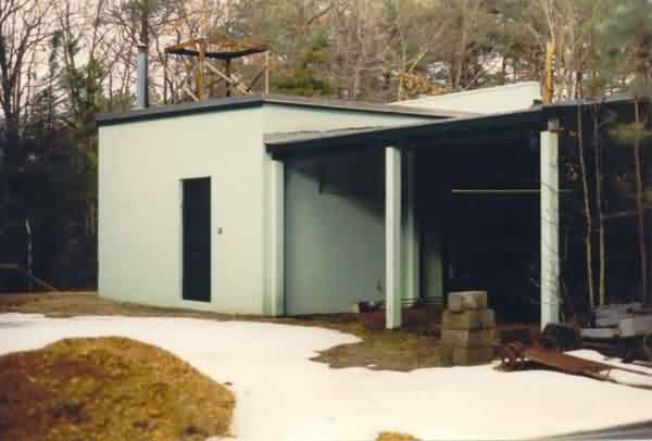
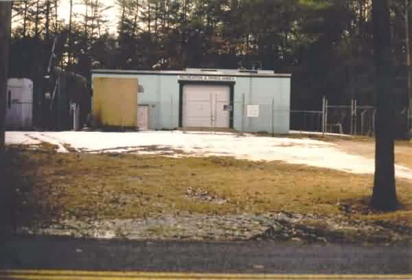 This photo shows the front of the former gap-filler radar building as viewed from Poplar Ridge Road. The radar tower stood to the left (south), but is no longer there. The sign over the roll-up door identifies the present-day owner. [looking west]
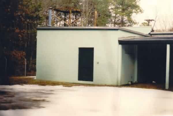
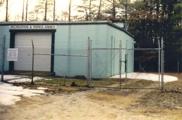 This photo shows the northeast corner of the GFA facility and what appears to be the original gate in the chain-link fence. The diesel-generator section of the building is to the right and back (west) beyond the firewall, while the radar-equipment section is in the front and left (south). [looking west-southwest]
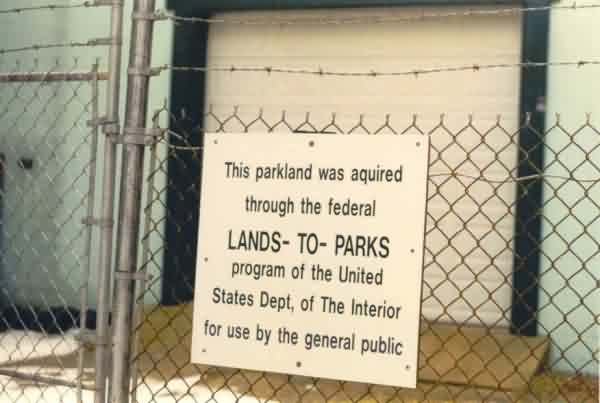 This photo shows the Federal Lands-To-Parks sign on the front fence. (We`ll forgive the spelling and punctuation errors.)
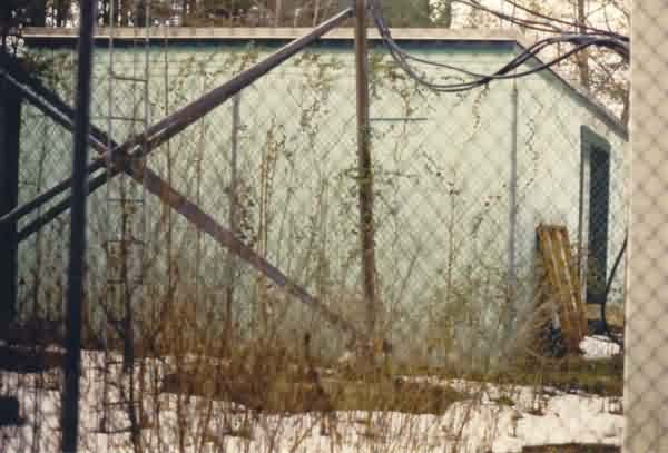 This photo shows the south end of the gap-filler annex building where the radar tower once stood. A modern-day microwave tower (foreground) is using the original radar-tower foundations/footings. [looking north-northwest]
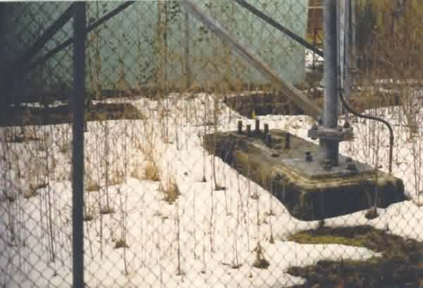 This photo is a close-up showing the three original radar-tower foundations/footings. [looking north-northeast]
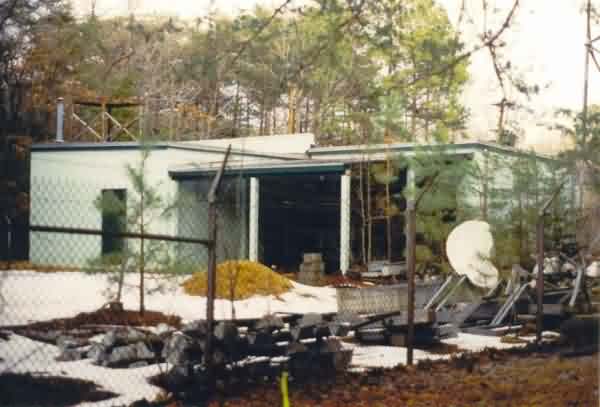 This photo shows the rear of the GFA facility as viewed from the southwest corner. The diesel-generator section is on the far left, and the radar-equipment section is on the far right. A shed roof has been added inside the the "L" between the two building sections (which explains in part why the site is very difficult to recognize in the "TerraServer" aerial imagery). Miscellaneous sports and recreation equipment is seen in the foreground lining the fence. [looking northeast]
 This photo offers another view of the rear of the GFA facility and its added shed roof. [looking north-northeast]
 This photo shows one more view of the rear of the diesel-generator wing of the old gap-filler annex. [looking east-northeast]
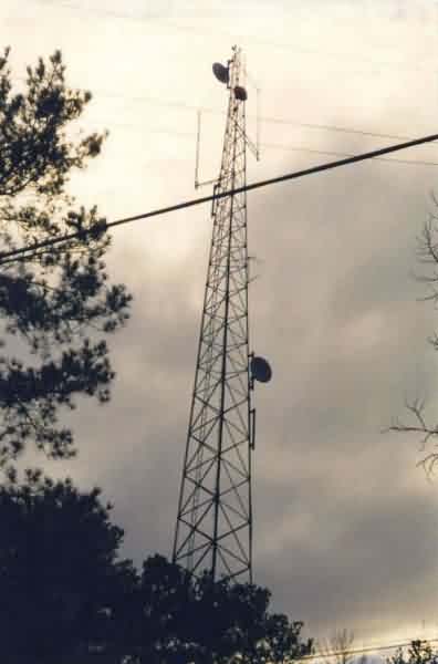 This photo shows the modern-day microwave tower that stands on the original radar-tower foundations/footings. [looking southwest]
The following photo was taken from the Hermanville FUDS report.
