Recent Photos of Fannett GFA, TX
2012 image looking South
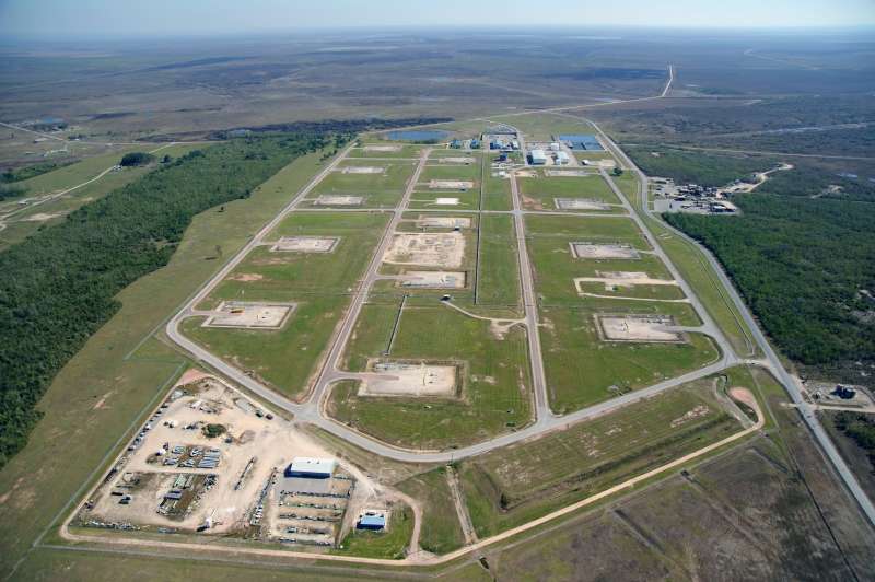
This aerial photo shows the present-day Strategic Petroleum Reserve facility atop the Big Hill salt dome which also once hosted the Fannett Gap-Filler Annex. The GFA would be in the wooded area on the left.
Source: http://clui.org/sites/default/files/ludb/tx/7798/5663573486_b539d730a3_o.jpg linked from http://clui.org/ludb/site/big-hill-strategic-petroleum-reserve
Source: http://clui.org/sites/default/files/ludb/tx/7798/5663573486_b539d730a3_o.jpg linked from http://clui.org/ludb/site/big-hill-strategic-petroleum-reserve
Photos and text are from Tom Page, Radomes Staff
Tom took these photos during a May 2003 road trip.
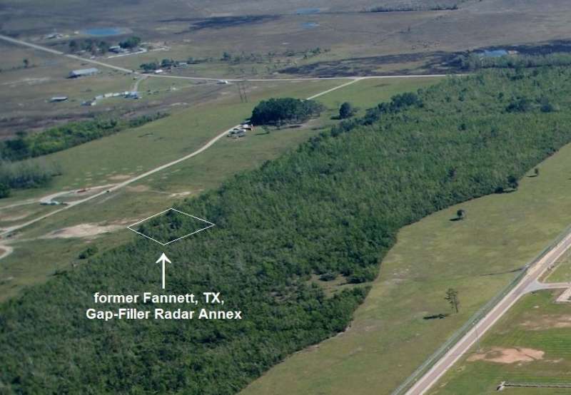
The former Fannett Gap-Filler Annex is located atop the Big Hill salt dome in southern Texas. Until this visit, we did not know precisely where on the hill the old radar site was located; the building is not visible at all in the on-line aerial imagery. Also, it was discovered that the two site maps on page 2 of the U.S. Army Corps of Engineers FUDS report are 90 degrees off from reality. That is, the direction arrow that points ``north`` really points west.
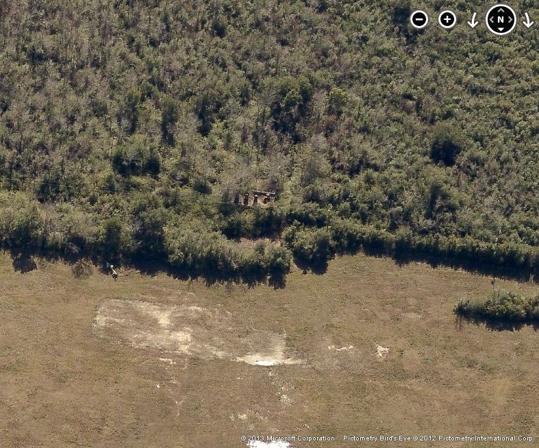
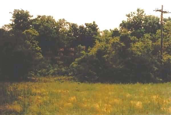
This photo shows the old gap-filler radar site as viewed from the east-west dirt road that crosses the salt dome. I had driven to where I thought the site was, east of this point, only to find nothing there. I turned around here, as the road to the west began going downhill. Before going back to the east, I decided to look around carefully … just in case. At first, I spotted nothing whatsoever that looked like a gap-filler building. Then, I finally spied something that resembled the top of a building with several very-rusty ventilation vents protruding. Sure enough, that was the facility. As one can see from this photo, the site is almost "invisible" against the tree line. The building is just to the right of center. [looking south-southeast]
This photo shows the site from just outside of the opening in the trees, presumably the entrance to the site. As one can see, even up close, the building (to the left of center) does not stand out very well. [looking southeast]
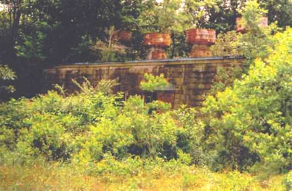
This close-up view shows the ``front`` (i.e., the radar-equipment section) of the building from inside the opening in the trees. As one can see, the building is well ``camouflaged.`` [looking southeast]
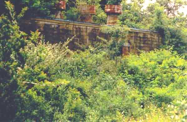
This photo is another close-up view of the ``front`` (i.e., the radar-equipment section) of the building from the northeast corner of the site. [looking southwest]
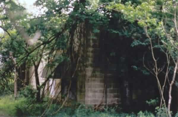
This photo shows the diesel-generator section of the building. The timbers inside supporting the ceiling were quite rotten, and many had already broken away. Outside, deer flies were very numerous. [looking north-northeast
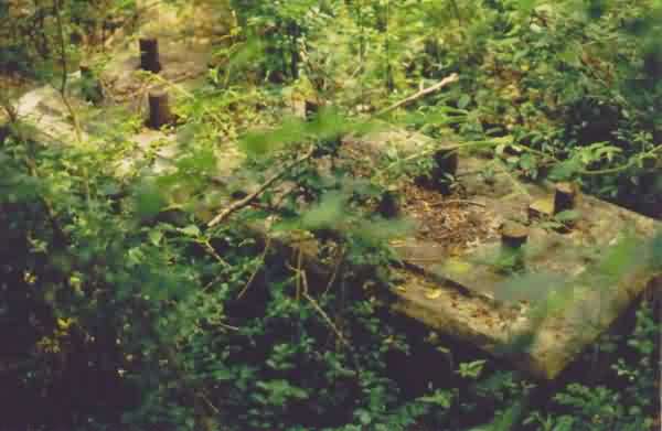
This photo shows one of the three radar-tower foundations / footings. All three were still extant; however, this was the only one that was easy to get to. The underbrush at this side of the site was very dense.
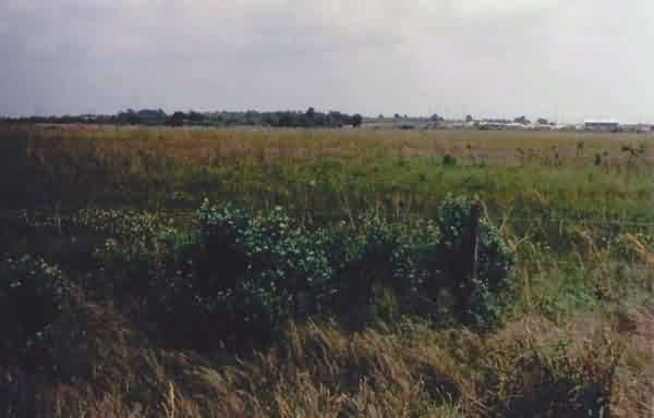
This photo show the Big Hill salt dome (not really all that big) from the west side. The radar site was near the center of the photo. The buildings to the right (south) are part of the Big Hill Strategic Petroleum Reserve (SPR). [looking east]