Recent Photos of Cut Bank AFS, MT
............................................................................................................................................................................................
The following photos were made by Tom Page on 20 June 2018:

This photo was taken from the site access road, with the old radar station seen in the distance. Just before I stopped and took this photo, a gray fox trotted across the road. (looking southwest)
.

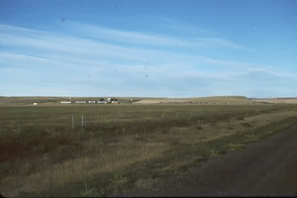
This photo was also taken from the site access road, just after it turned south (near the site of the family-housing area). The higher land was a rise to the right (west), and seemingly the radar towers should have been emplaced there for better range. A couple of older photos show two radar towers further up on the ridge; however, the final radar-tower layout was in this lower area. This doesn't make sense to me. (looking south-southwest)
.

This photo shows the location and remaining foundations of the AN/FPS-66 search radar tower and the two AN/FPS-6B height-finder radar towers, situated to the south and west of the Operations building (on the right). A cable trough is also seen running through the center of the compound right-to-left. The GATR site can be seen on the ridge in the far distance. (looking northwest)
.

This photo shows another view of the aforementioned radar tower foundations. I believe the closest foundations seen here were for the AN/FPS-66 search radar tower. (looking west-northwest)
.

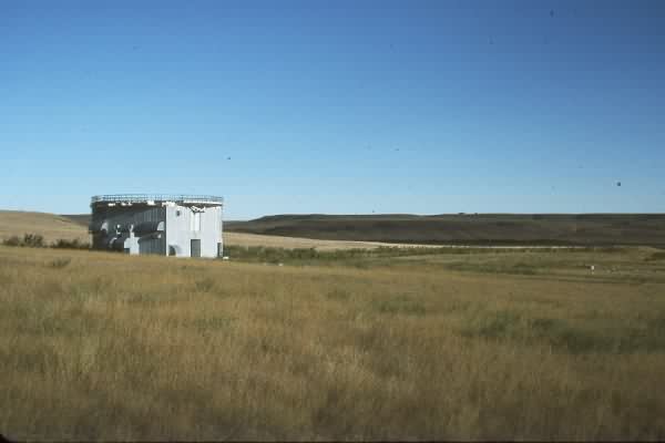
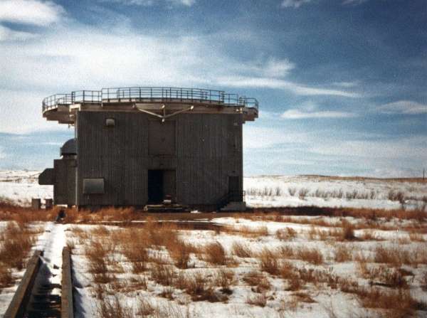
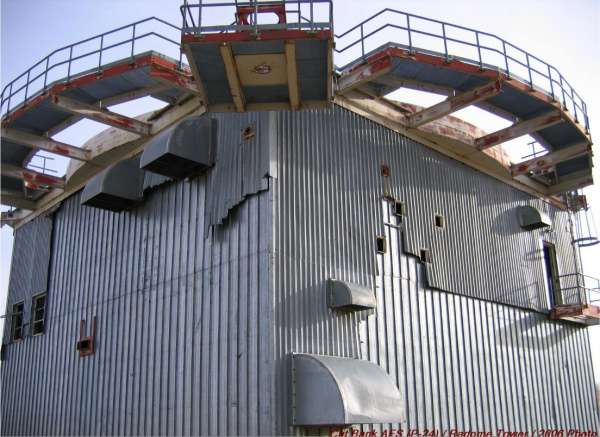
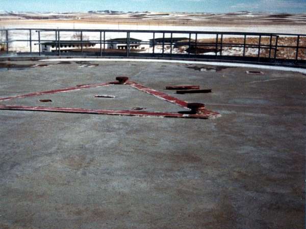
The sole remaining tower, seen here, once housed the AN/FPS-26 FD height-finder radar. (looking west)
.

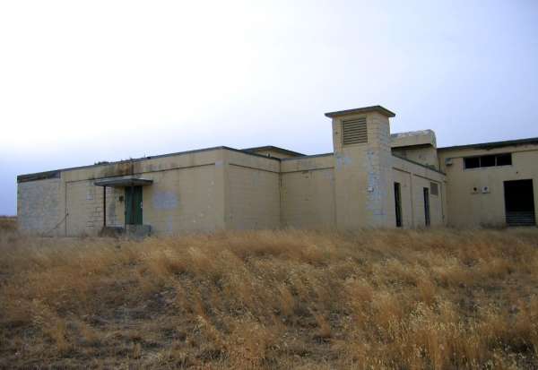
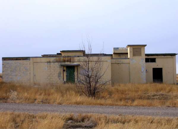
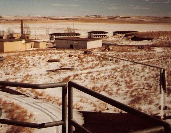
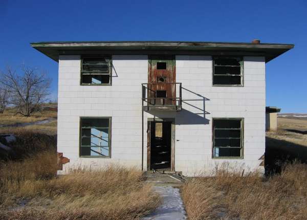
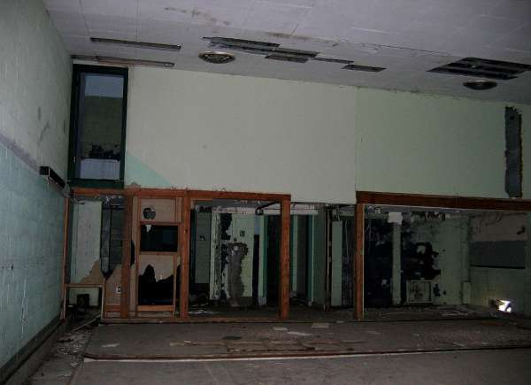
This photo shows the east and south sides of the former AC&W Radar Operations building. (looking west-northwest)
.

This photo shows the east and north sides of the former AC&W Radar Operations building. The SAGE addition is seen on the building's north side. (looking west-southwest)
.

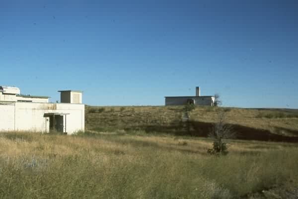
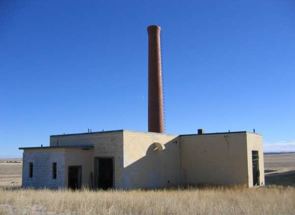
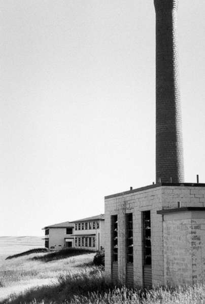
Not sure, but I believe that was the diesel Power Plant building to the left (south) of the Operations building. (looking south-southwest)
.

This photo shows one of the two manual Ground/Air/Ground Radio facilities, possibly the Receiver site, on the north side of the compound. (looking northwest)
.

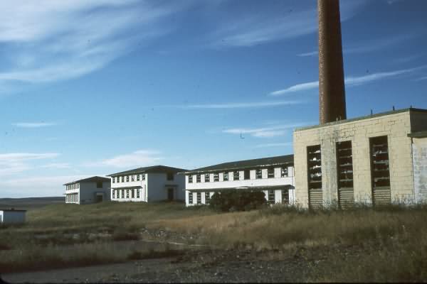
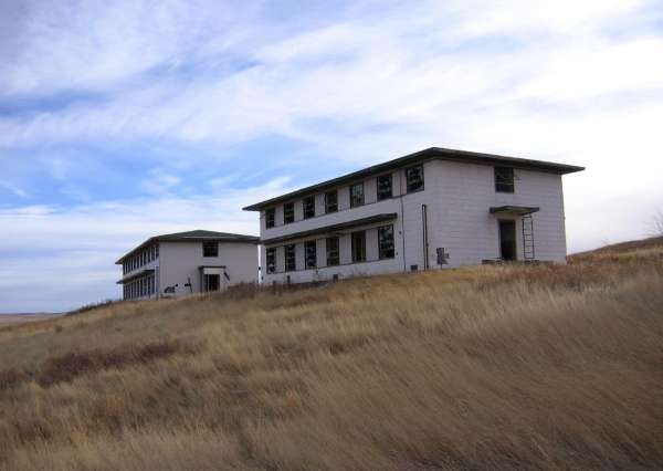
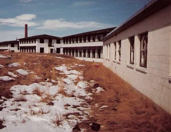
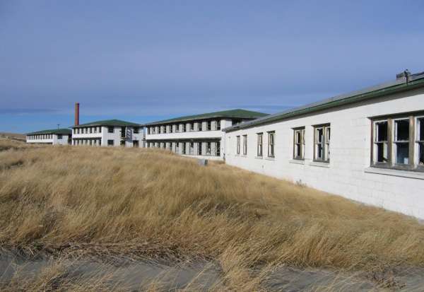
This photo shows the row of remaining barracks which appear to be occupied now by only birds. (looking east-southeast)
.

This photo shows the row of remaining battacks and the Heating Plant from their north side. (looking southeast)
.

This photo shows the Heating Plant from its south and west sides. (looking northeast)
.

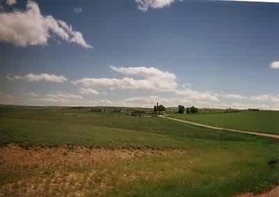
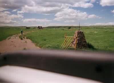
This photo shows the area once occupied by the family-housing area, as seen from the site access road north of the main site. The only traces remaining are this stone post and broken-up sections of paved road. (looking west-northwest)
.

This photo shows the foundation for the Security Police gate shack on the west side of the access road on the north side of the main site. Once again, the GATR site is seen on the ridge in the far distance (looking west)
.

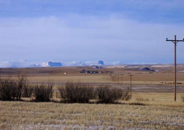
This final view shows a zoomed-in view of the GATR site on the distant ridge. (looking northwest)
.
The following photos, source http://news.webshots.com/album/579267600TXBUEe
(C) Copyright - All Rights Reserved - Displayed Here for Historical / Non-Commercial Uses Only
Source: http://www.examiner.com/x-10832-Billings-Sightseeing-Examiner~y2009m10d14-Ghost-Towns-of-Montana
From the source article: "The new type of ghost towns now are the closed military installations. 3 miles west of Opheim, Montana there is a USAF radar station that was built in 1954 and abandoned in 1979. Another radar base north of Havre was abandoned in 1994. There is a ghost radar station between Maiden and Fort Maginnis and another west of Miles City of which no trace remains."
1997 photos contributed by MSgt Mackie D. Bailey, Retired
Entering the old radar squadron
Not much left of the housing area
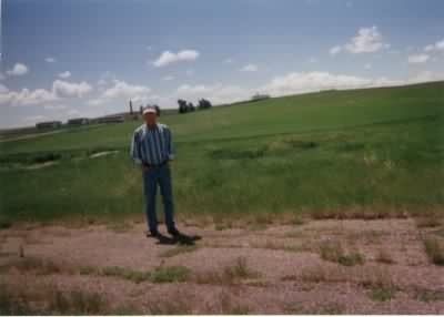
Another view of the housing area and the contributor
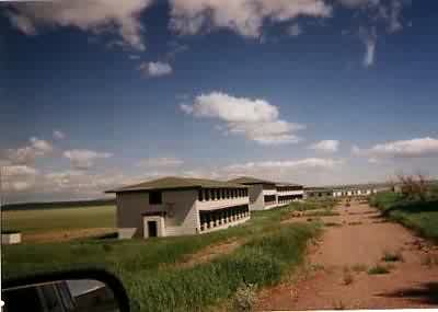
The barracks area is fairly intact
The following 1996 photos contributed by Mark Morgan