Recent Photos of Cottonwood AFS, ID

..................................................................................................................................................................................................... 

The following photos were taken by Tom Page on 18 June 2018:  

CottonwoodAFSID_2018_Family-Housing-Area-1.jpg

CottonwoodAFSID_2018_Family-Housing-Area-2.jpg

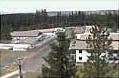
The first two photos show the old family-housing area on the north side of the town of Cottonwood.  Twenty (20) of the original twenty-seven (27) houses remain and appear to be occupied.  Both views are looking roughly south from Cottonwood Butte Road. 

.

The road to the top of Cottonwood Butte where the old radar site is located is paved.  However, past the former cantonment area (now the North Idaho Correctional Institution, NICI), the road has numerous potholes, some fairly deep.  There is also a metal grating in the middle of the road (at some former gate) further up the road that one must avoid so as not to damage any tires.  

CottonwoodAFSID_2018_Radar-Site-1.jpg

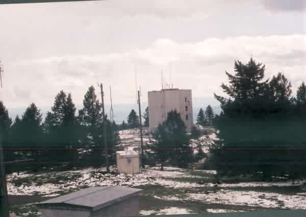
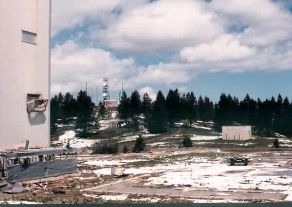
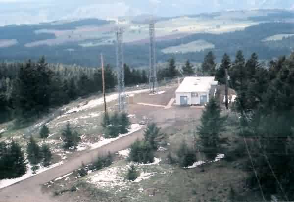
This photo shows one of the first views one gets of the old AN/FPS-24 FD Search Radar tower from the site access road as one nears the top of the butte.  (looking southeast) 

.

CottonwoodAFSID_2018_Radar-Site_FPS-24_1.jpg

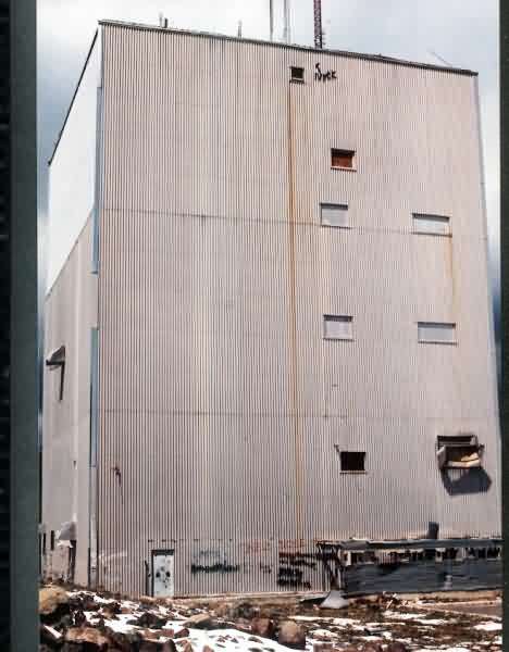
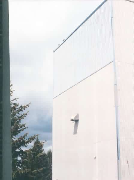
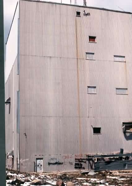
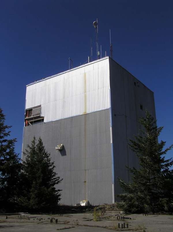
This photo shows the AN/FPS-24 FD Search Radar tower, as seen from its north side.  The tower appears to be in relatively good condition, although some of the metal siding is missing on its south side near the top at its southwest corner, shown later.  The tower now hosts a number of commercial transmitters and repeaters.  (looking south-southwest) 

.

CottonwoodAFSID_2018_Radar-Site_FPS-6-1_1.jpg

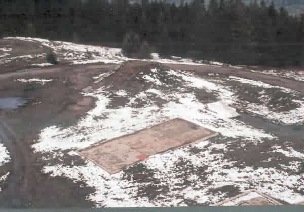
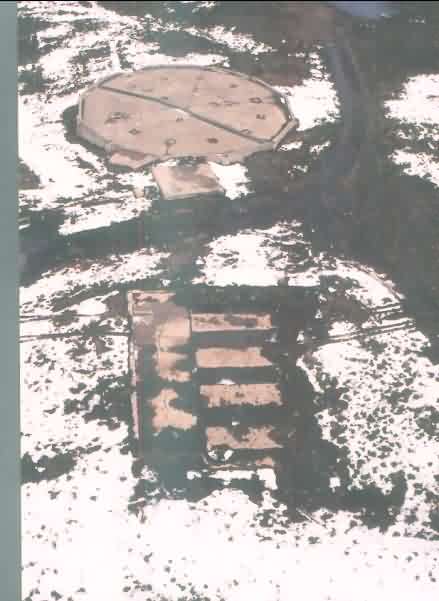
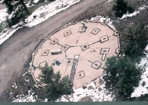
This photo shows the concrete foundations of one AN/FPS-6 (or -6A or -90) height-finder radar tower, the tower just north of the AN/FPS-24 radar tower.  (looking northwest) 

.

CottonwoodAFSID_2018_Radar-Site_FPS-6-2_1.jpg

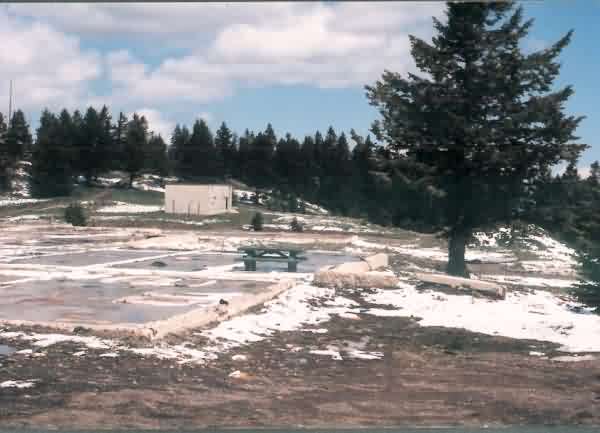
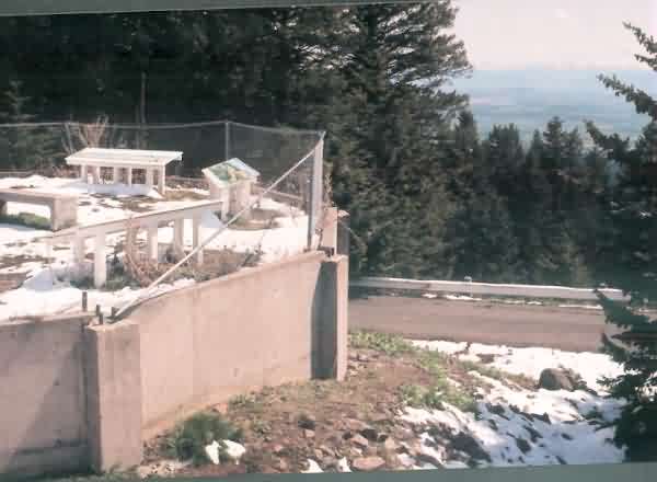
This photo shows the foundations of the other AN/FPS-6 (or -6A or -90) height-finder radar tower, the one on the east side of the site.  Earlier recent photos showed some plaques / interpretive displays and several picnic tables at this location; however, none of those are there now.  (looking east) 

.

CottonwoodAFSID_2018_Radar-Site_FPS-6-2_2.jpg

This photo shows another view of the height-finder radar tower base on the site's east side.  (looking northeast) 

.

CottonwoodAFSID_2018_Radar-Site_FPS-6-2_3.jpg

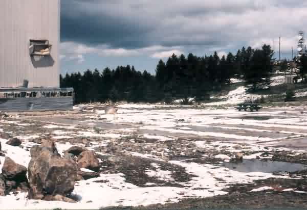
This photo shows one more view of the height-finder radar tower base on the site's east side.  This view is from the road that goes around the radar site on its east side to the south side where the GATR facility is believed to have been located.  The piece of metal siding in the foreground is from the search radar tower.  Several other pieces are strewn about the ground on the site's east side.  (looking northwest) 

.

CottonwoodAFSID_2018_Radar-Site_MPS-7_1.jpg

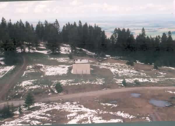
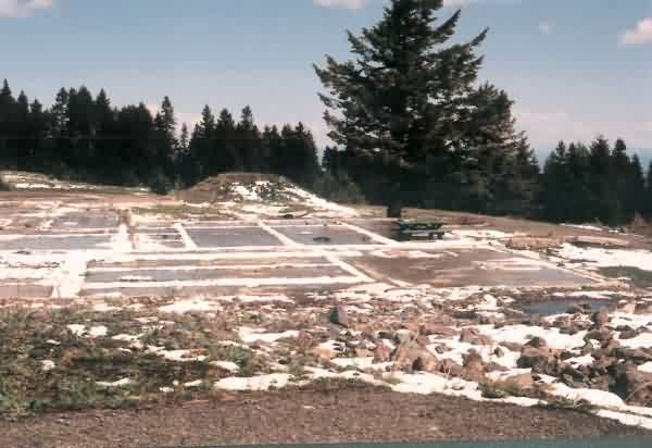
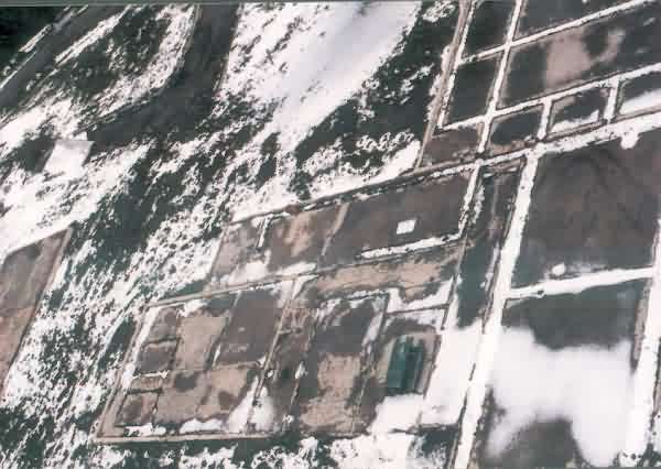
This photo shows the foundations for the site's first search radar, the AN/MPS-7 radar (mobile AN/FPS-3 radar).  The AN/FPS-24 radar tower is seen in the background.  (looking northwest) 

.

CottonwoodAFSID_2018_Radar-Site_FPS-24_2.jpg

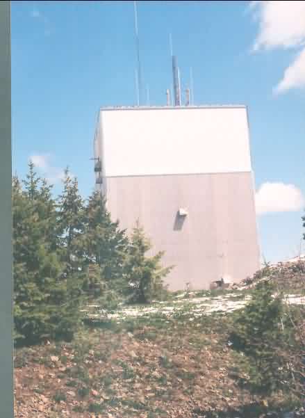
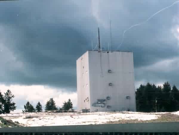
This photo shows another view of the AN/FPS-24 FD Search Radar tower and the corner where a section of its metal siding is missing.  (The entire top section of the metal siding on the tower's south side was replaced several years ago, but apparently it has been no match for the strong winds that frequent this mountaintop location.)  The foundations of the AN/MPS-7 Search Radar tower is again seen in the foreground.  (looking northwest) 

.

CottonwoodAFSID_2018_Radar-Site_Operations-Bldg-1.jpg

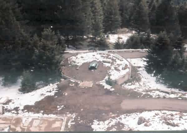
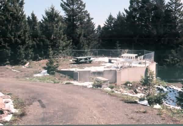
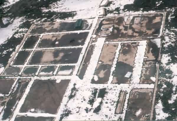
This photo shows the concrete foundations for the radar Operations building (looking just east of due south) 

.

CottonwoodAFSID_2018_Radar-Site_Operations-Bldg-2.jpg

This photo shows another view of the radar Operations building foundations, as seen from the vicinity of the AN/MPS-7 Search Radar tower location.  (looking just east of due north) 

.

CottonwoodAFSID_2018_Radar-Site_FPS-24_3_antenna-deck.jpg

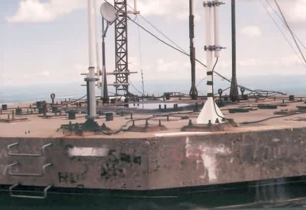
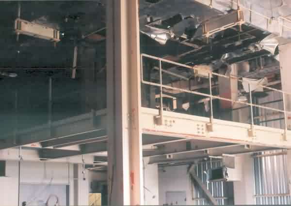
This photo shows the antenna deck for the AN/FPS-24 FD Search Radar, now sporting several modern-day commercial transmitter / repeater antennas (looking roughly northwest).  The radar tower is open (and not posted), and thus any capable person can climb up the stairs to any floor or all the way up to the antenna deck.  A few words of caution, though:  The stairway is not lighted, so a good flashlight is strongly advised (a typical smartphone LED light is sufficiently bright); there are numerouse openings in the tower floors which are not covered (so one must watch where he/she steps); the outer bay doors on the upper floors are completely open and have no barriers (so, one must not get too close -- it's a long drop straight down); and the antenna deck itself has no railings (the railings were removed when the Radome Support Structure [RSS] and the Radome were added) (as before, one must not get too close to the edge -- did I mention it's a long drop straight down?).  Nonetheless, the views from the tower top are fantastic on clear days.  

.

CottonwoodAFSID_2018_Radar-Site_FPS-6-1_above.jpg

This photo shows the foundations for the northern-most height-finder radar tower, as viewed from the antenna deck of the AN/FPS-24 radar tower.  (looking north) 

.

CottonwoodAFSID_2018_Radar-Site_MPS-7_above.jpg

This photo shows the foundations of the AN/MPS-7 Search Radar tower, as viewed from the antenna deck of the AN/FPS-24 radar tower.  Note the lack of railing on the AN/FPS-24 radar tower top in the foreground.  (looking southeast)  

.

CottonwoodAFSID_2018_Radar-Site_FPS-6-2_above.jpg

This photo shows the foundations of the other height-finder radar tower, the one on the east side, as viewed from the antenna deck of the AN/FPS-24 radar tower.  (looking east) 

.

CottonwoodAFSID_2018_Cantonment-Area_distant-1.jpg

This photo shows the former cantonment area (now NICI) several miles down the butte, as viewed from the antenna deck of the AN/FPS-24 radar tower.  (looking east-northeast) 

.

CottonwoodAFSID_2018_GATR-site-maybe_above-1.jpg

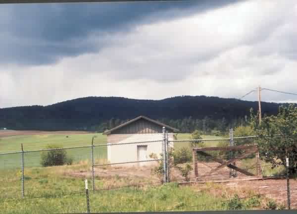
This photo shows what is believed to have been the Ground-Air/Transmitters-Receivers (GATR) radio and data-link facility, as viewed from the antenna deck of the AN/FPS-24 radar tower.  (looking south-southwest) 

.

CottonwoodAFSID_2018_view-west-1.jpg

This final photo shows one of the great views one gets on a clear day from the antenna deck of the AN/FPS-24 radar tower.  Again, note the lack of railing at the tower's edge.  (looking west)  

.

..................................................................................................................................................................................................... 

YouTube video (dated 2012):  https://www.youtube.com/watch?v=v4PgPtffydM 

..................................................................................................................................................................................................... 
.
.
CottonwoodAFSID_NICI_aerial_recent.jpg
.
former cantonment area, now the North Idaho Correctional Institution (looking east) 
.
source:  
http://www.idahocountyfreepress.com/news/2017/may/04/get-acquainted-spotlight-north-idaho-correctional-/ 
.
..................................................................................................................................................................................................... 


source: http://backwoodsmanagement.com/current_events


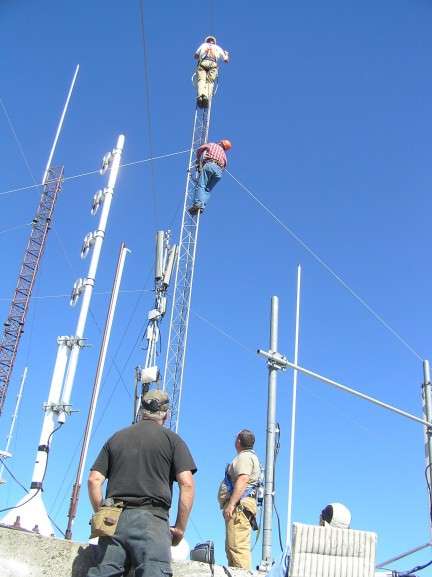
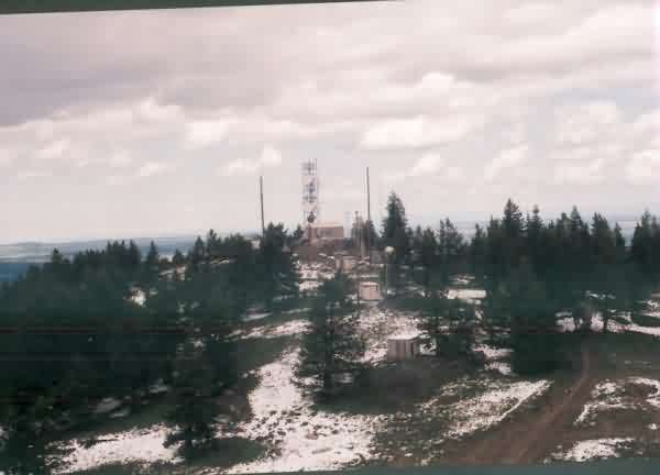
The antenna farm on the antenna deck of the former AN/FPS-24 radar tower.


source: http://backwoodsmanagement.com/


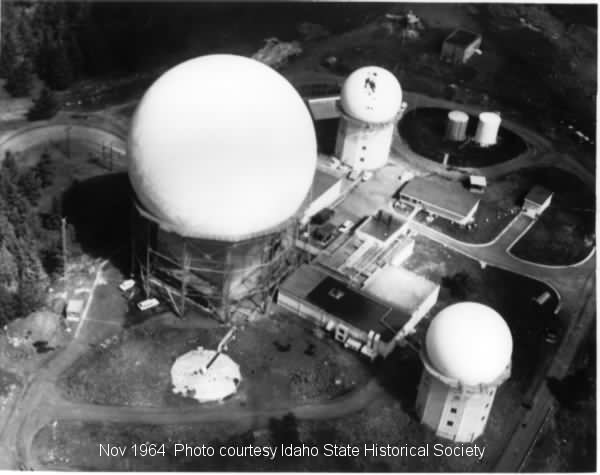
May, 2004 photos & notes contributed by Tom & Shirley Bower

Tom writes: Much of this information I received from my granddad, the late Frank "Nobby" Bower, who worked closely with the Air Force during construction and operations of this AFS. All of the buildings of the site were torn down in the summer of 1994 with the exception of the 24 tower which is used for a radio repeater facility. 


This photo is taken from the top of the AN/FPS-24 tower facing due north. The two smaller water puddles are where the two above ground fuel tanks were located. I'm not sure what the building in the center was for but it had a bathroom facility in it and had a small telephone patch panel installed on one fo the walls. It may not have had anything to do with the AFS because it was outside of the chain link perimeter fence that was removed in the summer of 1994.


Photo taken from the top of the 24 tower facing due east. At the center is the base of one of the smaller towers and domes.


Photo taken from the top of the 24 tower facing north east. The slab is what I believe used to be the mess hall. It had a nice sort of decorative wooden beam running down the center for the ridge support and had areas about 10 feet square designated as "Bays." The earthen dome begind is where the 5,000 gal. water storage tank is buried. The pump house was located next to the mound.


Photo of the well down on the prairie below the AFS. It pumped water to the cantonment area and to the top where the AFS is barely visible on the top of the butte with a series of booster pump stations to a distance of about 4 miles and an altitude rise of about 2,000 ft.


Photo of the east elevation of the 24 tower.


Photo of the south elevation of the 24 tower. Some of the siding was blown off over the years, but since the tower is used for a radio facility, it was repaired.


Photo from the top of the 24 tower facing north. The slab in the foreground was the backup generator facility and the other is the base of the other radar to the north.


Photo facing north west across the slab where the ops building stood.


Photo facing SSE of the 24 tower.


Photo of the south elevation of the 24 tower showing replacement siding.


Photo facing NNE across the slab of the ops building. The Douglas fir tree to the right is the same one that is in the Nov. 1964 aerial photo by the Idaho State Historical Society (below).


Photo facing NNE across the slab of the ops building with generator building slab and the north tower base.


Photo of the east tower base.


Photo facing north across the ops building slab with the 5,000 gallon water tank earth mound in the background. The Douglas fir tree behind the picnic table is the same tree barely visible by the corner of the ops building in the Nov. 1964 aerial photo above.


Photo across the top of the FPS-24 tower main bearing pad.


Photo of the top floor mezzanine where I believ the antenna drive motor controllers were.


Photo from the top of the 24 tower showing the slab of the ops building. The light snow shows the cabling cuts cast into the floor when the concrete was poured. These cuts were used to interconnect the various units and were covered with 1/4" diamond plate steel where exposed to foot traffic.


Another view of the photo above.


Photo from the top of the 24 tower facing south showing the antenna base that was torn down in Aug. of 1959 when the 24 tower system was contracted to be built by Canaday Construction Company.


Photo from the top of the 24 tower facing south showing what I believe is the GATR site which is still operational.


Photo of the north elevation of the AN/FPS-24 tower.


Photo from the top of the 24 tower facing NNW of the other facilies on top of Cottonwood Butte.


Photo of the east elevation of the 24 tower.


Photo of the antenna base due east of the 24 tower.


Photo source: North Idaho Correctional Institution (NICI)


"NICI is a former military radar station north of the small town of Cottonwood. This is a program-specific prison designed for male offenders sentenced to a retained jurisdiction commitment by the court. It provides a sentencing alternative for the courts to target those offenders who might, after a period of programming and evaluation, be viable candidates for probation rather than incarceration." 

.............................................................................................................................................................................................................. 


CottonwoodAFSID_Recent_NICI-1.jpg

A recent photo of the former cantonment area, now North Idaho Correctional Institution (NICI), looking north

source:  http://www.lcsc.edu/adult-learning-center/department-of-correction/ 

.................................................................................................................................................................................................................. 

CottonwoodAFSID_Recent_NICI-2-.jpg

Another recent photo of NICI, looking south

source:  http://www.idahocountyfreepress.com/news/2014/aug/06/thursday-nici-open-house-mark-40th-anniversary/