Recent Photos of Cape Charles AFS, VA (P-56 / Z-56)
Photo Source:
http://members.tripod.com/airfields_freeman/VA/Airfields_VA_Norfolk.htm#capecharles.
Photo by Russ Roslewski.
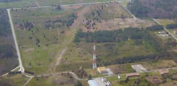
The former Air Force Station itself is seen in the lower center and right of the photo.
The view in the photo is roughly to the west-northwest.
2002 photos & notes contributed by Larry D. Whitten
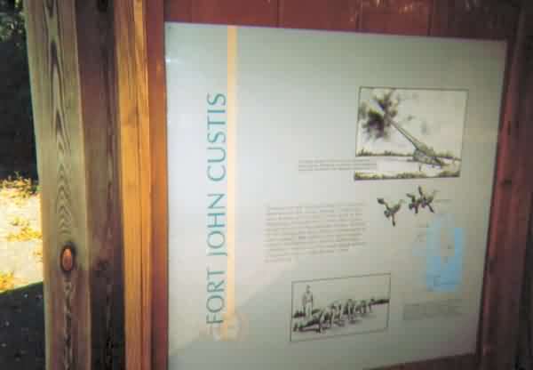
An information poster along a footpath that takes you on a nature walk and goes through one of the old Coastal Artillery bunkers. As I`m sure you already knew, Cape Charles AFS was the former Ft. John Custis during WWII.
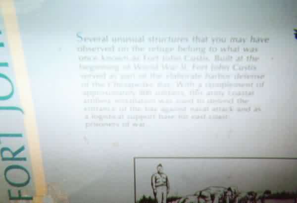
A close up of the information poster, which explains the purpose of the coastal artillery bunkers.
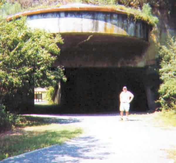
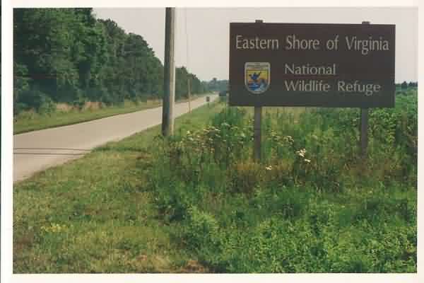
Larry Whitten standing in front of the coastal artillery bunker. This particular bunker was not used for any special purpose when I was stationed at CCAFS, both in 1959-60 or in 1966-68. However, two bunkers were used; one was on the site proper and was used as the Civil Engineers/AIO office and workshop. The other bunker was along the access road to the site, which Tom has already put the picture in (picture #2 which shows the Eastern Shore Wildlife Refuge sign) and was used as the NCO Club during my 1966-68 tour. In 1959, the NCO Club was located just as you cross the boundary to the site.The information building for the Wildlife Refuge is on what was the NCO Club site in 1959.
This mound in this picture, that is covered by weeds and trees and is virtually impossible to get to, was the NCO Club in 1966. It was located on the east side of the access road. It had a large frame building attached to the east side of the bunker, which was used as a kitchen and dance hall. The bar, managers office, dance floor and liquor storage vault were located in the bunker. It was a damp and smelly club and when everybody had lit up, it was a smoky, smoky joint. We had to have the TV repaired one time and when the back was removed from the TV, the tubes looked as though someone had poured syrup on them. Nicotine had collected on the tubes. It was an awful mess. I thought then if my lungs were as bad as those TV tubes, my time must be short. (I finally quit smoking in 1985).
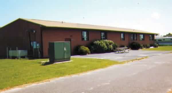
This building, which is now the Educational Building was the Motor Pool and Special Services/Library when I was there in 1959. In 1966, on my second tour to CCAFS, it was the site commissary. A big help, because in 1959, families either shopped in Cape Charles or had to take the ferry across the Chesapeake Bay to use the commissary and other facilities at Langley AFB.
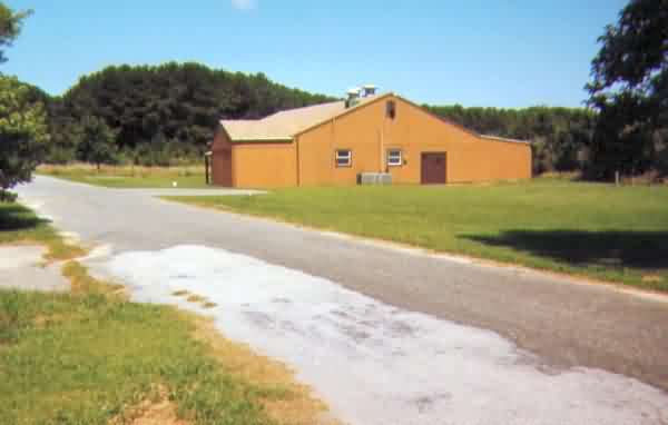
This building which is now the Training/Conference Building was the Dining Hall during both of my tours. Talk about some good "chow". I have never had any dinner as good as the one they served in this Dining Hall on Tuesdays and Fridays. In 1959, our mess hall used local rations and bought off the economy. Tuesdays was "Steak Day". Big,thick, juicy steaks cooked to order with all the trimmings, baked potatoes, salad, etc. But it was nothing compared to Fridays. Of course back in those days, Fridays was always fish day. Had something to do with the Pope, I believe. On Fridays, everyone showed up for dinner. People on seperate rations, mid shift workers, off duty people, and I think a few times some oystermen from up the coast snuck in. We had fresh fish, usually flounder, fried clams, oyster stew, fried onion rings, french fries, steamed oysters and clams. What a feast! And only $.55 if you were on seperate rats. Boy, how I miss that Friday dinner. I better get off this subject.
June 2001 photos & notes by Tom Page
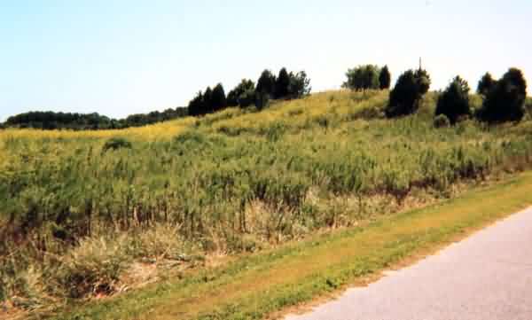
The radar site, located east of US Rte 13 at the southern tip of Virginia’s eastern shore, is now the `Eastern Shore of Virginia National Wildlife Refuge.` Very few of the original Air Force buildings remain; none of the radar towers remain. Most of the grounds have been returned to their natural state.
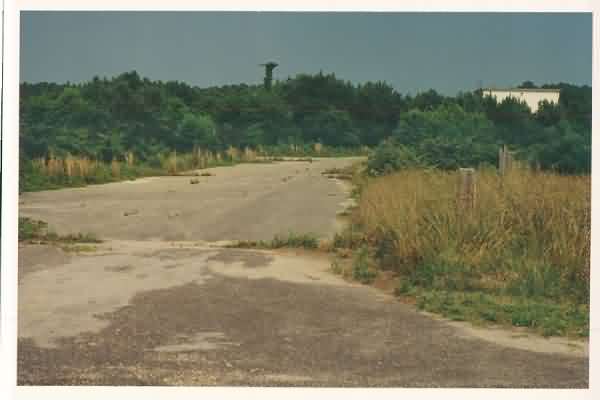
The access road for the former Cape Charles AFS. This road goes south (parallel to US Rte 13), then turns east (up to the former gate), then north again (to the site). [looking south]
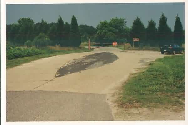
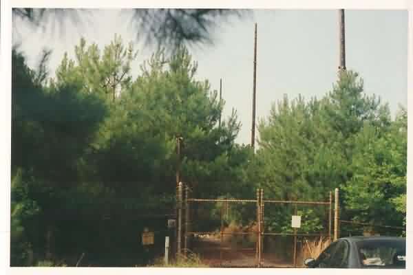
Former entrance gate and SP guard shack location. [looking east]
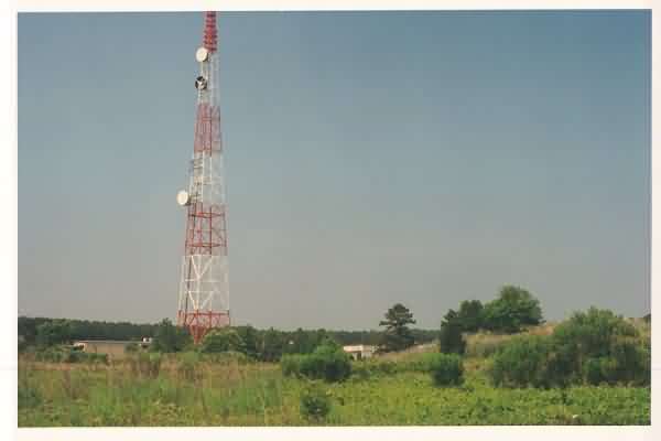
View of the commercial transmitter tower on site (and maybe the site’s former TELCO building?), with the motor pool building seen on the right, as viewed from the site entrance. [looking north-northeast]
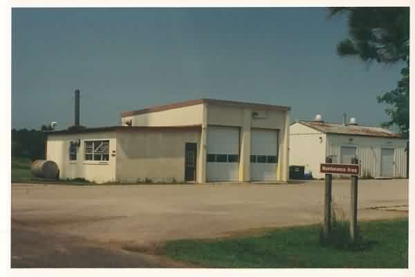
The old motor pool building. [looking north-northeast]
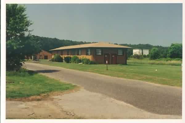
Motor Pool & Special Service/Library building, with the water-treatment plant (white square building) seen in the distance. [looking north-northeast]
Looking toward where the AN/FPS-26 radar tower used to stand in the distance, with the water-treatment plant seen to the right. An osprey nest perch stands in the photo’s center just inside the tree line. [looking east]
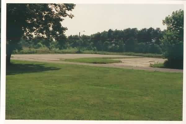
Parking area for support buildings, no longer extant. [looking west-southwest]
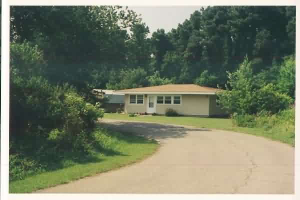
One of the family-housing units. [looking north-northwest]
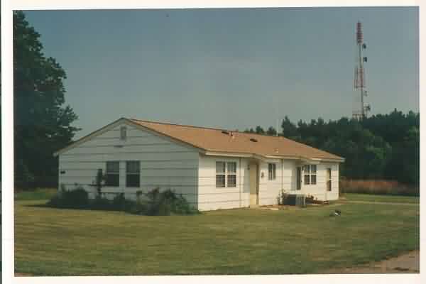
Another one of the family-housing units. [looking south-southeast]
Gate to the former GATR site, now heavily overgrown with small trees. The GATR building could not be seen from the gate. [looking north]
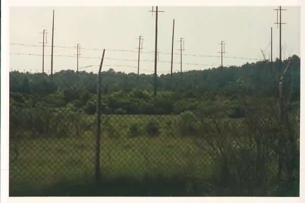
The antenna farm of the former GATR site, reportedly in-use by the Navy (?). The top of the GATR building could be seen, but barely. [looking west-northwest]
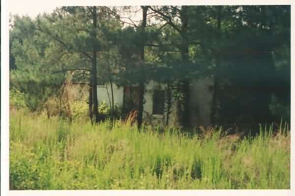
Another military building not far south of the GATR site; this facility is now believed to be the Transmitter building for the Seaward Extension Shore Station (SESS) which employed HF radios for communicating with U.S. Navy Radar Picket Ships in the 1960s. The SESS Receiver site was located about 20 miles further north near Eastville, VA. No antenna poles were observed. The woods are heavily infested with ticks. [looking northwest]
The SESS Receiver building for Cape Charles AFS. This facility is located at Eastville, about 20 miles north of the SESS Transmitter site. The Receiver site is now Indiantown Park.
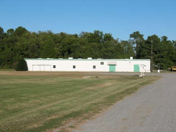
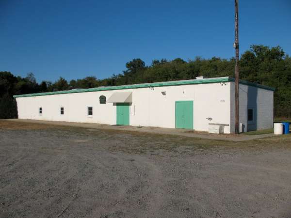
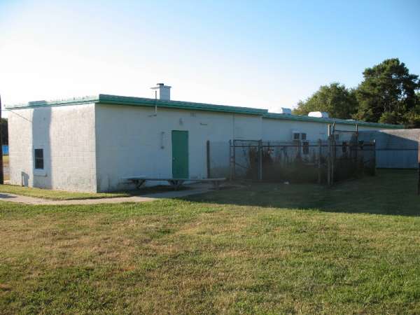
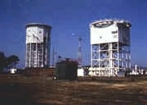
Photo Source:
http://easternshore.fws.gov/ESVNWR%20Gen%20Info/ESVNWR%20History.htm
Shortly after deactivation, this photo was taken from SE of the operations area, looking NW. The AN/FPS-7 tower is on the left, the AN/FPS-26 tower on the right.