Cambria AFS, CA Recent Photos
-----------------------------------------------------------------------------------------------------------------------------------------------------------------------
.
.
-----------------------------------------------------------------------------------------------------------------------------------------------------------------------
The linked drone video (October 2019) was contributed by John R. Albrektson
.
.
-----------------------------------------------------------------------------------------------------------------------------------------------------------------------
.
The following two circa-2018 photos were contributed by John Delmerico
.
This photo shows the former AN/FPS-26 FD height-finder radar tower (looking north)
.
.
This photo shows the former AN/FPS-107 search radar tower
.
-----------------------------------------------------------------------------------------------------------------------------------------------------------------------
The following two photos are from https://www.facebook.com/CambriaAirForceRadarStation/


-----------------------------------------------------------------------------------------------------------------------------------------------------------------------

Photo source: http://www.sanluisobispo.com/news/article38963397.html
Photo by Joe Johnston 12-18-08; courtesy of "The Tribune"
Displayed here for historical / non-commercial purposes only
-----------------------------------------------------------------------------------------------------------------------------------------------------------------------
2004 photos contributed by Tim Tyler
Tim writes: I noted during my visited that the original GATR site on the SW of the property -- one that you pass fairly close to as you drive up the access road to the main AFS gate, had a couple antennas & a USCG sign on it, indicating it`s still in use by the US government. Turns out that it is a USCG NAVTEX (Navigational Telex, broadcasting safety notices & weather info to ships) station callsign NMQ & transmitting with identifier `Q` on 518kHz in SITOR mode. It`s nice to know that one of the original Cambria AFS GATR facilities is still transmitting official US government radio signals.
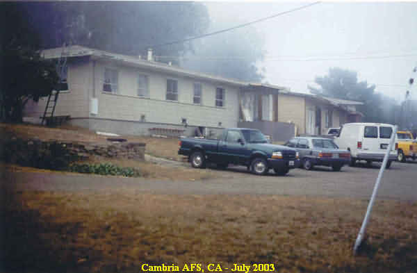
July 2003 photos and captions by: Tom Page, Radomes Staff
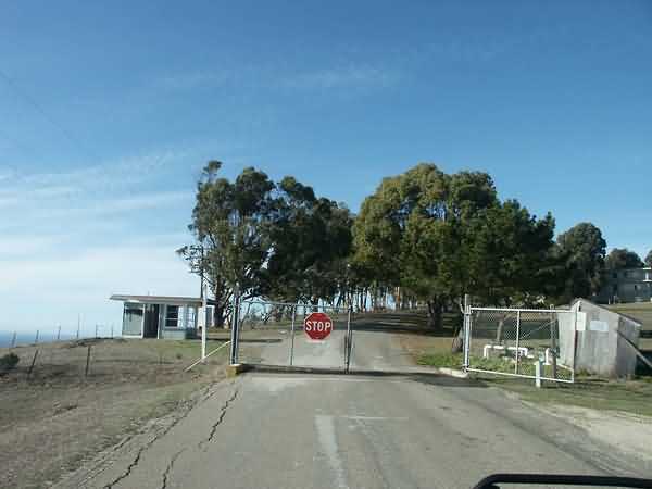
Tom says: "I located the access road to the former Cambria AFS with little difficulty only to find a locked gate and no one around. It was late on a Saturday afternoon, so it appeared that this former air-defense radar station would go unvisited by yours truly on this occasion.
I returned to town to find restrooms for the family. I was hoping to locate a local person who might know someone I could call for entry to the site, but I found no one to ask. So, I gave up, and resumed our drive down the coast.
Passing the site access road again, I suddenly spied a couple of people inside the gate! What the heck, maybe they could open the gate for me?! I pulled up, and got their attention. After some initial reluctance, the guy opened the gate for me. He said we could drive up to the site, but there would be a locked gate at the top, so I would not be able to go to where the towers stood. So, up we went. The access road was a very scenic drive, although fog was rolling in off the cold Pacific waters, and visibility was severely limited. When we arrived at the top, lo and behold, there was an open gate ... and a care-taker. After I explained my purpose, he allowed us to drive on the rest of the way for a few pictures. I lucked out after all. The fog made for less-than-ideal photos -- but better than nothing. Overall, the site structures were found to be in relatively good condition."
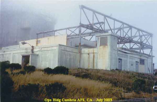
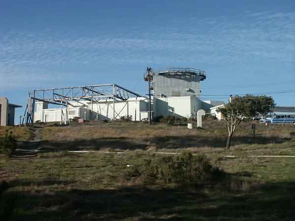
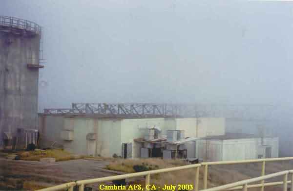
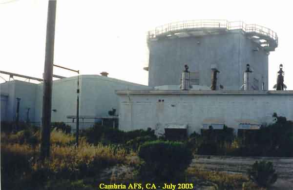
This photo shows the old Long-Range Radar (LRR) Operations building. The purpose of the metal truss work over the roof is not known to me. My best *guess* is that there might have been early plans to harden the Ops building for use as a Back-Up Interceptor Control (BUIC) facility, but then plans changed, and construction was halted prior to completion. However, this is mere speculation on my part. If anyone out there knows for sure, please let us know. Thanks. [looking northeast]
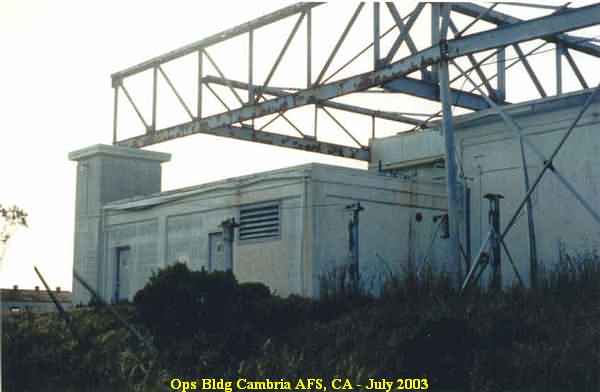
This photo also shows the old LRR Operations building, from the south side. [looking west-northwest]
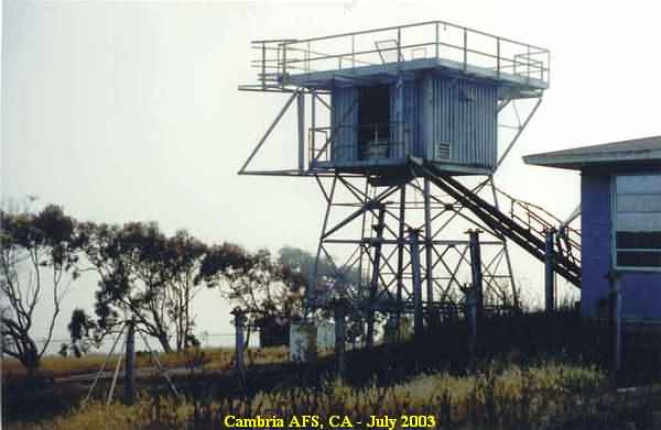
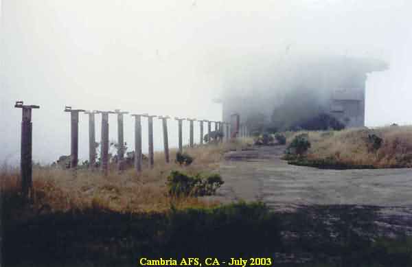
This photo shows the temperate tower for the AN/FPS-6 height-finder radar located south of the LRR Ops building. [looking west-southwest]
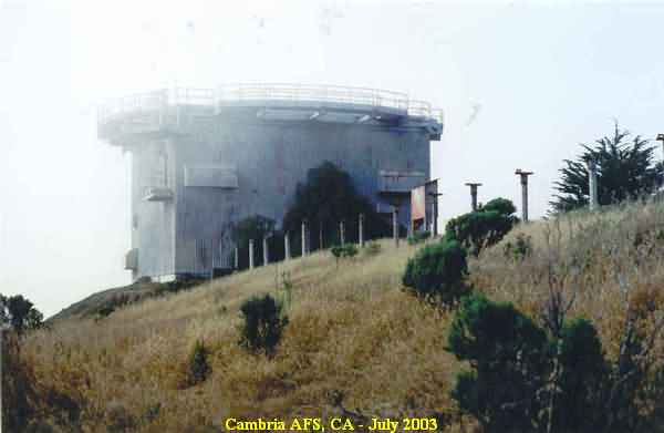
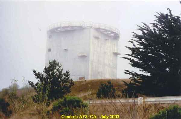
This photo shows the former AN/FPS-107 search radar tower, with the LRR Ops building to the right. [looking northeast]
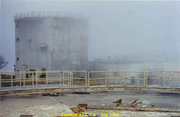
This photo shows the former AN/FPS-26A height-finder radar tower located in the northwest corner of the station. [looking north-northwest]
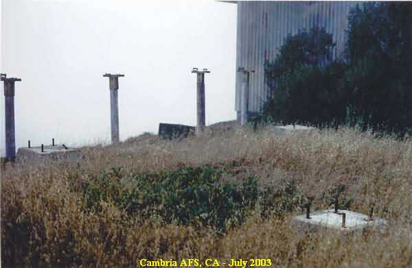
This photo shows the foundations of a temperate tower, probably for the other AN/FPS-6 height-finder radar. This set of foundations is situated immediately next to the AN/FPS-26A height-finder radar tower on its south side. [looking west-northwest]
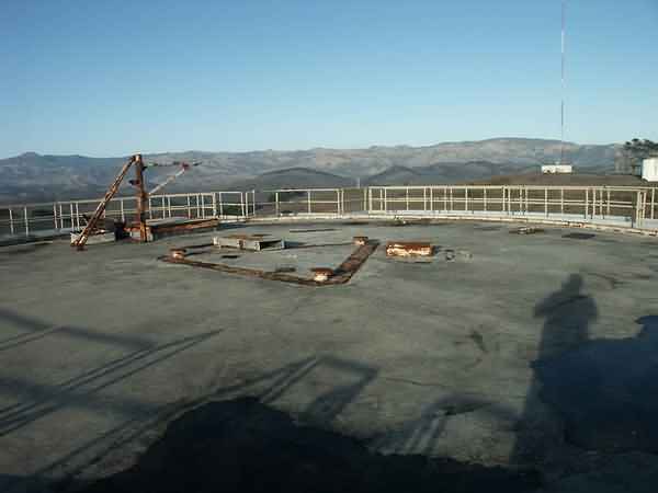
This photo shows AN/FPS-107 search radar tower (left) and the LRR Ops building as viewed from the antenna deck of the AN/FPS-26A height-finder radar tower. [looking southeast]
This photo also shows AN/FPS-107 search radar tower (left) and the LRR Ops building as viewed from the antenna deck of the AN/FPS-26A height-finder radar tower. Also seen immediately west of the AN/FPS-107 tower is the foundations of a temperate tower, probably for the AN/FPS-3 or the AN/FPS-8 search radar (?). [looking south-southeast]
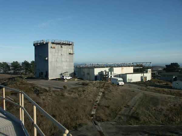
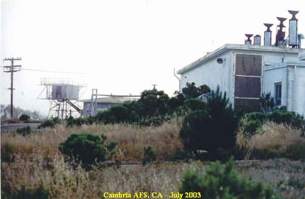
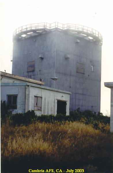
This photo shows the Power Plant in the foreground, the LRR Ops building to the left, and the AN/FPS-107 search radar tower in the background. [looking northwest]
This photo shows the Power Plant in the foreground to the right, and the AN/FPS-6 height-finder radar tower in the distance. [looking west]
This photo shows another view of the AN/FPS-26A height-finder radar tower. [looking north]
This photo shows yet another view of the AN/FPS-26A height-finder radar tower, this time from the north side. [looking south]
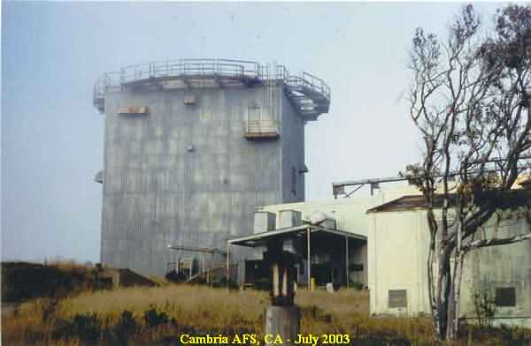
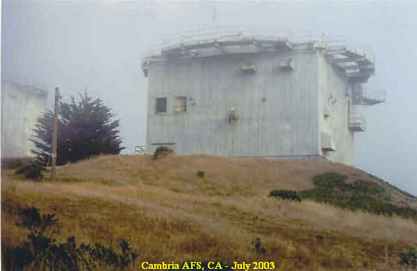
This photo shows the old AN/FPS-107 search radar tower as viewed from the northwest corner of the station. [looking southeast]
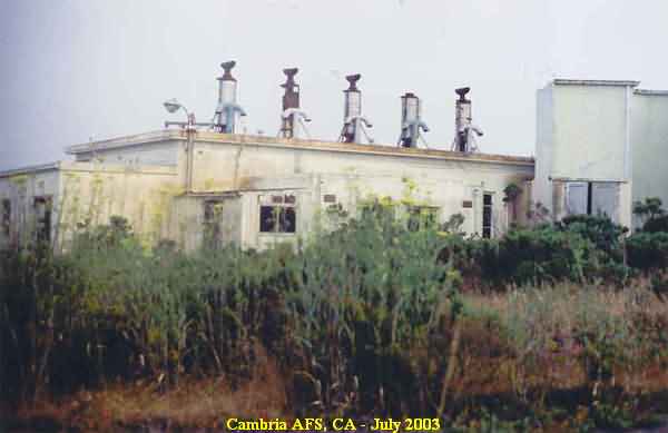
This photo shows Power Plant from the north side. [looking south]
This photo shows another view of the AN/FPS-107 search radar tower. The Power Plant is in the foreground on the far left. [looking northwest]
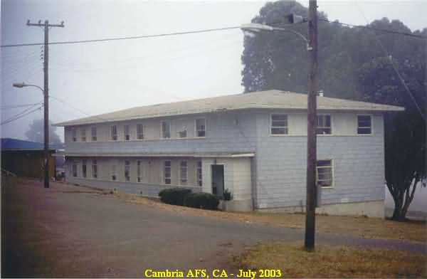
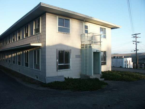
This photo shows one of the barracks, the one at the west end of the cantonment area on the south side of the road. [looking east-southeast]
This final photo shows one of the administrative buildings and others at the west end of the cantonment area on the north side of the road. [looking east-northeast]
From the web site http://www.jackposemsky.com/
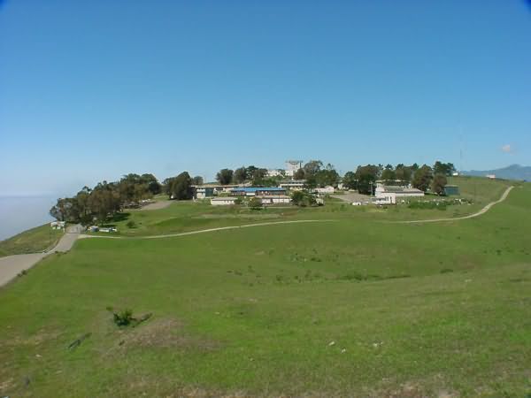
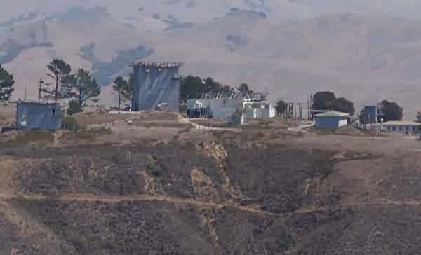
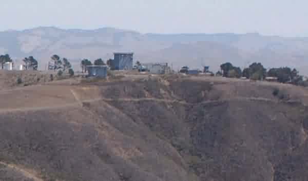
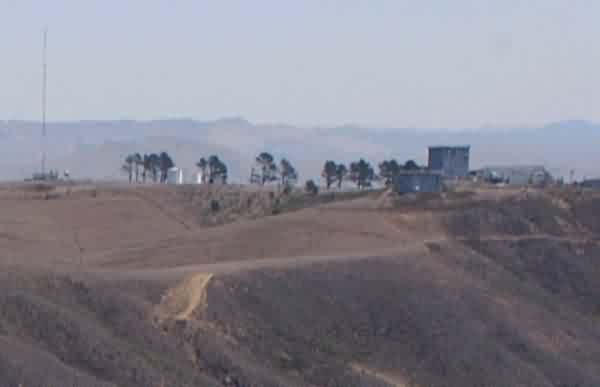
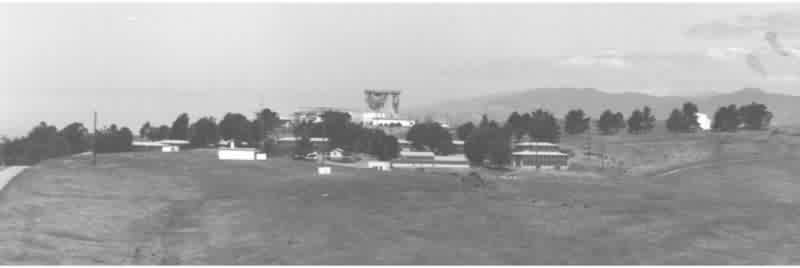
Cantonment area
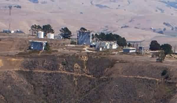
Note that the temperate AN/FPS-6 height-finder radar tower is visible to the right (south).
Also, the taller arctic-style radar tower in the photo`s center housed the AN/FPS-107 search radar, and the shorter one to the left (north) housed the AN/FPS-26A height-finder radar.
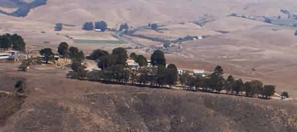
From the "California Coastline" web site
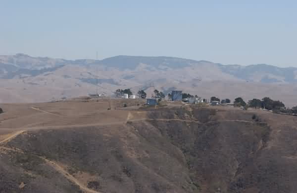
This photo from the Cambria Air Force Base Conversion Project


