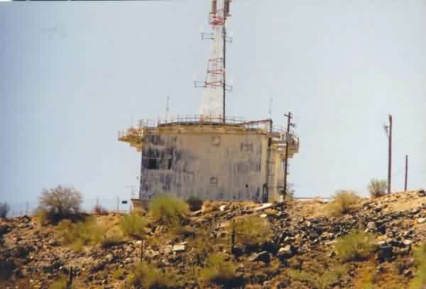
The former AN/FPS-26 FD height-finder radar tower as seen from the present-day ARSR-4 radar tower (looking south). Photo is courtesy of Bruce Robie (February 2024).


The radar tower in the foreground is the only original Air Force tower remaining at this site, and once housed the AN/FPS-26 height-finder radar. In the background is the modern joint-use ARSR-4 radar.
Photo Source: http://boondogsworld.phanfare.com/
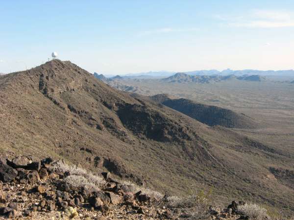
Photo source: http://farm4.static.flickr.com/3559/3373561082_d59f45f86f_b.jpg
The view is looking south.
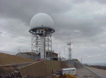
Photo source: http://www.azcommerce.com/doclib/COMMASST/Originals/BMGR-GilaBend/BMGR%20Briefing%207%2004_files/frame.htm#slide0114.htm
Mar 2005 photo contributed by Gary & BJ Thomas "on the road".
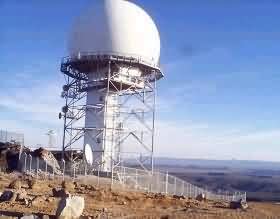
Photo source: http://www.primagraphics.net/pr/arsr.html
September 2002 photos contributed by Tom Page
Special thanks go to Mr. Vergial Harp of the Cabeza Prieta National Wildlife Refuge (Ajo, AZ) for escorting me up to their observation site on Childs Mountain, the former home of the 612th Radar Squadron (SAGE), Ajo AFS, AZ (Z-181), as well as the present-day location of the Ajo JSS Radar Site (J-29A). This site visit took place on Friday, 20 September 2002.
Sad to say, all buildings and structures of the original Air Force Station, except for the AN/FPS-26 height-finder radar tower, are now gone. The NPS has demolished the site, and restored it to its natural state. Even the concrete pads for the buildings have been removed.
I was allowed to visit the former cantonment area, the GATR site, and the family-housing area. However, I was not allowed to go all the way up to the mountain top where the FAA`s ARSR-4 radar tower is. Still, I got close enough to get an excellent view of the radar area.
The first stop was the Childs Mountain observation area of the Cabeza Prieta NWR. The observation area is located immediately west and slightly north of the former GATR site. The view from there is fantastic. I took several photos from there of the radar site and the GATR site. I then took other photos as we worked our way back down the mountain.
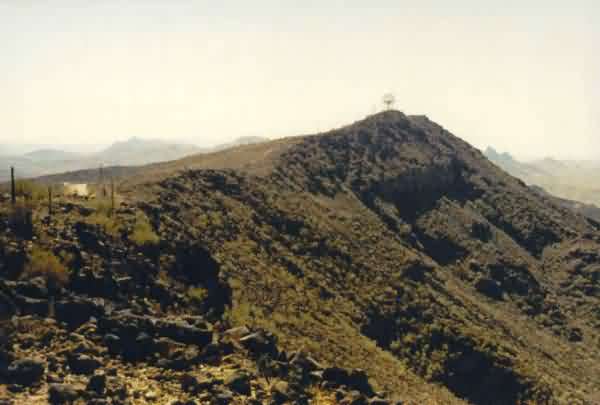
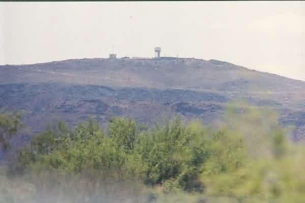
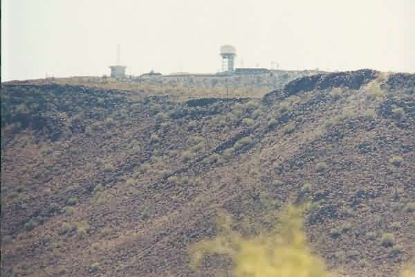
This view is looking from the Cabeza Prieta NWR observation area near the former GATR site. Seen atop Childs Mountain is the present-day joint-use ARSR-4 radar tower operated by the FAA. [looking slightly east of due south]
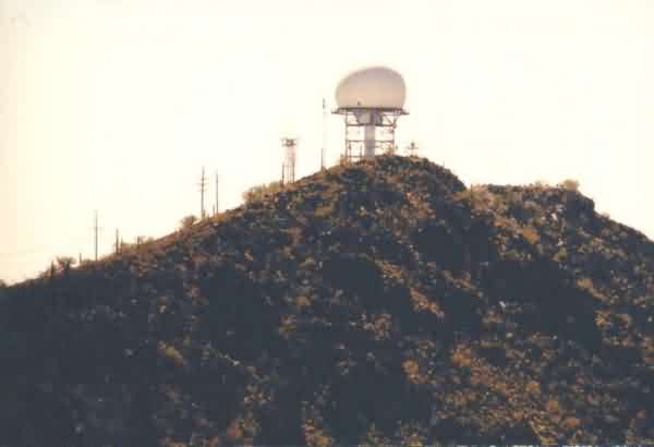
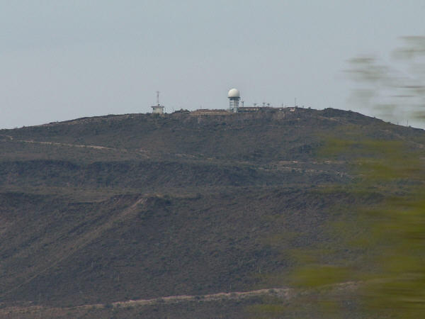
This is the same view of the ARSR-4 as in the first photo, except it is a close-up view made with my 300-mm telephoto lens. [looking slightly east of due south]
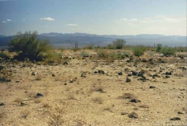
This view shows the plot of land where the GATR building once stood. No trace of the building or any antenna poles remains. [looking east]
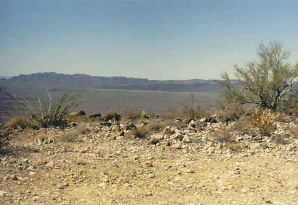
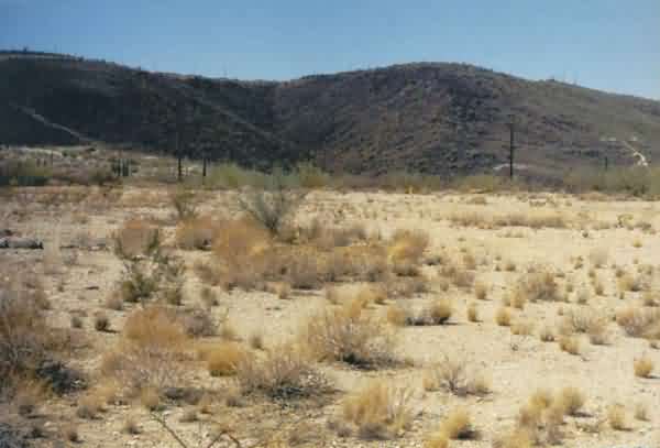
This is a view from the former GATR site looking out over the wildlife refuge. [looking west]
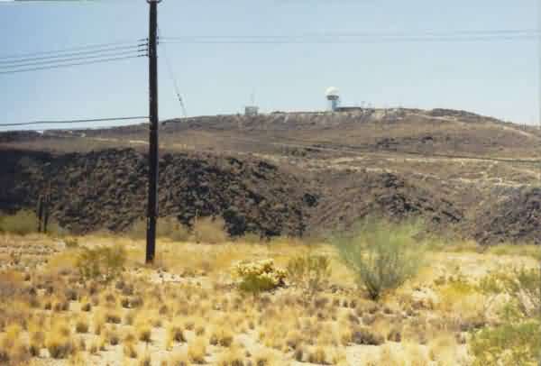
This is a view from the former GATR site of the present-day radio facility for the Barry M. Goldwater Air Force Range, formerly known as the Luke-Williams Range (also the earliest name of Ajo AFS). [looking northwest]
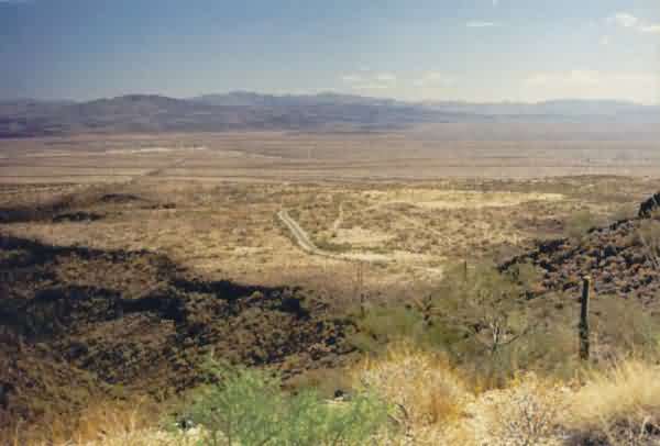
This view shows the former 612th RADS cantonment area. Although all buildings have been removed, the cantonment area is clearly visible as the light-colored area near the center of the photo to the right (south). The view is from the GATR-site access road. [looking east]
This is another view of the cantonment area as seen from the access road that leads up to the radar site. As one can see, the cantonment area (the light-colored area in the center of the photo) sat on a plateau on the east side of Childs Mountain.
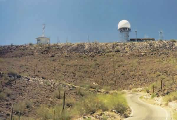
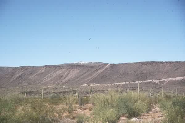
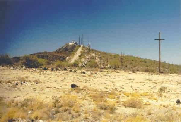
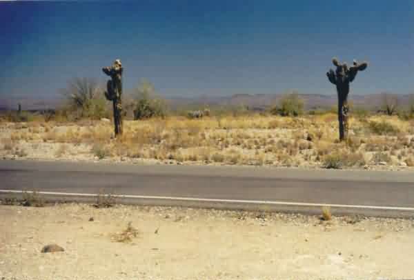
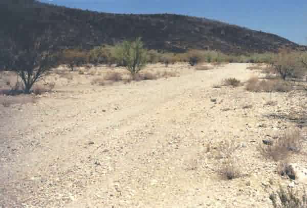
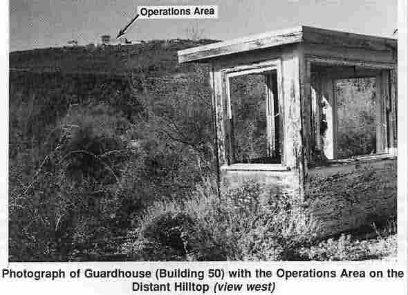
This is a view of the Operations area as seen from the main access road between the cantonment area and the mountain top. The photo was taken at the intersection where the GATR access road branches off to the north. The present-day ARSR-4 radar tower is seen on the right (north side), and the old AN/FPS-26 height-finder radar tower is seen on the left (south side). [looking west-southwest]
This is a close-up of the old AN/FPS-26 height-finder radar tower as viewed though my 300-mm telephoto lens. [looking west-southwest]
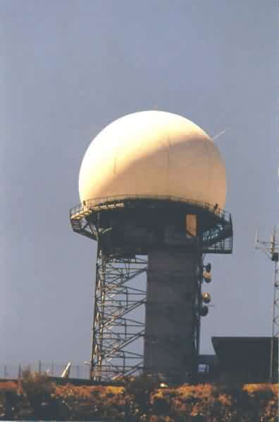
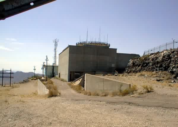
This is a close-up of the modern ARSR-4 radar tower and radome. [looking west]
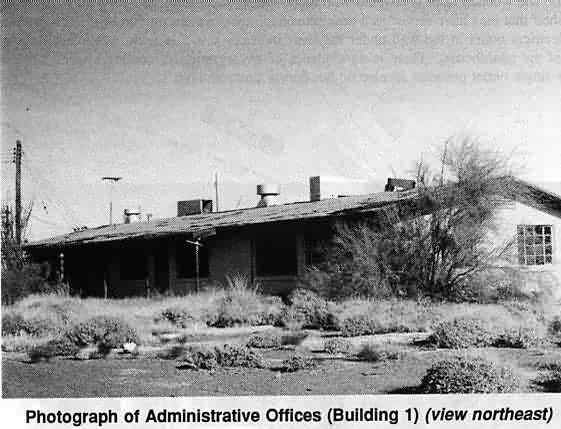
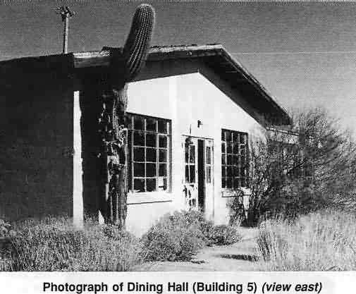
This is a view of the former cantonment area, looking southeast along the access road. The foreground is where the dining hall used to stand, and beyond that is where the administration building used to stand. [looking southeast]
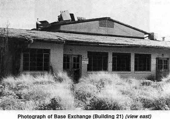
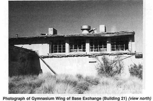
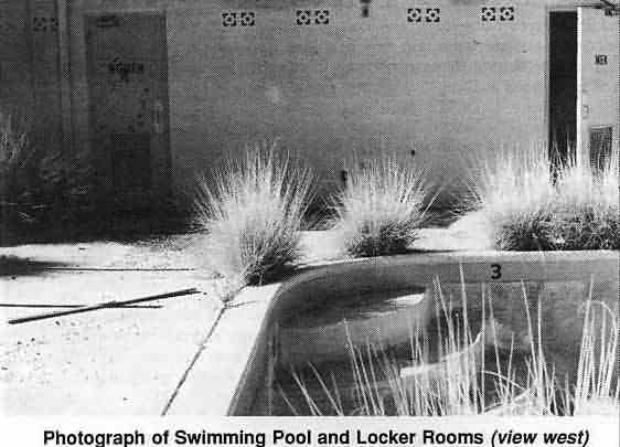
This is another view of the former cantonment area, looking east across the access road. Between and behind the two saguaro cacti are the former locations of the base exchange, recreation hall (gym), and swimming pool. [looking slightly north of due east]
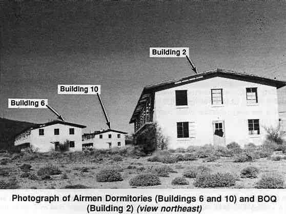
This photo shows the area where the airmen / NCO dormitories and BOQ used to stand. In the distance are the former GATR site (near the top center of the photo) and the present-day radio site (in the upper right of the photo). [looking west-northwest ]
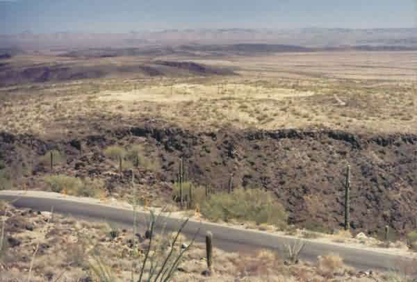
This photo shows the radar / Operations area as seen from the cantonment area where the dormitories used to stand. [looking west-southwest]
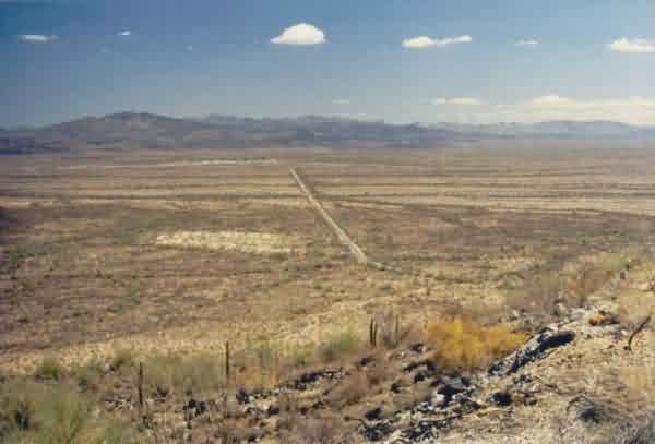
This view shows the former family-housing area in the distance, just to the left (north) of the access road. The housing area is visible as the light-colored area just left of the photo`s center. The houses were all relocated to Gila Bend Auxiliary Field after the 612th RADS deactivated. Now, even the concrete pads have been removed. The access road terminates at AZ Road 85 in the far distance. [looking east]
This final view shows the former family-housing area from ground level along the loop road. As one can see, there is nothing left. [looking northeast]
May 2001 photos and notes contributed by Tom Page
The former AF Station and present-day JSS Site. On the left (south) is the old AN/FPS-26 height-finder tower; on the right (north) is the new ARSR-4 search radar tower & radome. [looking west; photo was made using a 300-mm telephoto lens]
Same as above, only somewhat closer.
contributed by Bill Clemens
Photos and notes by John Tianen
| This is a shot of the sign at the entrance to the access road off Arizona Route 85. The sign (and road) is a few miles north of Ajo. Based on the sign, I think the site should correctly be called Ajo Air Force Station and not Luke-Williams Range Air Force Station. | 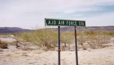 |
| This is a shot of a warning sign on the access road forbiding further access. The Air Force still maintains communications equipment on the mountain for the bombing and gunnery range nearby. The park ranger at the Cabeza Prieta Wildlife Refuge Headquarters in Ajo said that twice a year the general public can drive up the road as part of a guided tour. I sensed they might allow others (with an escort) to go at other times if they had a legitimate reason. Hiking to the top is allowed at any time according to the park ranger although a permit is required and can be obtained at park headquarters in Ajo. | 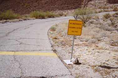 |
| This is a shot of the site on Childs Mountain. Three towers are visible on the ridge line. From right to left is FAA radar (still not fully operational according to FAA technicians), old FPS-7C tower and on the extreme left is an old "arctic" style tower. I suspect there may have been other towers on the mountain but all I could see was three. | 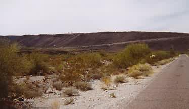 |
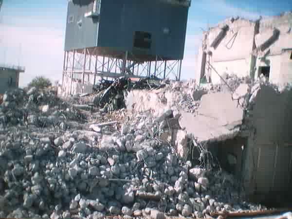
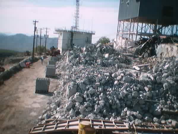
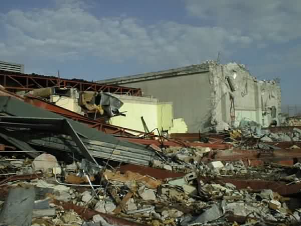
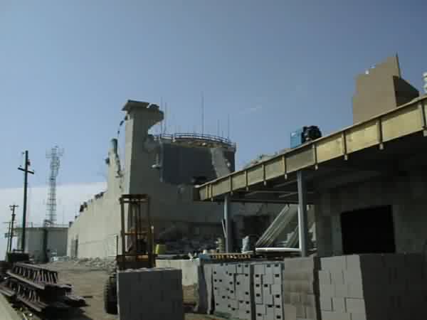
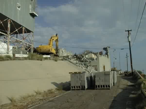
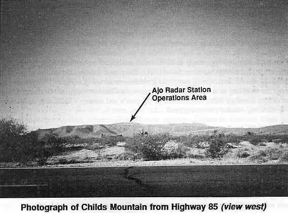
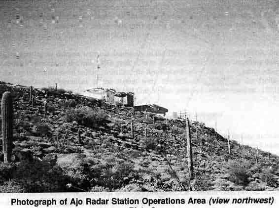
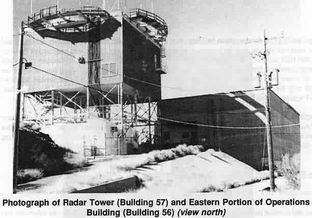
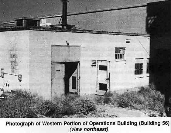
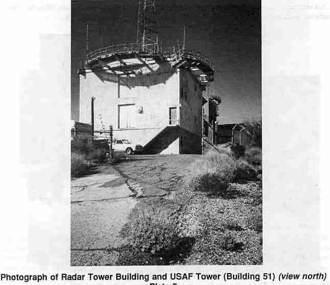
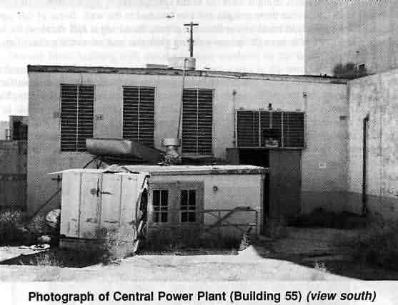
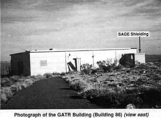
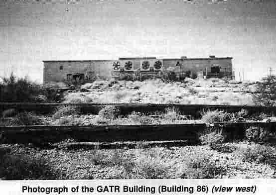
The following photos are from the Dames & Moore Intermountain Cultural Research Paper No. 18 - "Cultural Resource Inventory for the Ajo Radar Station Demolition Project at Childs Mountain, Arizona" - 1994. The document was contributed by Mellissa Keane.
June 1993 photo below by Mark Morgan