Site Remains, March, 2001
contributed by Richard Konizeski
contributed by Richard Konizeski
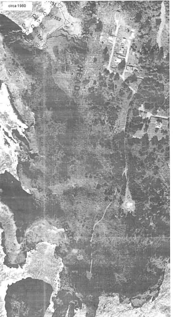
The `L shaped` annex building in this circa 1980 image is clearly apparent, along with the old Lifeboat Station barracks and other buildings. The building doesn`t appear visible in other aerial images. Shown along with the 1960 photo of the annex and barracks previously provided, we have good documentation of its location within the area. Both the 1960 and this 1980 photo were provided by Barbara and Frank Eckley of the `Port Orford Heads State Park` of Port Orford, OR.
Regarding the access road to the site of "the Old Gap Filler Radar" at Port Orford, my wife and I walked out to the site yesterday. We found several holes with remains of the concrete footing, re-bar, some electrical conduit and a small iron truss. The roadway is particularly obscured by encroaching brush; therefore, not open to vehicular traffic. However, it is easily accessible from the Coast Guard Barracks Building by following the concrete walkway until it intersects with the old road bed. Go left on the old road bed about 150 feet to the "site".