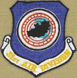
Information for Snelling AFS, MN *

Latitude: 44-52-13.87 N, Longitude: 093-12-40.97 W

Call Sign(s): Charles


Perm ID Sage ID JSS ID Unit Location Early
Equip.
Final
Equip.
Oper.
Date
Inact.
Date
Notes
P-36     31 ADD Snelling AFS, MN *     6 Oct 1950 circa 1961 * Manual Air-Defense Control Center (ADCC), and HQ 31st Air Division (Defense). After the Air Force moved out, Snelling AFS served as an Army Nike-missile direction center with radar, site MS-48DC.

Current Use: No longer extant; grounds are now part of the Fort Snelling National Cemetery.

NOTICE:
Some photos and documents may be marked with varying degrees of classification, up to SECRET. Data so marked is the way it was delivered from official USAF sources, and have been completely declassified. To the best of our knowledge, no currently classified data is stored on this site.
The following site information is available: