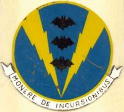
History of Red Bluff AFS, CA
This site became operational in 1956 under the jurisdiction of the 859th AC&W Squadron. The site used AN/MPS-8 and AN/MPS-11 radars. The AN/MPS-11 remained until 1963. In 1959 the Air Force placed AN/FPS-6 and -6A height-finder radars and removed the AN/MPS-8 from Red Bluff. SAGE operations began in 1960. In 1964 Red Bluff became an FAA/ADC joint-use facility, using the AN/FPS-67 search and AN/FPS-6 and AN/FPS-90 height-finder radars located on site. The 859th was deactivated 30 September 1970. The FAA continues to operate the AN/FPS-67B search radar, now CARSR.
References: "Searching the Skies"; misc. ADCOM documents; eyewitness accounts.
Hide
