History of Opheim AFS, MT
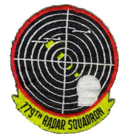
The 779th AC&W Squadron began operations in 1952 with AN/FPS-3 and AN/FPS-4 radars. An AN/GPS-3 radar operated here between 1957 and 1961. In 1958 and 1959 AN/FPS-6 and AN/FPS-6A radars replaced the AN/FPS-4 height-finder radar. The AN/FPS-3 left service in 1960, and was replaced by an AN/FPS-7C search radar. In 1961 the site was integrated into the SAGE system. In 1963 the 779th Radar Squadron operated the AN/FPS-7C search radar along with AN/FPS-26A and AN/FPS-90 height-finder radars. The AN/FPS-90 was damaged by a fire in 1966, but was repaired; it was removed some time in the early 1970s. Opheim AFS ceased operations on 1 June 1979. The 779th Radar Squadron (SAGE) was deactivated in September 1979.
References: "Searching the Skies"; misc. ADCOM documents; eyewitness accounts.
Hide