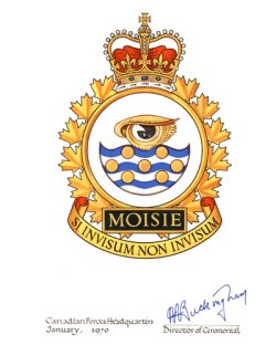
NOTICE:Some photos and documents may be marked with varying degrees of classification, up to SECRET. Data so marked is the way it was delivered from official USAF sources, and have been completely declassified. To the best of our knowledge, no currently classified data is stored on this site.The following site information is available: History of Moisie AS, QC, CNConstruction commenced in 1951 at a new RCAF installation at Moisie (C-33) and was completed by June 30 1953. The unit assigned to man the station, 211 Aircraft Control & Warning Squadron (callsign Crowbar), began life on 23 May 1953 when the advance party of RCAF personnel arrived at Moisie. On the same day, 211 Aircraft Warning (AW) Squadron was formed at Moisie providing limited early warning services, eight hours a day, five days a week. The RCAF Detachment assumed control of the station on 1 July 1953. In September of the same year, the detachment commander was elevated to Commanding Officer of RCAF Station Moisie; which became part of Air Defence Command. Forest fires raged in the area during mid-July 1954. Thirteen personnel from the station were called out to assist in fire-fighting. They helped save Shelter Bay, now known as Port Cartier, and helped minimize damage at Clarke City. In November 1956, 211 AW Squadron became 211 AC&W Squadron. For a few tense days in July 1958, the station was put on increased alert status due to the critical situation in the Middle East. During May 1959, Moisie went from a strictly early warning unit with identification function, to that of an air defence ground control interceptor site. The squadron became operational with the SAGE on 1 November 1963 and reported to the Bangor Sector. They were renamed as 211 Radar Squadron, RCAF Station Moisie on 1 December 1963. Radio Station CFRM began broadcasting from the radar site in 1964. The popular station with a 10 watt output was located at 1340 on your dial. The station was then renamed RCAF Station Moisie and once again 211 Radar Squadron Moisie in early 1967. But on 10 August that same year, the unit simply became CFS Moisie. The village of Moisie that had endured for over 100 years was demolished in the fall of 1977 as a result of flooding. Now in its place is a beautiful provincial park. CFS Moisie became part of the Canada East ROCC, which eventually became fully operational by August 1984. A few years later, on 1 April 1987, CFS Moisie ceased operations. --The NBC Group - Don Nicks, John Bradley, Chris Charland. |
 |