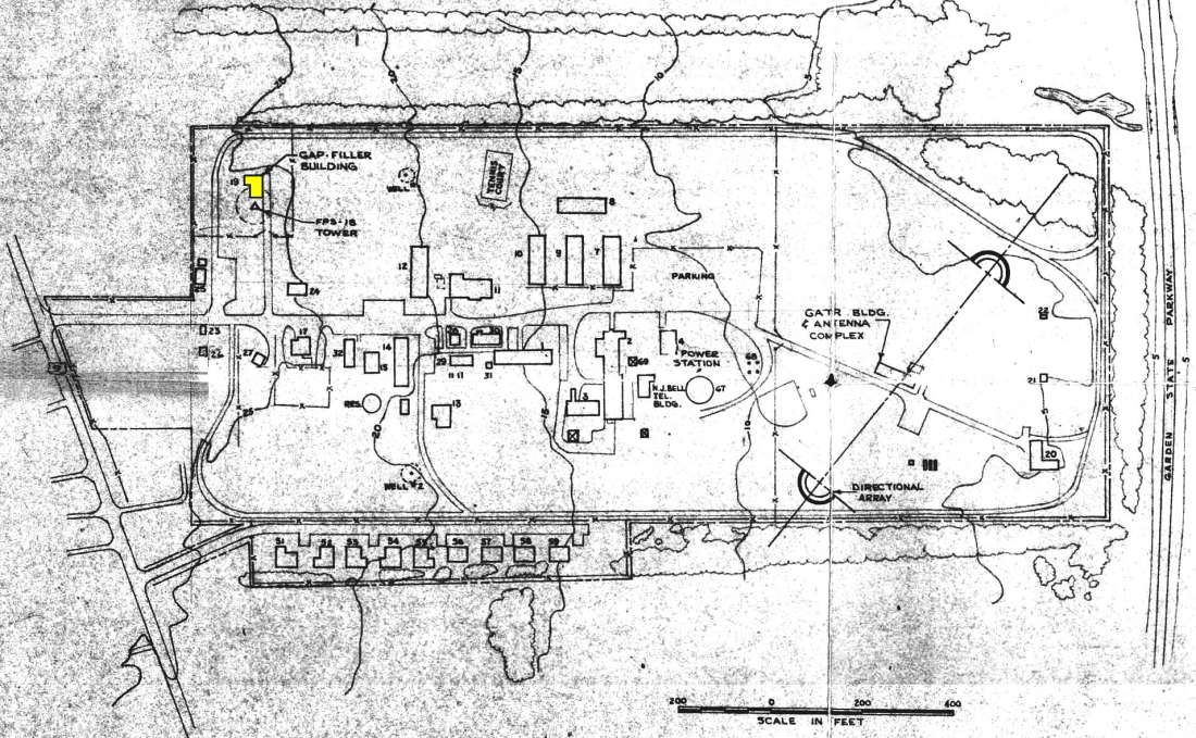
The enclosed site map, dated 1962, was actually created for the Palermo GATR Site (R-14) which operated as a remote radio facility assigned to the 770th RADS at Fort Meade, MD, during the time Palermo AFS was inactive as a long-range radar station (1961-1962). In addition to this GATR facility, a gap-filler annex (RP-63C) was being planned for the Palermo location. However, after the collapse of TT-4 in January 1961, ADC decided to reopen Palermo AFS as a LRR and to cancel the GFA.
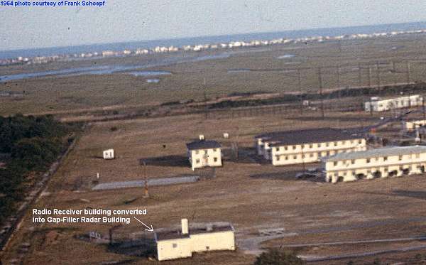
The 1962 map actually shows an "FPS-18 Tower" next to the "Gap-Filler Building." So, now we know that an FPS-18 model gap-filler radar was slated for this site. However, it appears doubtful that the equipment or even the radar tower was ever installed. One of Frank Schoepf`s aerial photos (enclosed, two versions) from 1964 clearly shows the old Radio Receiver building / GFA building, but no tower foundations / footings are visible. This suggests that the plans were cancelled before the tower was erected. But, who knows? Also, my earlier guess had been that it was the old Radio Transmitter building that was to have been converted into the GFA facility. Instead, it was the Radio Receiver building that was chosen. (At the former Claysburg AFS, PA, it was the Radio Transmitter building that was converted into the GFA building, but likewise was never activated, as best we know.)
The Palermo GFA building still appears in "Google Earth" aerial imagery at Latitude 39° 13` 24.84" N, Longitude 074° 41` 14.73" W. However, the entire AF Station site has since been cleared away. Only the original family-housing units still stand, plus the GATR Site`s north-most FRT-49 antenna pole (now serving as a platform for osprey nests).