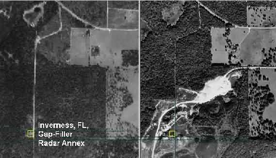
Aerial Photos - Then & Now
Contributed by Tom Page
Contributed by Tom Page
Most of the roads look about the same ... except the north-south road that led from County Road 480 to the site where it was truncated by the quarry. In any case, this side-by-side comparison pretty much shows just where the old radar site was once located.