The Road to Bedford Air Force Station, VA
(or, you can’t get there from here … if you’re driving a truck, that is!)
Contributred by Tom Page
Bedford AFS was located in one of the most scenic locations anywhere in the Lower 48, atop Apple Orchard Mountain right off the Blue Ridge Parkway. So, what’s wrong with that? Well, for one thing, trucks were – and still are – prohibited from the Blue Ridge Parkway. No exceptions. Not even for the United States Air Force!
Despite repeated negotiations with the National Park Service, the answer remained “no trucks – period.” So, how did U.S. Air Force trucks get up to Bedford AFS when deliveries or pick-ups of large cargo were required? The answer was, the Air Force had to build their own road from the western valley near Arcadia up to the site access road just off the Blue Ridge Parkway. It was not exactly the shortest route, either. But the Air Force did build the road. And that road is still there today, now labeled on maps as a fire road.
The first two images below, courtesy of “Google Earth,” show some of the old Air Force truck road for Bedford AFS.
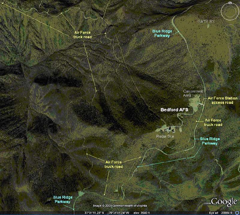
Figure 1. High-Level View Showing the Air Force Truck Road Route.
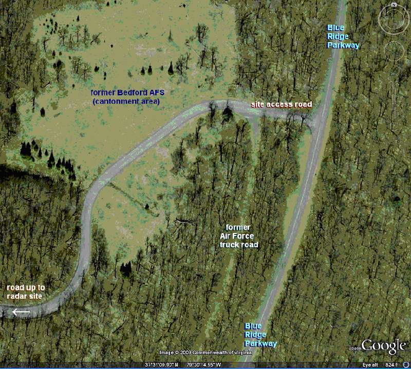
Figure 2. Close-Up View Showing the Air Force Truck Road where it meets the Bedford AFS Access Road off the Blue Ridge Parkway.
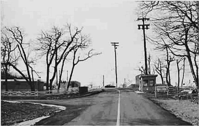
Figure 3. Vintage Photo of the Bedford AFS site entrance
as viewed from the Blue Ridge Parkway turnoff.
The Cantonment area is seen straight ahead, and the Air Force truck road
is seen on the left just before the white fence. [looking west]