Findings of Fact, Site Location, and Information on
Askov GFA, based on information provided by US Army Corps of Engineers Formerly Used Defense
Site (FUDS) document E05MN0038 of Feb 1985
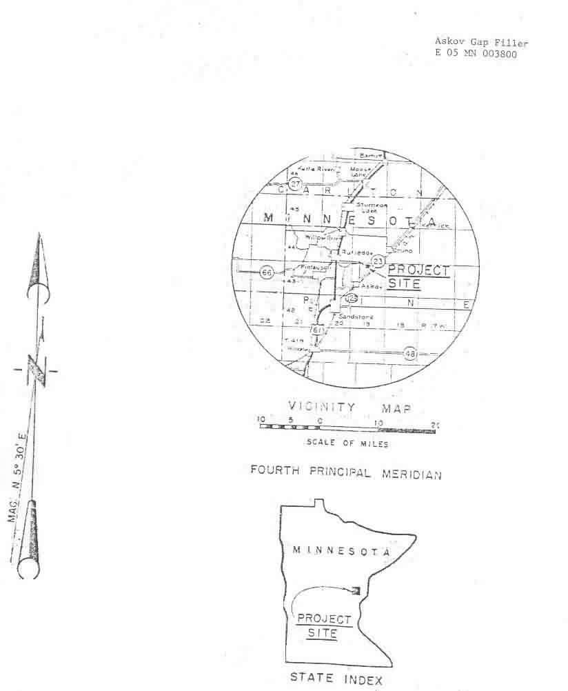
Site Location
Along and east of State Highway 23, northeast of Askov and southwest of Bruno, Township 43N, Range 19W, Pine County, MN
Site History and Findings of Fact
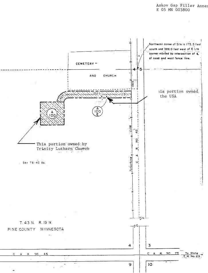
Askov Radar Gap Filler Annex was constructed by the Air Force in 1956, and operated as unmanned radar station until the late 1960s. It was excessed on June 16 1970 to private owners who conveyed it in December 1982 to the Trinity Lutheran Church of Bruno, WN.
The radar tower had been removed, and the concrete lock building was being used by the church for storage purposes. The three concrete tower pads are still in existence.
A site map indicates the access road was still owned by the Government, with the Trinity Church and cemetery located due north of the road. The road leads due west to the site from a county road.
Site Map and Photos
One Xerox copy of a B & W photo depicts the building, security fence, and what looks to by Air Force signage containing warning information.